![]() March is usually a snowy month in Whistler and 2025 is no exception, though the freezing level hovers around the valley. Snowshoes are already not necessary for lots of trails in and around Whistler. If you have not been to Whistler Train Wreck, you have to, it's a must see. It's a decades old train wreck which was turned into an art exhibit in 2011 when local artists painted extraordinary murals over the mangled train cars.
March is usually a snowy month in Whistler and 2025 is no exception, though the freezing level hovers around the valley. Snowshoes are already not necessary for lots of trails in and around Whistler. If you have not been to Whistler Train Wreck, you have to, it's a must see. It's a decades old train wreck which was turned into an art exhibit in 2011 when local artists painted extraordinary murals over the mangled train cars.
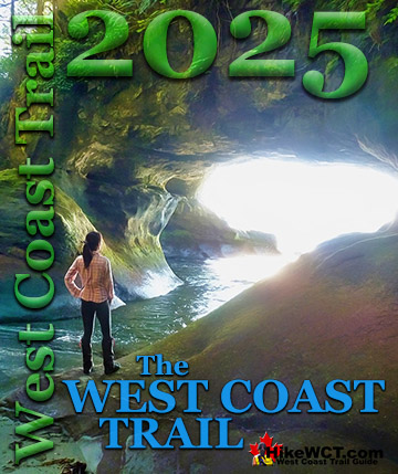
March Whistler Trails Guide
- Whistler Train Wreck
- Parkhurst Ghost Town
- Alexander Falls
- Blueberry Trail
- Joffre Lakes
- Sproatt East
- Taylor Meadows
- Cheakamus River
- Brandywine Falls
- Hot Springs Near Whistler
- Hiking in Whistler by Month!
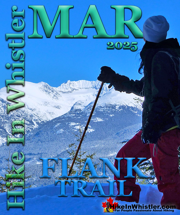
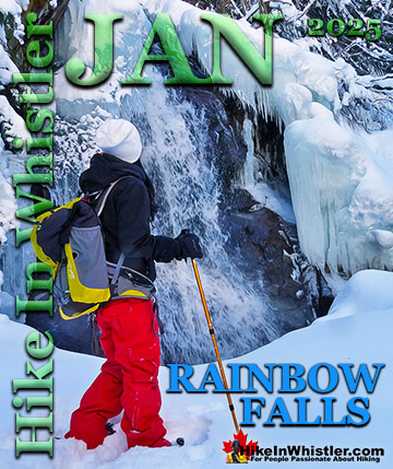
It is an amazing surreal world hidden just a couple hundred metres from the busy Sea to Sky Highway, running along the spectacular Cheakamus River. An easy hike through the beautiful forest takes you to the Train Wreck bridge over Cheakamus River which crashes dramatically below. Over the years muralists and graffiti artists have continued to paint and though the incredibly surreal murals from 2011 have long since been painted over, Whistler Train Wreck is still worth seeing. For a look at Whistler Train Wreck over the years you can see it here. March is usually one of the nicest months for snowshoeing in Whistler. The days get considerably longer and warmer, yet snow falls almost daily. In March 2012, for example, over four metres of snow fell! With some sunny days mixed into these heavy snowfall days, makes March something amazing. This year spring has come early and you have to head up to higher elevation trails to find snowshoeing. One great trail to try is the Flank Trail. It cuts across Sproatt and Rainbow mountains, the two big mountains that you see directly across the valley from Whistler and Blackcomb mountains. There are several access trails to reach the Flank Trail, however the short and scenic Rainbow Trail is the best and most convenient way to reach it. This well used trail never goes in a straight line and goes up and down through a beautiful and deep forest. There is only one small, easy to miss sign to Rainbow Falls, but finding the falls is easy. To find Rainbow Falls, begin at the trailhead parking for "Rainbow Trail" on Alta Lake Road. Follow the trail as it winds along the river. If you come to obvious forks in the trail, choose the right fork. In 0.8 kilometres from the trailhead parking you will arrive at Rainbow Falls. The trail to Rainbow Falls is fairly popular in the winter so the snow is usually well packed down so you often don't need snowshoes. The route to the falls is never in a straight line. Zig-zagging left and right, up and down, some parts are steep, but at just 0.8 kilometres, the shortness of the trail makes it suitable for kids. The topography and sheer volume of snow make this a very fun trail to snowshoe for everyone.

Rainbow Falls to the Flank Trail
After Rainbow Falls, you can backtrack a few dozen metres and then head off to the right and uphill towards the Rainbow Lake trail. In just a couple minutes you will see the water treatment building and a nice map board. If you take the wide path/service road on the immediate right of the building you will see, (in just a couple dozen metres) the cute, snow covered bridge over the river. This is a beautiful little area, and in the winter, very deep in snow. You can continue past this bridge, however, the bridge marks the end of the best sights to see. Back on the main, Rainbow Trail, you will notice signs for the Flank Trail. In this section, the Rainbow Trail and the Flank Trail overlap for about 400 hundred metres. If you follow this overlapping trail as it bends around the water treatment building, quickly ascending in the direction of Rainbow Lake, you will come to the Flank Trail junction. The Flank Trail quickly ascends through deep forest and after about 15 minutes opens up and begins to gradually flatten out. The views become beautiful and trail less tiring. Whistler Mountain, Blackcomb Mountain and Wedge Mountain all come dramatically into view and Alta Lake appears far below. Just steps from the trail take you to pristine, snowy outcrops, perfect for taking in the view on a sunny day.. and with most of the Flank Trail south facing, sun will always be facing you over Whistler Mountain.
Flank Trail View of Armchair Glacier

Whistler Hiking & Snowshoeing March
 Whistler Train Wreck
The trail to Whistler Train Wreck is an easy, yet varied route through deep forest, across a great suspension bridge over Cheakamus River, to a stunning array of wrecked train cars. The trail from your car to the wrecks only takes about 15 minutes, however once you reach one wreck, you see another, then another. There are seven wrecks in total that are spread over an area about 400 metres long. Along with the surreal train wrecks painted with stunning murals, you find yourself in a thick forest that runs along Cheakamus River. Cheakamus River is a beautiful, wild and crashing river that snakes past the train wrecks. Numerous side trails take you to some marvellous viewpoints, several metres above the rushing water below. Whistler Train Wreck in March continued here...
 Parkhurst Ghost Town
In March, an excellent place to snowshoe in Whistler is to Parkhurst Ghost Town. Sitting on the far side of Green Lake, Parkhurst was a thriving logging community several decades ago. It has since been abandoned except for intermittent squatter communities over the years. Most famously, it was the home of Toad Hall, an idyllic collection of ski bums that will forever be memorialized by Chris Speedie's Toad Hall picture of 14 naked people posing with ski gear. Toad Hall is long gone along with all, but one of the old Parkhurst houses which is painted with a large, haunting blue face. Wandering around Parkhurst you will stumble upon many old relics. Parkhurst Ghost Town continued here...
 Alexander Falls
Driving up into the mountains is a great way to seek out some springtime snow. Alexander Falls is beautiful these days with deep snow everywhere. Not really a hike as the walk from your car to the viewpoint is just a hundred metres or so, it is worth the drive, especially on a sunny day! High up in the Callaghan Valley, Alexander Falls is easy to get to in any weather and amazing in March. The falls crash down 43 metres into the snow filled valley below. When Whistler Valley is slushy and wet, everything in the Callaghan Valley is insanely buried in snow. Anytime of the year is great to go to Alexander Falls. In the winter months, the valley is a massive, snowy playground. Alexander Falls continued here...
 Blueberry Trail
The Blueberry Trail is a relatively unknown, though very scenic trail that ascends quickly up to a cliff viewpoint high above Alta Lake. Geographically, the Blueberry Trail is directly across Alta Lake from Rainbow Park. It can be accessed from either end via the neighbourhoods of Whistler Cay at the end of Crabapple Drive, or in Alta Vista at the end of St Anton Way. Either trailhead is just a five minute drive from Whistler Village and both are conveniently close to Whistler's Valley Trail. If it has not snowed heavily in the last couple days, you will likely not need snowshoes for the Blueberry Trail as the snow will have been packed down by others. Blueberry Park continued here...
 Joffre Lakes
For more challenging snowshoeing, Joffre Lakes Provincial Park is hard to beat. A long, though beautiful drive into the mountains, north of Pemberton takes you to this moderately challenging, 11 kilometre(6.8mile) roundtrip snowshoe trail. The frequently steep, winding trail takes you through a winter paradise and around, or over three frozen lakes. In the summer Joffre Lakes is insanely popular with hikers. In the winter, on snowshoes, you will find Joffre Lakes wonderfully serene. Positioned high up in the mountains, Joffre Lakes gets tremendous amounts of snow and on a sunny winter day you'd have trouble finding more of a winter wonderland anywhere else in the world! Joffre Lakes continued here...
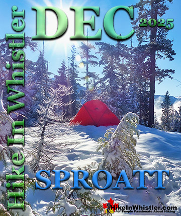
 Sproatt East
The Sproatt East trail is one of the nicest snowshoe trails in Whistler. With the trailhead high up in Stonebridge, partway up the flank of Mount Sproatt, you start snowshoeing already high up in the wonderfully secluded wilderness overlooking Whistler valley. Just a few metres along the trail you catch glimpses of Black Tusk far across the valley before entering the forest along the Sirloin trail. Sirloin ascends through the forest and soon crosses the Rainbow-Sproatt Flank Trail and connects to Darwin's trail. Darwin's bends further up Sproatt along beautiful and elaborate, wooden boardwalks that zig-zag up a steep section. Soon the trail emerges from the forest for the first of many beautiful views over the valley. Sproatt East Trail continued here...
 Taylor Meadows
Taylor Meadows, in Garibaldi Provincial Park is an amazing place to snowshoe in the winter near Whistler. Beautiful snowy meadows surrounded by mountains everywhere you look. Black Tusk towering in the distance so close and blanketed in wonderful, beautiful snow. Garibaldi Lake is accessible as well on this snowshoeing hike. The Taylor Meadows trail forks partway up, left goes to Taylor Meadows, right to Garibaldi Lake. The trail joins again at the far side of both campsites. Garibaldi Lake, so massive and dramatically beautiful in the winter, a huge frozen valley. Taylor Meadows is then just 7.5km from the Rubble Creek trailhead. Garibaldi Lake similarly beautiful and just 9km from the trailhead. Taylor Meadows continued here...
 Cheakamus River
Cheakamus River is a beautiful, crashing, turquoise coloured river that flows from Cheakamus Lake, through Whistler Interpretive Forest at Cheakamus Crossing, then down past Brandywine Falls to Daisy Lake. Cheakamus River has a wonderful and quite extensive network of trails that run along either side of it. The Riverside trail and the Farside trail hug both sides and connect at both ends by bridges. This well marked, though beautifully remote feeling snowshoeing trail takes you along both sides of the wildly crashing Cheakamus River. These trails are frequently used year-round so the snow on the trail is often packed down. You may find that you don't need snowshoes for much or all of the trail. Cheakamus River continued here...
 Brandywine Falls
Brandywine Falls is a beautiful park centred around the wonderful falls that plunge 70 metres down a vertical wall of glacier fractured rock. The park is located along the Sea to Sky Highway, 15 minutes south of Whistler and BC Parks has blocked the parking lot during winter for years. With no decent parking alternatives nearby this has caused wintertime visitors to Brandywine Falls to park at the Bungee Bridge down the very potholed Cal-Cheak forest service road. As inconvenient as this sounds, it is actually a pretty nice alternative as the Bungee Bridge is a worthwhile sight on its own and the 3 kilometre trail to Brandywine Falls is nice and easy. Brandywine Falls Via Bungee Bridge continued here...
 Skookumchuck Hot Springs
The various hot springs near Whistler are also great destinations in March. Skookumchuck Hot Springs is open year-round and the two hour drive to reach it is really part of the fun. It is a beautiful drive through Pemberton, Mount Currie and along the beautiful and massive Lillooet Lake and Lillooet River. The gravel In-Shuck-Ch Forest Service Road which branches off the Sea to Sky Highway is plowed in the winter and accessible for most cars. Though gaining popularity, the remoteness almost guarantees no one there but you on a typical spring day. Skookumchuck Hot Springs continued here...
 Sloquet Hot Springs
Sloquet Hot Springs is an hours drive past Skookumchuck and extraordinarily beautiful and desolate. They are a wonderfully wild set of shallow, man-made pools fed by a small, all natural, and very hot, waterfall. The pools stretch from the waterfall to the large and crashing Sloquet River. The large, spread out campsite for the hot springs lies a short 5 minute walk from the springs. You have to follow a dark and quickly descending trail toward the crashing river to reach the amazing Sloquet Hot Springs. The 11km logging road to Sloquet is not snow plowed in winter and in March you may have to park and hike part of this road to the springs. Sloquet Hot Springs continued here...
Guides to the Best of Whistler
 Best Dog Friendly Hiking Trails
Whistler is very dog friendly and the number of wonderful hiking trails that your dog will love is huge. The massively varied hiking trails range from easy, short, close to Whistler Village to challenging, long and deep in the endless wilderness around Whistler. You can find dog friendly trails in and around Whistler Village that take you through deep, dark and magical forests. Or you can drive beyond Whistler Village and take your dog to spectacular alpine lakes. Some requiring little or no hiking, while others are found after hiking challenging and long trails. Many of these places are comparatively quiet and often you and your dog will have the the wilderness to yourselves. In and around Whistler Village you have Lost Lake with its spider web of trails... Continued here.
 Best Free Whistler Camping
Whistler is surrounded by an immense wilderness dotted with spectacular, hidden lakes and amazing places to set up a tent. Decades of logging activity has left a network of forest service roads that has opened easy access to these places. Some of these you can drive to and some you may need a 4x4 to comfortably get to. Some places to camp for free you can drive to, some require a short hike and others are fairly long hikes to reach. Beautiful Callaghan Valley is home to several incredible and free places to camp. Callaghan Lake has a great free drive-to campsite just steps from this spectacular alpine lake. If you have a canoe, you can paddle to the end of Callaghan Lake and hike the short, but steep trail up to Cirque Lake. This gorgeous lake is deep in the alpine wilderness... Continued here.
 No Car? No Problem! Whistler Trails
Whistler as a resort has a wonderful car-free core. The Village Stroll runs through the heart of Whistler Village and is entirely car free. If you are visiting Whistler or living here and you don't have a car, it's no problem. On foot or on a bike you can travel the extensive network of non-motorized trails. The Valley Trail snakes through Whistler Village and extends in several directions, all of which lead to beautiful parts of Whistler. The Sea to Sky Trail and the Lost Lake trails continue this massive, car-free network of trails running almost everywhere in Whistler. When it comes to many of the best hiking trails, getting to the trailheads on foot, by bike or public transit can be tricky at best or complicated and impractical at worst. Many trailheads are far from Whistler Village and... Continued here.
 Kid Friendly Whistler Hiking Trails
There are plenty of excellent, kid and family friendly hiking trails and destinations in and around Whistler. Kid and family friendly generally means an easy and somewhat short trail that a toddler can happily manage. Some of these trails are flat enough to be stroller friendly, such as Brandywine Falls, Whistler Mountain and Blackcomb Mountain. Others such as Logger’s Lake, Cheakamus River and Madeley Lake have short enough trails to reach them that you can manage with little kids that don't want to hike too far. Some of these hikes and walks are popular and close to Whistler Village, like Whistler Mountain, Blackcomb Mountain, Lost Lake Park, Rainbow Park and Meadow Park. Others are a beautiful, but far drive into the mountains and tricky to find... Continued here.
 Best Sights Sea to Sky 99
The Sea to Sky Highway links Vancouver to Whistler and has several stops along the way that are often overlooked. Porteau Cove, for example, is surprisingly unknown even to locals that have driven past hundreds of times. Just off the highway the parking area is just steps from the huge pier stretching way out over the ocean. This gigantic pier is actually a rarely used emergency dock for BC Ferries, though more often used by visitors for its stunning views of Howe Sound. Porteau Cove is an excellent pit stop on the way to Whistler, not only for the spectacular views of Howe Sound, but one of the nicest picnic spots and most convenient restrooms! Other attractions along the Sea to Sky Highway are more obvious, such as Shannon Falls, the Sea to Sky Gondola... Continued here.
 Best Whistler Waterfalls
There are lots of beautiful waterfalls in and around Whistler. From the towering drop of Brandywine Falls to the awesome, up close and breathtaking view of Keyhole Falls. Some are absurdly convenient and easy to see and others require some tough hiking, or tricky driving to get to. All of them, however, are well worth a visit. Brandywine Falls is the most well known, impressive and easy to find along the Sea to Sky Highway. The viewing platform positioned across from the falls gives you a direct view of its 66 metre(216 feet) plunge into the chasm below. Located 17.1 kilometres(10.6 miles) from Whistler Village. The short, 1 kilometre long, dog friendly trail to the viewpoint is wide and smooth gravel. Alexander Falls, located up... Continued here.
 Whistler Aerial Views
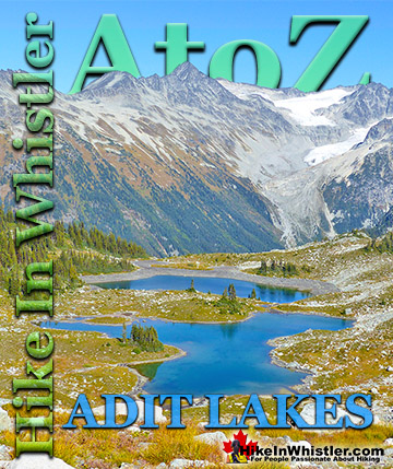
Aerial views of Whistler hiking trails give you a nice perspective on how beautiful this part of the world is. Wedge Glacier is hard to grasp its immensity from across the valley. Up close, from above, the endless rows of crevasses and massive contours give this hulking glacier a more complete picture. The mountains around Wedgemount Lake tower around the valley and seeing them in profile is a great way to grasp the wild, chaotic, boulder strewn landscape below. Along with Wedge Glacier and Wedgemount Lake we have some great aerial views of Panorama Ridge, Parkhurst Ghost Town, Russet Lake, Adit Lakes, Overlord Mountain, Overlord Glacier, Whistler Mountain, Blackcomb Mountain, Brandywine Falls and many more... Continued here.
 Whistler Train Wreck Murals
The colourful graffiti and murals that make Whistler Train Wreck the magical place it is today began appearing in 2011, when this hidden place was known by just a few Whistler locals. In the summer of 2011 several Whistler artists came here for "The Train Wreck Paint Jam" and transformed the mangled wreckage into a surreal art exhibit. The artists ranged from aspiring graffiti artists to professional artists like Kups. Remnants of one of his murals from 2011 is found inside the first boxcar you come to after crossing the bridge into Whistler Train Wreck. Several of the original murals were gorgeous. Brilliantly coloured and surreal in such an unusual, tranquil and hidden forest with seven mangled train boxcars scattered. Like some sort of haunting art gallery... Continued here.
 Northair Mine Murals
Way up in the Callaghan Valley on the back side of Mount Sproatt is an abandoned gold mine. Old cement foundations and two unexpectedly beautiful lakes mark the location of Northair Mine, abandoned in 1982. It was a fairly productive gold mine that extracted five tons of gold. Largely forgotten for years, in the last decade it has come to life in stunning colour by graffiti artists and professional muralists. In the summer of 2013, the first mural appeared on the blank foundation walls of Northair Mine. A creation of a professional Whistler artist PETKO. Painted on one of the inside, pillar walls, the mural is about 8 feet tall and five feet wide of what looks like a robot snake in front of a cube background. It stood out in striking contrast to the grey walls in the background... Continued here.
 Neal Carter Mountaineer
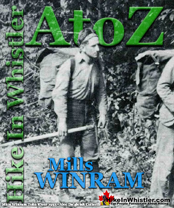
Neal Carter (14 Dec 1902 – 15 Mar 1978) was a mountaineer and early explorer of the Coast Mountains primarily in the 1920’s and 1930’s. Highly skilled as a mountaineer and climber, Carter also excelled at cartography and surveying which he used to map the vast unnamed and unexplored mountains of BC. He named a staggering number of mountains and alpine features, as well as making at least 25 first ascents, many around what we now call the Whistler Valley. Carter began climbing the mountains around Vancouver as a teenager and at the age of seventeen he met someone who would change his life forever. In 1920, while hiking with high school friends Carter had a chance encounter with Tom Fyles, arguably the greatest mountaineer of the era. Continued here.
 Tom Fyles Mountaineer
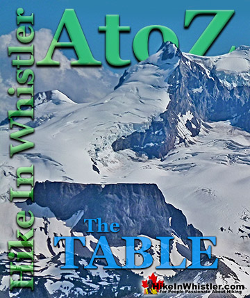
Tom Fyles (27 June 1887 - 27 March 1979) was an astoundingly skilled climber that figured prominently in the mountaineering community in Vancouver for more than two decades. From his introduction to mountaineering in 1912, to his prolific array of elite level climbing ascents that began in earnest just four years later. In 1916 he solo climbed The Table in Garibaldi Park, a mountain widely considered to be too difficult and dangerous to even attempt. Those that knew him well admired his friendliness, enthusiasm, boundless endurance and incredible ability to read a mountain and navigate the best route to the summit. He made many first ascents and inspired countless new climbers, some becoming giants of the era. Continued here.
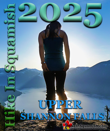
Hiking in Whistler and Garibaldi Park by Month!

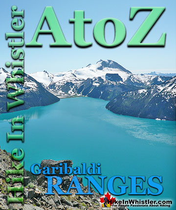
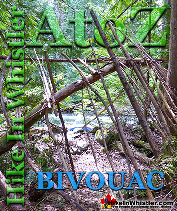
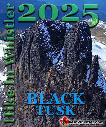
Whistler Hiking Glossary A to Z

Explore BC Hiking Destinations!
Whistler Hiking Trails
Squamish Hiking Trails
Vancouver Hiking Trails
Clayoquot Hiking Trails
Victoria Hiking Trails