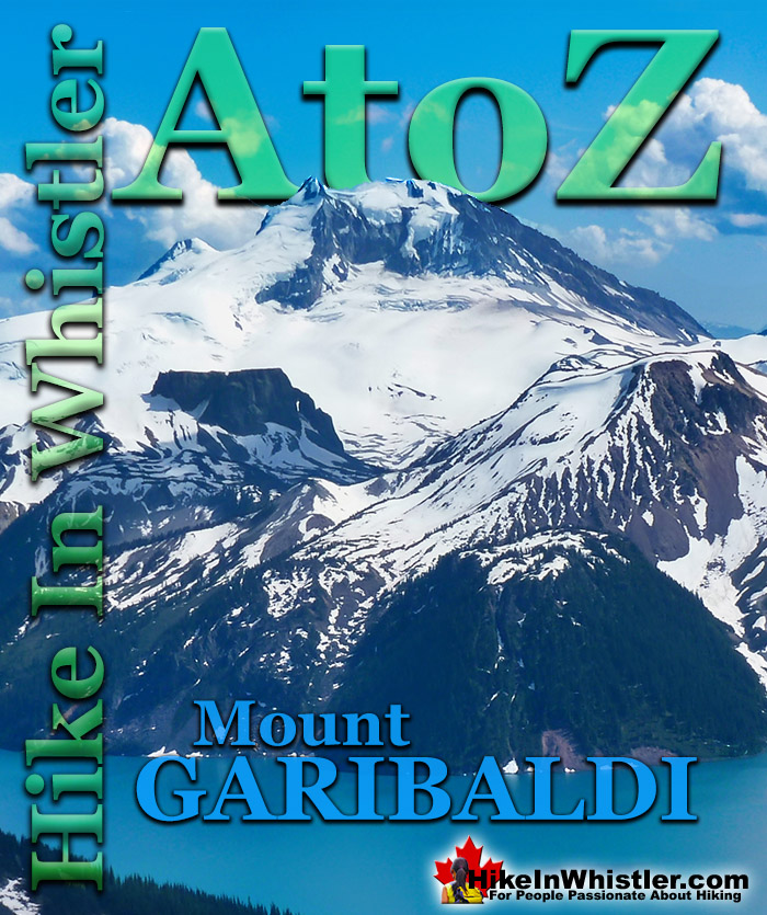
Mount Garibaldi is the huge, potentially active volcano that Garibaldi Provincial Park is named after. Mount Garibaldi also lends its name to the Garibaldi Ranges, the group of mountain ranges that fill Garibaldi Park. A subsection of the Garibaldi Ranges is the Garibaldi Névé, which is the large icefield that stretches out along the east side of Mount Garibaldi.
Whether you are standing in Squamish or high up on Panorama Ridge, Mount Garibaldi towers in the distance. From a wonderful vantage point such as Brandywine Meadows high up in the mountains across the valley, Mount Garibaldi appears monstrously huge. It is easy to imagine it bursting to life as an active volcano, which it technically still is. Named after a 19th century patriot and soldier, Giuseppe Garibaldi, Mount Garibaldi is a massive 2678 metre giant at the southern end of the park. It was named after Garibaldi by Captain George Henry Richards of the Royal Navy in 1860. Guiseppe Garibaldi had gained worldwide acclaim that year by unifying Italy by repatriating Sicily and Naples. In 1907 a group of Vancouver climbers reached the summit of Mount Garibaldi and marvelled at the view. In particular, Garibaldi Lake and Black Tusk caught their interest. Several forays into the area followed and a regular hiking camp was established between Black Tusk and Garibaldi Lake. In 1920 the Garibaldi Park Reserve was established and in 1927 Garibaldi Provincial Park was born.
Mount Garibaldi From Panorama Ridge
Mount Garibaldi, The Table and Mount Price
Garibaldi's Peaks
Garibaldi has two peaks in addition to the highest peak that is referred to as Mount Garibaldi , with an elevation of 2678 metres/8786 feet. The next highest peak is Atwell Peak on the southern edge of the summit plateau, with an elevation of 2655 feet/8711 feet. Atwell Peak is named after Atwell King, who led the first recorded ascent of Mount Garibaldi in 1907. One of the guides in the party, Arthur Tinniswood Dalton, has the third highest peak of Mount Garibaldi named after him. Dalton Dome is located on the west of the main summit and sits at an elevation 2653 metres/8704 feet and can be distinguished by its rounded shape. Other minor summits on Mount Garibaldi include, The Tent at 2465 metres/8087 feet, Diamond Head at 2056 metres/6745 feet, and so named because of its resemblance to Hawaii's Diamond Head.
Mount Garibaldi From Alice Lake
Mount Garibaldi From Black Tusk
Mount Garibaldi From Brandywine Meadows
More Whistler & Garibaldi Park Hiking A to Z!
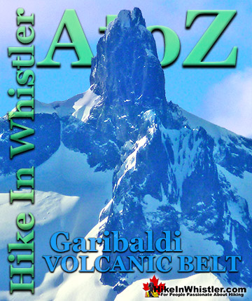
The Garibaldi Volcanic Belt is a line of mostly dormant stratovolcanoes and subglacial volcanoes largely centred around Whistler and extending through much ...
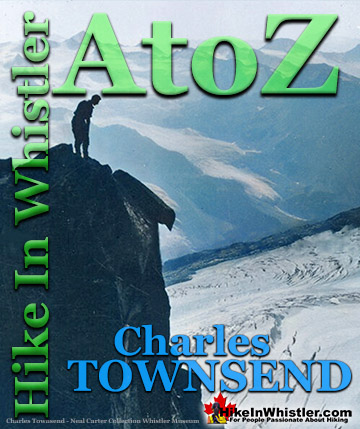
Charles Townsend (1900-1997) moved from London, England to Vancouver in the early 1920's where he met Neal Carter while studying Agriculture at UBC. Townsend was ...
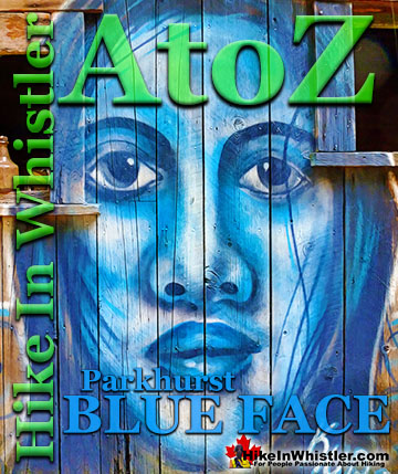
Back in 2011 Kups, a Whistler local and now professional muralist painted a hauntingly surreal, blue face on the side of this house. This beautiful ...
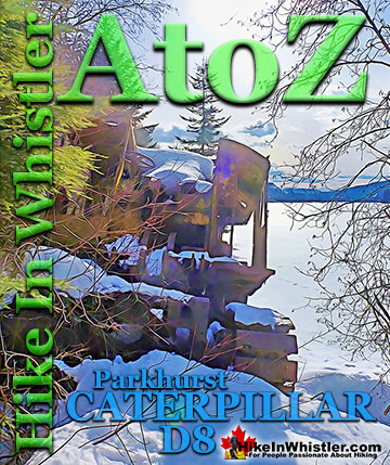
Along the shore of Green Lake, you will find a monstrous old Caterpillar tractor that dates from the 1930’s. Abandoned here in the 1950’s, it looks as if the ...
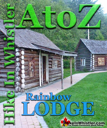
Rainbow Lodge was a popular wilderness lodge in the small community called Alta Lake, and what would eventually be called Whistler It was a fishing and ...
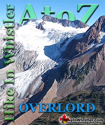
Overlord Mountain is the highest peak in the Fitzsimmons Range. Overlord is surrounded by several mountains that collectively are named the Overlord ...
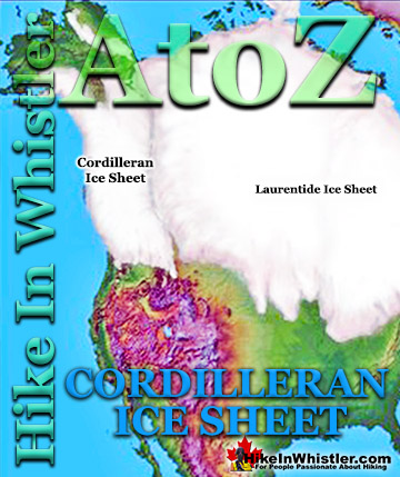
The Cordilleran Ice Sheet covered most of north-west North America for much of the last 2.6 million years. At the Last Glacial Maximum during the Last ...
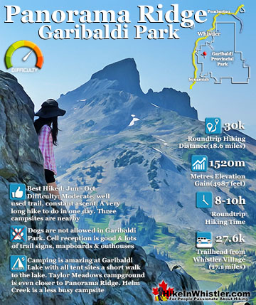
Panorama Ridge is easily one of the most amazing hikes in Garibaldi Provincial Park. The 15 kilometre(9.3 mile) hike from the trailhead at Rubble Creek to Panorama Ridge takes you through beautiful and deep ...
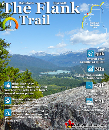
Hiking and biking trails are so abundant in Whistler that many go unnoticed, neglected or taken for granted. The Flank Trail is one of these. Most people in Whistler don't even know about it, but the ones ...
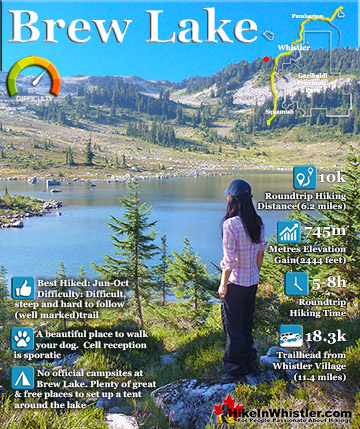
Brew Lake is beautiful mountain lake just a short drive south of Whistler and is relatively unknown and seldom hiked. Laying at the base of Mount Brew, Brew Lake lays in a massive alpine valley of enormous ...
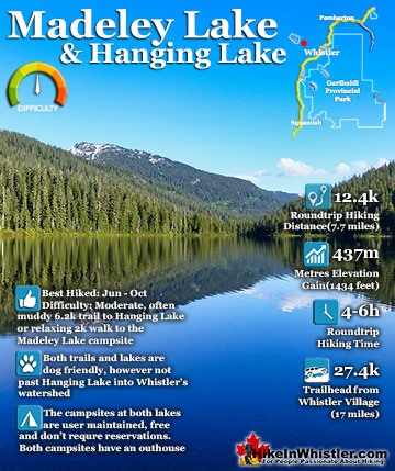
Madeley Lake is a gorgeous mountain lake located high up in the Callaghan Valley just a short drive past Alexander Falls. From Whistler Village it takes about 50 minutes to drive the 27.4 kilometres to get ...
Hiking in Whistler in October is often unexpectedly stunning. The days are much shorter and colder but the mountains are alive with colour from the fall ...
November in Whistler is when the temperatures plummet and the first heavy snow falls in the alpine and often in Whistler Village. The hiking opportunities become ...
December hiking in Whistler is mainly done on snowshoes, though not always. If it hasn't snowed much recently then trails such as Whistler Train Wreck and ...
Hiking in Whistler is spectacular and wonderfully varied. Looking at a map of Whistler you see an extraordinary spider web of hiking trails that are unbelievably numerous. Easy trails, moderate trails and challenging hiking trails are all available. Another marvellous ...
Squamish is located in the midst of a staggering array of amazing hiking trails. Garibaldi Provincial Park sprawls alongside Squamish and up and beyond Whistler. Tantalus Provincial Park lays across the valley to the west and the wonderfully remote Callaghan Valley ...
Clayoquot Sound has a staggering array of hiking trails within it. Between Tofino and Ucluelet, Pacific Rim Park has several wilderness and beach trails, each one radically different from the last. The islands in the area are often Provincial parks on their own with ...
Victoria has a seemingly endless number of amazing hiking trails. Most take you to wild and beautiful Pacific Ocean views and others take you to tranquil lakes in beautiful BC Coastal Rainforest wilderness. Regional Parks and Provincial Parks are everywhere you turn in ...
The West Coast Trail was created after decades of brutal and costly shipwrecks occurred along the West Coast of Vancouver Island. One shipwreck in particular was so horrific, tragic and unbelievable that it forced the creation of a trail along the coast, which ...