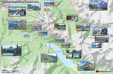
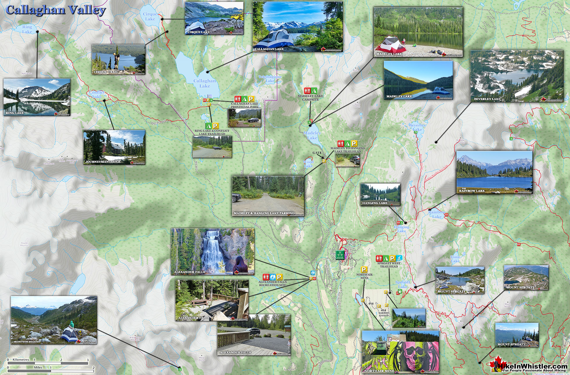
Ring Lake is a fantastically serene and wonderfully remote lake similar to Cirque Lake, but considerably farther to hike to reach it. The 10 kilometre(6.2 mile) hike takes you through a rarely hiked forest, then to an idyllic meadow filled with ponds and ringed with distant, mountains, then finally up an over some steep terrain to reveal this very hidden lake. 5 kilometres(3.1 miles) into the hike you come to Conflict Lake with trails running around it.
Idyllic lake high up in the mountains
Nice and varied trail infrequently hiked
Lots of accessible alpine routes beyond the lake
Black Tusk's little brother sits across the lake
Ring Lake feels wonderfully far from the world
Trail starts from beautiful Callaghan Lake
The trail is longer than other Whistler trails
No wow factor like Wedgemount or Joffre Lakes
Easy to lose the trail if you aren't careful
Local tour company marches groups through
Journeyman Lodge sits near Conflict Lake. A wilderness lodge operated by Callaghan Country, a tour company that operates in the valley. They offer a range of alpine activities, far more serene than across the valley on Whistler Mountain and Blackcomb Mountain. Signs along the trail and at Conflict Lake indicate which trail to take to reach Ring Lake, a further 5 kilometres from Conflict Lake. The trail from Conflict Lake to Ring Lake passes through a huge valley for a couple kilometres, then abruptly ascends on the right side of the valley. The trail is poorly marked in this section and you have to keep bearing right to avoid descending back into the valley. The trail is occasionally maintained, however owing to heavy winter snow, the trail gets pretty brutalized every winter. Because of the winter destruction, the visible trail in some parts disappears and you find yourself wondering if you are still on your way to Ring Lake.
Ring Lake Hiking Trail Map
The key to staying on the right route, you quickly figure out, is to keep to the right side of the valley. Three kilometres of, at times very steep, but not technical trail gets you to the magnificent Ring Lake and the imposing Ring Mountain across the emerald green water.
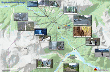
Keyhole Hot Springs (aka Pebble Creek Hot Springs) is located 100 kilometres from Whistler(Village Gate Blvd). Though most of the 100 kilometres is on logging roads, it is ...
Russet Lake is a surreal little paradise that lays at the base of The Fissile. The Fissile is the strikingly bronze mountain visible from Whistler Village. From the Village ...
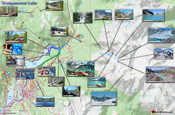
Wedgemount Lake itself is a magnificent destination for a day hike or spectacular overnight beneath the dazzling mountain peaks and stars. Many sleep under the stars on one of ...
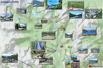
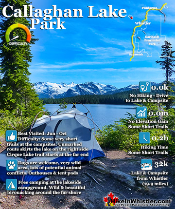
Callaghan Lake Park is a relatively untouched wilderness of rugged mountainous terrain. The valley walls were formed by relatively recent glaciation. Evidence of this can be ...
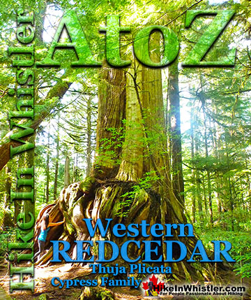
Western redcedar is a very large tree commonly found in the Pacific Northwest. Frequently growing up to 70 metres and with a trunk diameter of 7 metres, ...
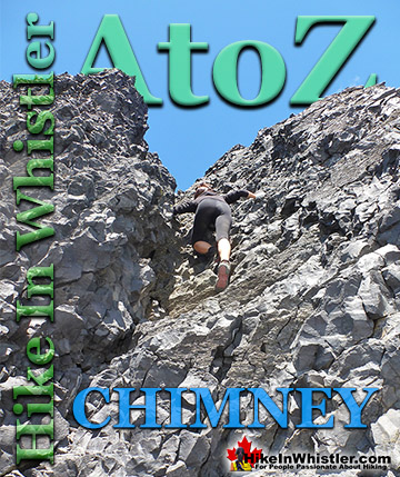
Chimney: a gap between two vertical faces of rock or ice. Often a chimney offers the only viable route to the summit of a mountain. An example of this is Black ...
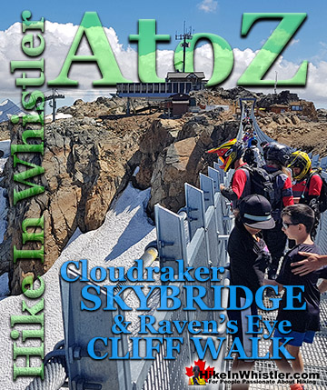
The Cloudraker Skybridge and the Raven’s Eye Cliff Walk are new additions to the summit of Whistler Mountain. The Cloudraker Skybridge stretches 130 ...
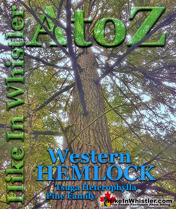
Western hemlock (tsuga heterophylla) is a large evergreen coniferous tree that is native to the west coast of North America. Unlike many other trees in ...
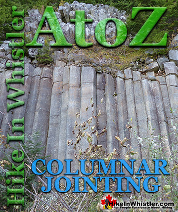
Columnar Jointing: bizarre looking columns of oddly angular rock formations that can be found in many places around Whistler and worldwide. Generally ...
Along Whistler’s Valley Trail near Rainbow Park you come across some impressively unusual trees. Unlike most other Whistler trees with straight trunks and ...
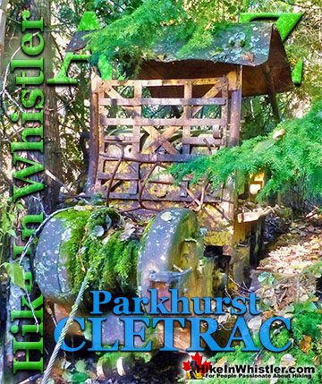
Adjacent to the huge Caterpillar tractor in Parkhurst is a large disintegrating wooden dock that is a great place to take in the wonderful view of Green ...
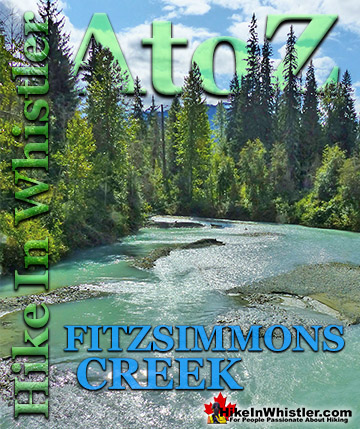
Fitzsimmons Creek is the beautiful and huge creek that crashes through Whistler Village. When walking from Whistler Village to the Upper Village, you will cross ...
Callaghan Lake Park is a relatively untouched wilderness of rugged mountainous terrain. The valley walls were formed by relatively recent glaciation. Evidence of this can be seen in the considerable glacial ...
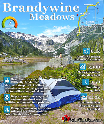
Brandywine Meadows is a nice, relatively short hike to a massive flower filled valley high up in Callaghan Valley. Located 40 minutes south of Whistler, this tough and sometimes muddy trail gains a huge 550 ...
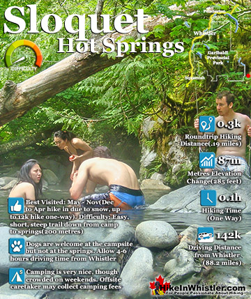
Sloquet Hot Springs is a wonderfully wild set of shallow, man-made pools fed by a small, all natural, and very hot, waterfall. The pools stretch from the waterfall to the large and crashing Sloquet River. The ...
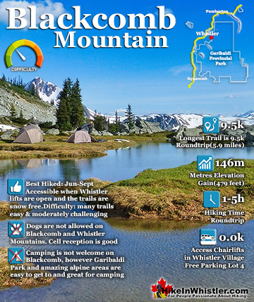
Blackcomb Mountain holds an impressive and ever growing array of hiking trails. From the moment you arrive at the Rendezvous Lodge, you see hiking trails ascend into the distance. The Rendezvous Lodge is ...
 Idyllic lake high up in the mountains
 The trail is longer than other Whistler trails