HikeInWhistler.com

HikeInWhistler.com

Menu
  • Hike
      • Alexander Falls Provincial Park
      • Ancient Cedars & Showh Lakes
      • Black Tusk in Garibaldi Park
      • Blackcomb Mountain Hiking Trails
      • Brandywine Falls Provincial Park
      • Brandywine Meadows
      • Brew Lake & Mount Brew
      • Callaghan Lake Provincial Park
      • Cheakamus Lake in Garibaldi Park
      • Cheakamus River & Interpretive Forest
      • Cirque Lake in Callaghan Valley
      • Flank Trail (Rainbow-Sproatt)
      • Garibaldi Lake in Garibaldi Park
      • Helm Creek in Garibaldi Park
      • Jane Lakes West
      • Joffre Lakes Provincial Park
      • Keyhole Hot Springs
      • Logger's Lake & Interpretive Forest
      • Madeley Lake & Hanging Lake
      • Meager Hot Springs
      • Nairn Falls Provincial Park
      • Newt Lake & Ancient Cedars
      • Panorama Ridge in Garibaldi Park
      • Parkhurst Ghost Town
      • Rainbow Falls
      • Rainbow Lake
      • Ring Lake & Conflict Lake
      • Russet Lake in Garibaldi Park
      • Sea to Sky Trail
      • Skookumchuck Hot Springs
      • Sloquet Hot Springs
      • Sproatt West(Northair) Trail
      • Sproatt East(Stonebridge) Trail
      • Train Wreck & Trash Trail
      • Taylor Meadows in Garibaldi Park
      • Wedgemount Lake in Garibaldi Park
      • Whistler Mountain Hiking Trails
  • Snow
      • Blueberry Trail Snowshoeing
      • Brandywine Falls Snowshoeing
      • Cheakamus River Snowshoeing
      • Elfin Lakes Snowshoeing
      • Flank Trail Snowshoeing
      • Joffre Lakes Snowshoeing
      • Nairn Falls Snowshoeing
      • Parkhurst Ghost Town Snowshoeing
      • Rainbow Falls Snowshoeing
      • Rainbow Lake Snowshoeing
      • Rainbow Park Snowshoeing
      • Sproatt East Snowshoeing
      • Taylor Meadows Snowshoeing
      • Train Wreck Snowshoeing
      • Wedgemount Lake Snowshoeing
  • Run
      • Whistler Golf Course 5k(3.1 Mile)
      • Blueberry Hill 6k(3.7 Mile)
      • Lost Lake 6k(3.7 Mile)
      • Alta Lake 8k(5 Mile)
      • Fitzsimmons Creek 9k(5.6 Mile)
      • Alta Green Lost 15k(9.3 Mile)
  • Best
      • Best Whistler Parks & Beaches
      • Best Whistler Waterfalls
      • Best Whistler Aerial Views
      • Best Whistler Hiking by Month
      • Best Whistler Snowshoeing
      • Best Whistler Running Trails
      • Best Whistler Hiking Trails
      • Best Squamish Hiking Trails
      • Best Vancouver Hiking Trails
      • Best Whistler Hiking Gear Rentals
  • AtoZ
      • Ablation Zone
      • Accumulation Zone
      • Adit Lakes
      • Aiguille
      • Alpine Zone
      • Arborlith or Lithophyte
      • Arête
      • A River Runs Through It
      • Armchair Glacier
      • The Barrier
      • Battleship Islands
      • Bears
      • Bench
      • Bergschrund or Schrund
      • Bivouac or Bivy
      • Blue Face House in Parkhurst
      • Bungee Bridge
      • Cairns & Inukshuks
      • Carter, Neal
      • Caterpillar D8
      • Caterpillar RD8
      • Chimney
      • Cirque or Cirque Lake
      • Cloudraker Skybridge
      • Coast Mountains
      • Col
      • Crevasse
      • Deadfall
      • Emerald Forest
      • Erratic or Glacier Erratic
      • The Fissile
      • Fitzsimmons Creek
      • Fitzsimmons Range
      • Fyles, Tom
      • Garibaldi Ranges
      • Garibaldi Volcanic Belt
      • Gemel or Inosculation
      • Glacier Window
      • Green Lake
      • Hoary Marmot
      • Krummholz
      • Moraine
      • Mount Garibaldi
      • Mount James Turner
      • Northair Mine
      • Nunatuk
      • Overlord Mountain & Glacier
      • Peak2Peak Gondola
      • Roundhouse Lodge
      • Rubble Creek
      • Spearhead Range
      • Tarn
      • The Table
      • Usnea or Old Man's Beard
      • Western Redcedar
  • Maps
      • Alexander Falls Maps
      • Ancient Cedars Maps
      • Black Tusk Maps
      • Blackcomb Mountain Maps
      • Brandywine Falls Maps
      • Brandywine Meadows Maps
      • Brew Lake Maps
      • Callaghan Lake Maps
      • Cheakamus Lake Maps
      • Cheakamus River Maps
      • Cirque Lake Maps
      • Garibaldi Lake Maps
      • Helm Creek Maps
      • Joffre Lakes Maps
      • Keyhole Hot Springs Maps
      • Logger's Lake Maps
      • Madeley Lake Maps
      • Meager Hot Springs Maps
      • Nairn Falls Maps
      • Panorama Ridge Maps
      • Parkhurst Ghost Town Maps
      • Rainbow Falls Maps
      • Rainbow Lake Maps
      • Ring Lake Maps
      • Russet Lake Maps
      • Skookumchuck Maps
      • Sloquet Hot Springs Maps
      • Sproatt Maps
      • Taylor Meadows Maps
      • Train Wreck Maps
      • Wedgemount Lake Maps
      • Whistler Mountain Maps
  • More
      • Whistler Hiking News & Blog
      • Live Whistler Webcams
      • Live Tofino Webcams
      • Live Vancouver Webcams
      • Garibaldi Provincial Park
      • Hike in Whistler Glossary

Sproatt East

Whistler Train Wreck

Wedgemount Lake

Black Tusk

Flank Trail

Northair Mine

Rent Snowshoes Here!

Whistler hiking gear rental at WeRentGear.com.  Free delivery in Whistler and to Rubble Creek for Garibaldi Provincial Park.  WeRentGear Whistler: Best gear, best prices, best service.

Best Trails This Week!

Best This Week: Alexander Falls, Brandywine Falls, Rainbow Falls, Nairn Falls, Sproatt East, Cheakamus River, Joffre Lakes, Blueberry Park, and Whistler Train Wreck.

The alpine hiking trails on Whistler Mountain are the ultimate in luxurious hiking. Little hiking effort gets you amazing views of turquoise lakes, snowy mountain, valleys of flowers, waterfalls and spectacular glaciers. In the summer months, Whistler Mountain is somewhat divided in two.  The lower half of the mountain is for biking and the upper half is for hiking, sightseeing, trail running, eating and drinking.

  • Endless beautiful trails accessible by gondola
  • Great way to access Garibaldi Provincial Park
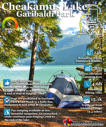
  • Best vantage point over Cheakamus Lake
  • Effortless sightseeing as you ride to the trails
  • Great eating & drinking at the Roundhouse Lodge
  • Wide range of easy to difficult hiking trails
  • The Peak Chair is incredible
  • Trails extend to Russet Lake in Garibaldi Park
  • Peak to Peak Gondola crosses to Blackcomb
  • Most other trails in Whistler are free

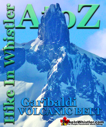
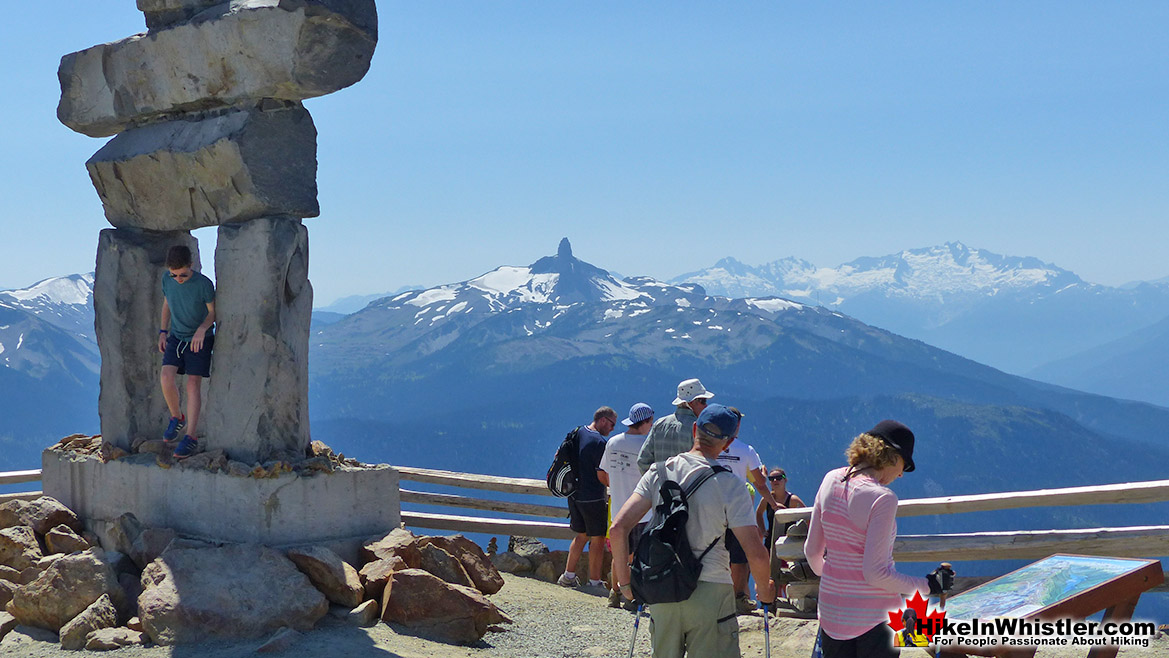
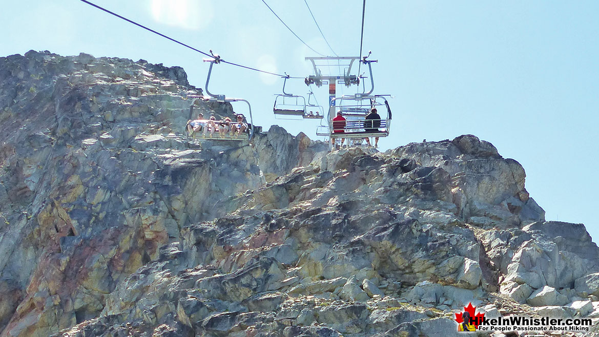
There are a few directions you can start hiking from the Roundhouse Lodge, however, taking the Peak Express(quad chairlift) up to the summit of Whistler Mountain is an amazing place to start. The Peak Express is an exhilarating ride that takes you to the start of Whistler Mountain's best hiking trails. The Half Note Trail, High Note Trail and Mathew's Traverse start here. The High Note Trail in turn leads to the Musical Bumps Trail to Russet Lake and Singing Pass in Garibaldi Provincial Park.  The summit of Whistler Mountain is also a destination of its own. Spectacular views all around from this rocky, alpine summit visible from almost everywhere in Whistler.  Black Tusk comes into view as you exit the Peak Express.  This amazingly distinct pinnacle of jet-black rock is a local icon and remnant of a not too distant history of volcanism in the area.  As you admire its absurdly vertical form, remind yourself that there is almost certainly a few hikers looking back at you from its summit.  Looking right as you get off the Peak Express you will see an enormous inukshuk.  A remnant of the 2010 Olympic Games and now a fixture in thousands of photos.

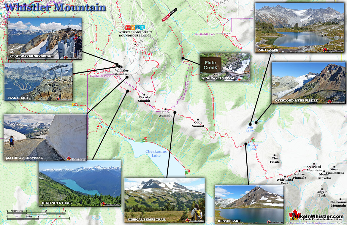
Whistler Mountain Hiking Trail Map

This beautiful stacking of huge rocks is a take-away from the Inuit tradition of marking routes in an otherwise stark landscape with a human form.  The inuksuk is part of the Whistler Summit Interpretive Walk.  This 1.6 kilometre(1 mile), trail takes you along an excellent route around the summit of Whistler to one amazing viewpoint after another.

Whistler Mountain Summit Inukshuk and Black Tusk

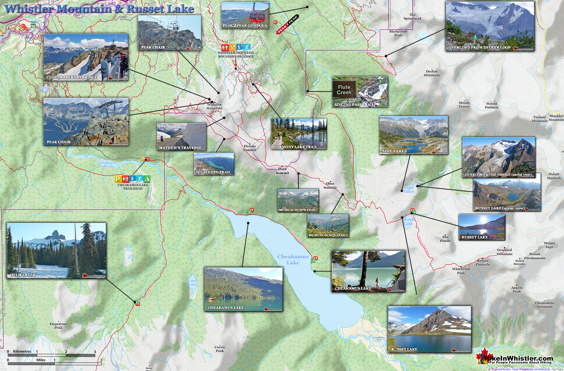
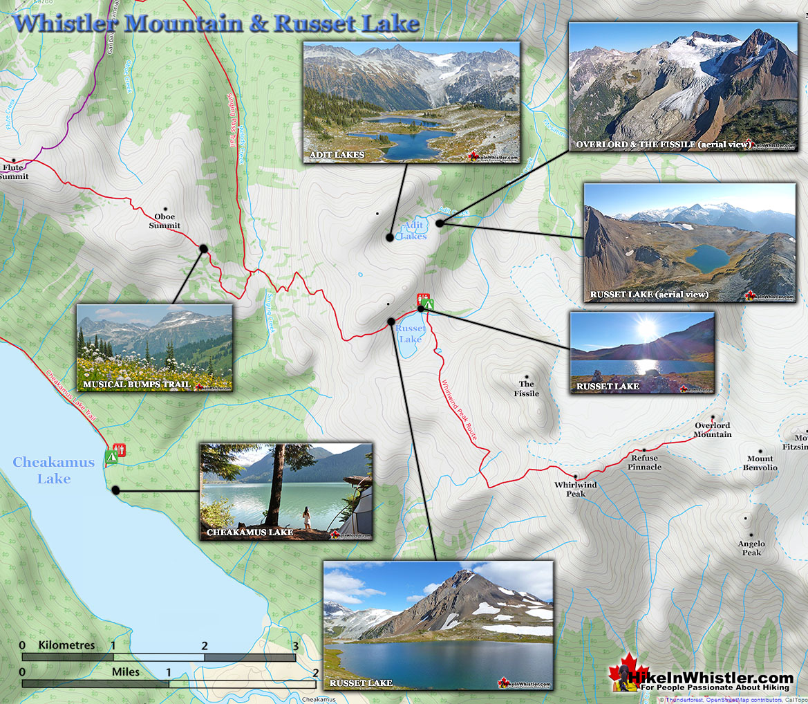
Whistler Mountain Russet Lake Map v20

High Note Trail - Whistler Mountain Maps

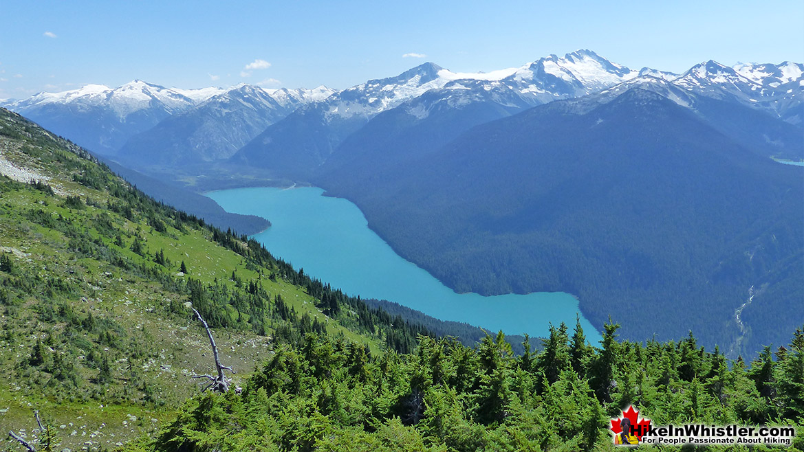
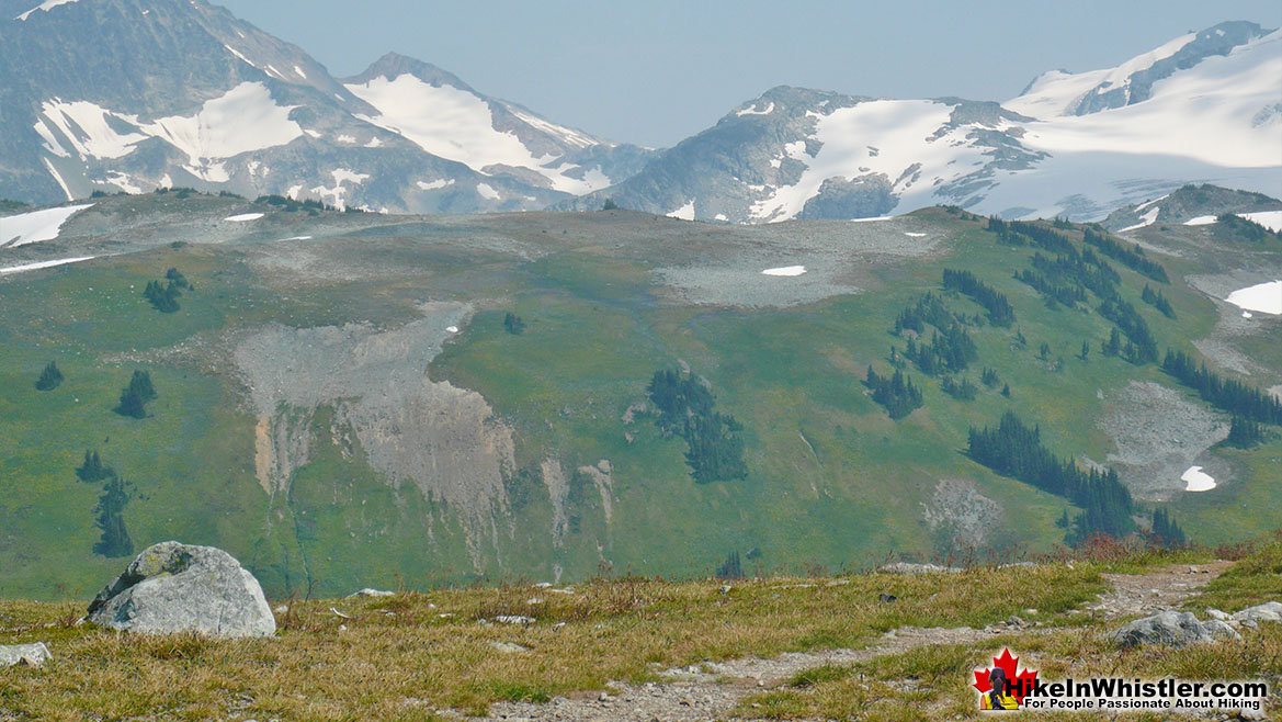
Branching off of the Whistler Summit Interpretive Walk you will see the High Note Trail extend toward the rocky cliffs.  The High Note Trail is a beautiful trail that skirts the edge of Whistler Mountain for several kilometres before bending back around Whistler to the Roundhouse Lodge.  A total of 9.4 kilometres(6 miles), the High Note Trail is a must-see trail on Whistler.  For much of the trail you have Cheakamus Lake down the valley on your right.  This huge lake fills the valley below with an extraordinarily vivid turquoise colour.  This amazing colour caused by glacial meltwater filling the lake with suspended particles of rock which in turn reflect the light in a strikingly beautiful way.

High Note Trail View of Cheakamus Lake

Whistler Mountain Musical Bumps Trail

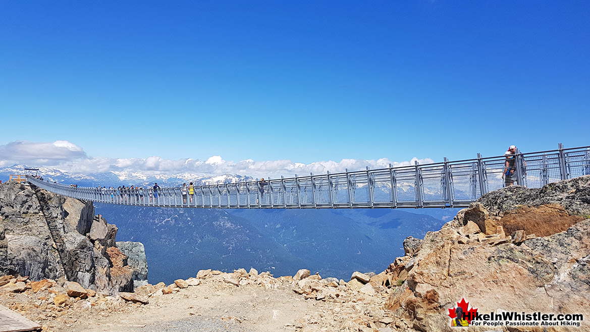
Whistler Peak Suspension Bridge

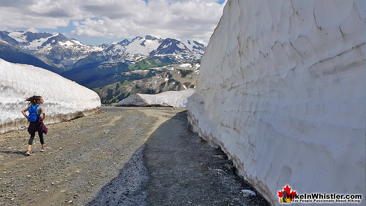
Whistler Mountain Mathews Traverse Ice Walls

Whistler Mountain Riding the Peak Chair

The High Note Trail takes about 3 hours for most to hike and returns you to the Roundhouse Lodge where you began before walking down to the Peak Express and riding it up to the trailhead at the summit of Whistler. If you prefer a shorter route you can veer off from the High Note Trail, part way and take the Half Note Trail back. The Half Note Trail takes a couple kilometres off of the High Note Trail, though doesn't cut it in half as the name suggests. The Half Note Trail connects you to Pika's Traverse, which is an access road that runs from Whistler's summit down to Roundhouse Lodge. Though it is a dusty road, it still has beautiful views for most of the way.

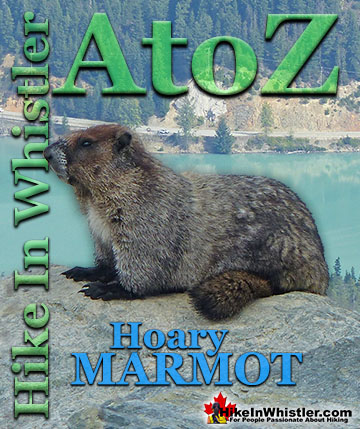
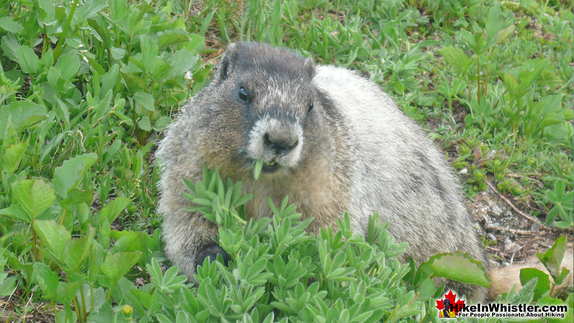
Hoary Marmot on the High Note Trail

Whistler Mountain Hiking Trails Map

Most start hiking the Whistler Mountain hiking trails at the Roundhouse at the terminus of the Whistler Gondola. You can also access Whistler Mountain for free by hiking the long Singing Pass trail and then across the Musical Bumps Trail to the peak of Whistler Mountain. The Singing Pass trail is long and boring as it runs a fairly direct line in between Whistler Mountain and Blackcomb Mountain, and always in deep forest. Years ago this 11.5 kilometre trail was much more enjoyable owing to the access road and parking area 4 kilometres up the trail. A slide took a chuck of the road out and years later you will still only find a ravine that you have to negotiate before continuing up to the original trailhead. Accessing Whistler Mountain with a day or season's pass is the best option for most. You ride in style up to the Roundhouse. From the lodge you can start hiking in a few directions or take the short walk down to the Peak Chair and ride up to the summit of Whistler Mountain. A pretty amazing way to start your hike.

Russet Lake Map v20

Hiking Trails Near Roundhouse Lodge

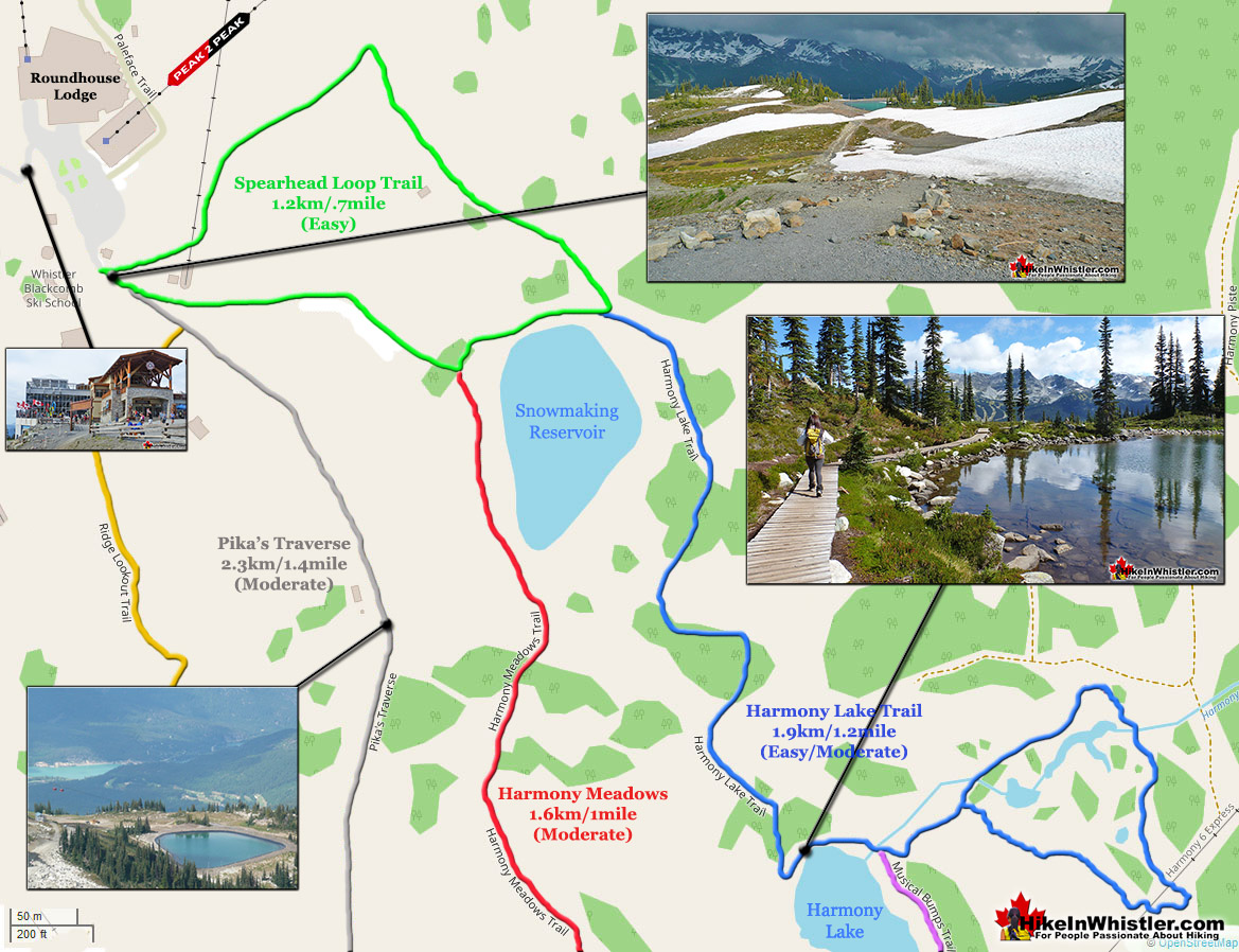
The Spearhead Loop Trail is EasyThe Spearhead Loop trail is a short, very easy, 1.2 kilometre or .7 mile loop trail that begins just past the Peak2Peak Gondola building.  It descends down a gravel path to a snowmaking reservoir before looping back to where it started.  The last section from the reservoir to the Peak2Peak Gondola building there are three trail junctions.  The Harmony Lake Loop trail bends around the back of the reservoir and through a lovely alpine forest to Harmony Lake.  Another trail junction at Harmony Lake goes left to another loop trail section of the Harmony Lake Loop trail or continues past the lake to yet another trail junction to the High Note trail and the Musical Bumps trail.  Or you can take the trail to the right and follow the short, but challenging trail section of the Harmony Meadows trail back to the Spearhead Loop trail.  The third Spearhead Loop trail junction, just before reaching the Peak2Peak Gondola building, is the wide gravel road hiking route, Pika’s Traverse.  This long and continuously steep ascent takes you to the summit of Whistler Mountain along a very beautiful and constantly scenic route.

Whistler Hiking Map Short Trails

More Whistler Mountain Hiking Info...

Helm Creek is a cute, meandering creek that winds its way from beyond Black Tusk, down the valley to the wonderful campground that takes its name. From the Helm Creek ...
Read more
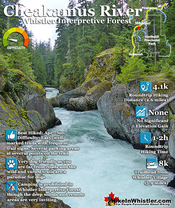
Cheakamus River is the beautiful, crashing and turquoise coloured river that flows from Cheakamus Lake, through the Cheakamus Valley to Daisy Lake.  Also a popular kayaking route, ...
Read more
The Rainbow Trail is a convenient and popular trail near Whistler Village that takes you to Rainbow Lake as well as the Flank Trail, Rainbow Falls, Hanging Lake, Madeley ...
Read more
Logger’s Lake is an amazing little lake hidden up in the deep forest above the more well known Cheakamus River. The lake, almost unbelievably exists in a long extinct ...
Read more

Garibaldi Park Wildlife & History

Plants of the Whistler RegionA Passion for MountainsPlants of the Whistler Region is an excellent book that includes great pictures and descriptions of most trees you will find in Whistler. Small enough to fit in your pocket and comprehensive enough to identify most things you will encounter growing in the forests of Whistler. Along with conifer trees and broadleaf trees the book has chapters on flowers, berries, ferns and shrubs. You can find Plants of the Whistler Region on Amazon, the Whistler Library and at Armchair Books in Whistler Village. The author Collin Varner has a wonderful series of Plants of.. books on various regions beyond Whistler. Plants of Vancouver and the Lower Mainland, Plants of the Gulf and San Juan Islands and Southern Vancouver Island, and Plants of the West Coast Trail. In the last couple years he has started a new series of books. The Flora and Fauna of Coastal British Columbia and the Pacific Northwest and Edible and Medicinal Flora of the West Coast: British Columbia and the Pacific Northwest.  A Passion for Mountains by Kathryn Bridge is a fascinating look at Don and Phyllis Munday's prolific exploration of the mountains in BC.  Based out of Vancouver, they were dominant figures of the climbing community in the early 1900's.  In 1923 they visited their friend Neal Carter in Alta Lake(Whistler) and explored the mountains around the valley.. many for the first time!

**We participate in the Amazon Services LLC Associates Program and earn a small commission on purchases we link through to Amazon at no extra cost to you.  We only link to books and products we love and highly recommend.  Thanks for your support!**

Waterbar and Cross-Ditch: the purpose of a waterbar or cross-ditch is to capture and redirect surface water from the road and channel it across the road ...
Read more
The pale green shub-like growths hanging from trees in the forests around Whistler is called usnea.  These bushy, coral-like fruticose lichens anchor to bark ...
Read more
Northair Mine is wonderful, hidden world high up in Callaghan Valley.  It was a gold mine run by the Northair Group from 1976 until was abandoned in 1982 ...
Read more
Mount Garibaldi is the huge, potentially active volcano that Garibaldi Provincial Park is named after.  Mount Garibaldi also lends its name to the Garibaldi ...
Read more
Russet Lake sits in a wide, glacier carved valley at the base of The Fissile.  In the direction opposite The Fissile, up on a plateau less than a ...
Read more
Accumulation Zone: the area where snow accumulations exceeds melt, located above the firn line.  Snowfall accumulates faster than melting, evaporation and ...
Read more
The Pacific yew or western yew is a coniferous tree that grows in Whistler and along the coast from Alaska to California. The Pacific yew’s unique ...
Read more
Armchair Glacier is one of the many easily identifiable mountain features around Whistler.  Along with Wedge Mountain and Black Tusk, Armchair Glacier has a ...
Read more
More Hike in Whistler Glossary

Rent Hiking Gear Whistler & Garibaldi Park

Whistler & Garibaldi Hiking

Easy Hiking Trail WhistlerAlexander Falls  Moderate Hiking Trail Whistler Dog FriendlyAncient Cedars  Moderate Hiking Trail WhistlerBlack Tusk  Pay Use Hiking Trail WhistlerBlackcomb Mountain  Easy Hiking Trail WhistlerBrandywine Falls  Moderate/Hard Hiking Trail Whistler Dog FriendlyBrandywine Meadows  Moderate/Hard Hiking Trail Whistler Dog FriendlyBrew Lake  Easy Hiking Trail WhistlerCallaghan Lake  Moderate Hiking Trail WhistlerCheakamus Lake  Whistler Hiking Trail EasyCheakamus River  Whistler Hiking Trail HardCirque Lake  Whistler Hiking Trail EasyFlank Trail  Moderate Hiking Trail WhistlerGaribaldi Lake  Moderate Hiking Trail WhistlerGaribaldi Park  Moderate Hiking Trail WhistlerHelm Creek  Moderate Hiking Trail Whistler Dog FriendlyJane Lakes  Joffre Lakes Hike in Whistler in SeptemberJoffre Lakes  Moderate Hiking Trail Whistler Dog FriendlyKeyhole Hot Springs  Hiking Trail Hard Dog FriendlyLogger’s Lake  Whistler Hiking Trail EasyMadeley Lake  Moderate/Hard Hiking Trail Whistler Dog FriendlyMeager Hot Springs Easy Hiking Trail WhistlerNairn Falls  Whistler Hiking Trail HardNewt Lake  Moderate Hiking Trail WhistlerPanorama Ridge  Whistler Hiking Trail EasyParkhurst Ghost Town  Hiking Trail Hard Dog FriendlyRainbow Falls  Moderate Hiking Trail WhistlerRainbow Lake  Moderate/Hard Hiking Trail Whistler Dog FriendlyRing Lake  Moderate Hiking Trail WhistlerRusset Lake  Whistler Hiking Trail EasySea to Sky Trail  Easy Hiking Trail WhistlerSkookumchuck Hot Springs  Easy Hiking Trail WhistlerSloquet Hot Springs  Sproatt East  Moderate Hiking Trail WhistlerSproatt West  Moderate Hiking Trail WhistlerTaylor Meadows  Whistler Hiking Trail EasyTrain Wreck  Hiking Trail Hard - Whistler TrailsWedgemount Lake  Pay Use Hiking Trail WhistlerWhistler Mountain

  Winter Hiking WhistlerJanuary  Winter Hiking WhistlerFebruary  Spring Hiking WhistlerMarch  Spring Hiking WhistlerApril  Spring Hiking WhistlerMay  Summer Hiking WhistlerJune  Summer Hiking WhistlerJuly  Summer Hiking WhistlerAugust  Fall Hiking WhistlerSeptember  Fall Hiking WhistlerOctober  Fall Hiking WhistlerNovember  Winter Hiking WhistlerDecember

Jane Lakes are a very remote feeling set of lakes in the beautiful wilderness near Cheakamus Crossing.  Consisting of three lakes, West Jane Lake, East Jane Lake and Little Jane Lake, they have a great ...
Read more
Russet Lake is a surreal little paradise that lays at the base of The Fissile, in Garibaldi Provincial Park. The Fissile is the strikingly bronze mountain visible from Whistler Village.  From the Village ...
Read more
Meager Hot Springs(aka: Meager Creek Hot Springs) is located 93 kilometres northwest of Whistler, was beautifully developed into gorgeous pools, with a caretaker and usage charge.  At its height of ...
Read more
Ancient Cedars is a nice, easy/moderate 2.5 kilometre (1.6 mile) hiking trail on the far side of Cougar Mountain, just 13.1 kilometres north of Whistler Village. A small, untouched grove of huge western ...
Read more
More Whistler Hiking Trails & Maps

HikeInWhistler.com HikeInWhistler.com © 2023
  • Contact Us: [email protected]