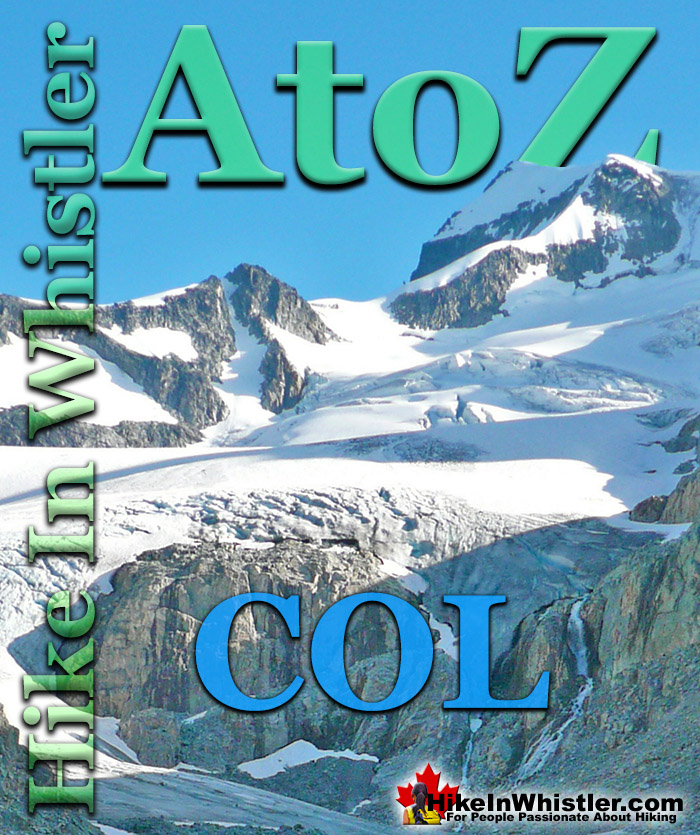
Col: a ridge between two higher peaks, a mountain pass or saddle. More specifically is the lowest point on a mountain ridge between two peaks. Sometimes called a saddle or notch. The Wedge-Weart Col is a popular destination at the top of Wedgemount Glacier. The Wedge-Weart Col connects these two highest peaks in Garibaldi Provincial Park and is easily visible from much of the area around Wedgemount Lake.
One of the defining features of Garibaldi Park, and Wedgemount Lake in particular, is the staggering number of branching hikes from the main destination of the lake itself. For many, Wedgemount Lake and the Wedge Hut is the base for hikes to Wedge Mountain, Mount Cook, Mount Weart, Mount Moe, Mount James Turner and Mount Currie in Pemberton, crossing glaciers such as Wedgemount Glacier, Weart Glacier, Armchair Glacier, Mystery Glacier and the Needles and Chaos Glacier to name a few. Wedgemount Lake itself is a magnificent destination for a day hike or spectacular overnight beneath the dazzling mountain peaks and stars. Many sleep under the stars on one of the many beautiful tent platforms that dot the landscape. Solidly built, wooden tent platforms are everywhere you look at Wedgemount Lake. Strategically positioned, these platforms manage to maintain an amazingly secluded feel despite their numbers. In all Wedgemount Lake has 20 of these tent areas. Most are wooden, but several down by the lake shore are gravel, yet every bit as nice. At a fast hiking pace you can reach Wedgemount Lake from the trailhead in just an hour and a half but at a leisurely or backpack laden pace you will likely take over two hours. The trail is well marked and well used. The steepness of the trail doesn't require any technical skill, however that last kilometre before the lake you will be scrambling on all fours quite a bit.
More Whistler & Garibaldi Park Hiking A to Z!
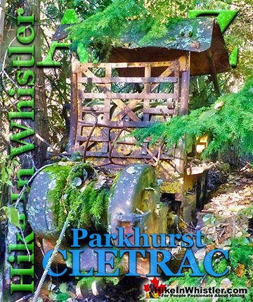
Adjacent to the huge Caterpillar tractor in Parkhurst is a large disintegrating wooden dock that is a great place to take in the wonderful view of Green ...
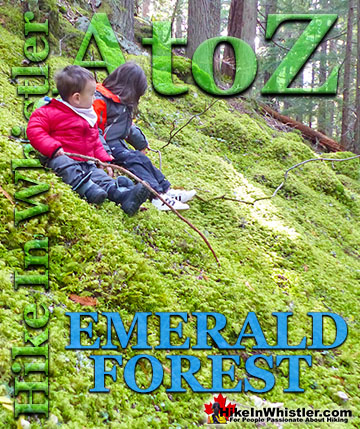
Emerald Forest is a cute little forest that is well hidden between Whistler Cay and Alpine. From Whistler Village, if you go down to the end of Lorimer ...
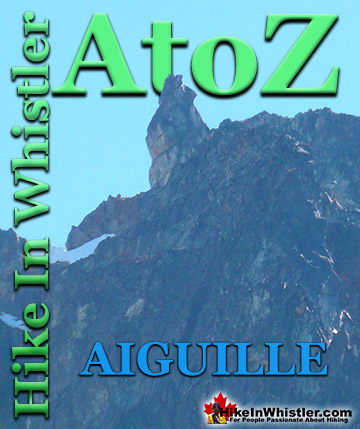
Aiguille: a tall, narrow, characteristically distinct spire of rock. From the French word for "needle". Used extensively as part of the names for many ...
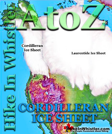
The Cordilleran Ice Sheet covered most of north-west North America for much of the last 2.6 million years. At the Last Glacial Maximum during the Last ...
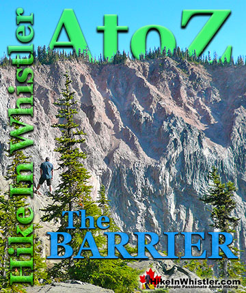
The Barrier formed as a result of huge lava flows from Clinker Peak on the west shoulder of Mount Price during the last ice age. About thirteen thousand ...
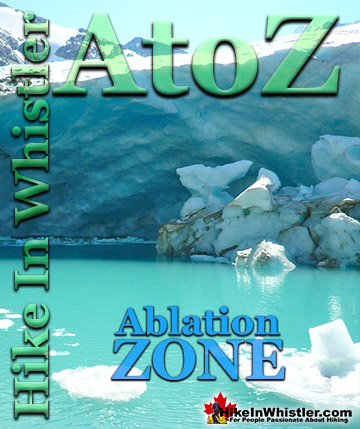
Ablation Zone: the lower altitude region of a glacier where there is a net loss of ice mass due to melting, sublimation, evaporation, ice calving or ...
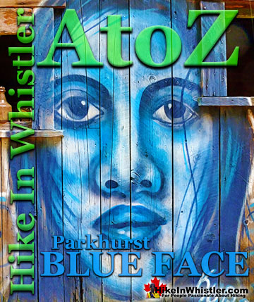
Back in 2011 Kups, a Whistler local and now professional muralist painted a hauntingly surreal, blue face on the side of this house. This beautiful ...
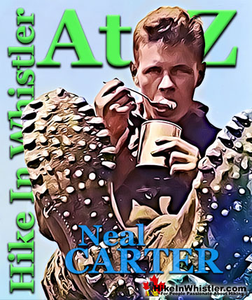
Neal Carter (14 Dec 1902 – 15 Mar 1978) was a mountaineer and early explorer of the Coast Mountains primarily in the 1920’s and 1930’s. Astoundingly skilled as a ...
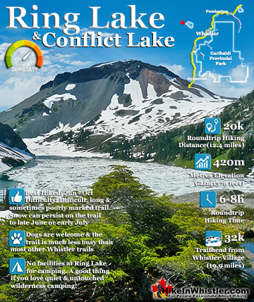
Ring Lake is a fantastically serene and wonderfully remote lake similar to Cirque Lake, but considerably farther to hike to reach it. The 10 kilometre(6.2 mile) hike takes you through a rarely hiked forest, ...
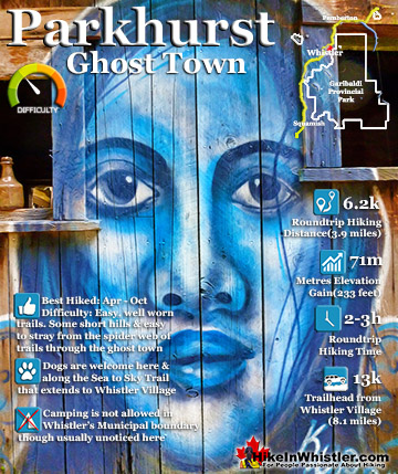
Whistler has an absurd number of wonderful and free hiking trails and Parkhurst Ghost Town certainly ranks as the most unusual and interesting. Parkhurst was a little logging town perched on the edge of Green ...
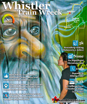
The trail to Whistler Train Wreck is an easy, yet varied route through deep forest, across a great suspension bridge over Cheakamus River, to a stunning array of wrecked train cars. The trail from your car to ...
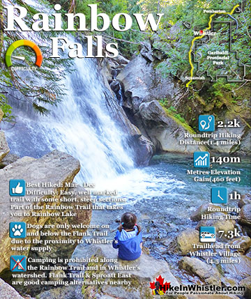
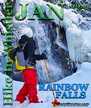
The short, winding, and ever-changing hiking trail to Rainbow Falls is the same as the much more popular trailhead for Rainbow Lake. The trailhead is marked as the Rainbow Trail, and the trail quickly ...
Hiking in Whistler in October is often unexpectedly stunning. The days are much shorter and colder but the mountains are alive with colour from the fall ...
November in Whistler is when the temperatures plummet and the first heavy snow falls in the alpine and often in Whistler Village. The hiking opportunities become ...
December hiking in Whistler is mainly done on snowshoes, though not always. If it hasn't snowed much recently then trails such as Whistler Train Wreck and ...
Hiking in Whistler is spectacular and wonderfully varied. Looking at a map of Whistler you see an extraordinary spider web of hiking trails that are unbelievably numerous. Easy trails, moderate trails and challenging hiking trails are all available. Another marvellous ...
Squamish is located in the midst of a staggering array of amazing hiking trails. Garibaldi Provincial Park sprawls alongside Squamish and up and beyond Whistler. Tantalus Provincial Park lays across the valley to the west and the wonderfully remote Callaghan Valley ...
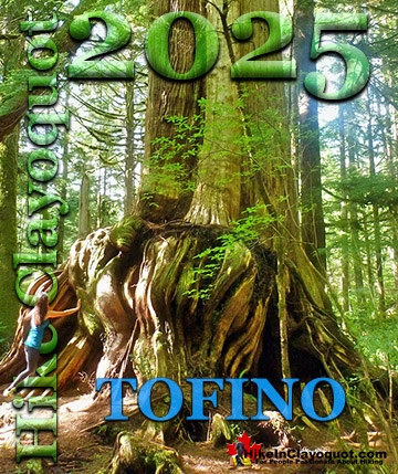
Clayoquot Sound has a staggering array of hiking trails within it. Between Tofino and Ucluelet, Pacific Rim Park has several wilderness and beach trails, each one radically different from the last. The islands in the area are often Provincial parks on their own with ...
Victoria has a seemingly endless number of amazing hiking trails. Most take you to wild and beautiful Pacific Ocean views and others take you to tranquil lakes in beautiful BC Coastal Rainforest wilderness. Regional Parks and Provincial Parks are everywhere you turn in ...
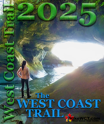
The West Coast Trail was created after decades of brutal and costly shipwrecks occurred along the West Coast of Vancouver Island. One shipwreck in particular was so horrific, tragic and unbelievable that it forced the creation of a trail along the coast, which ...