HikeInWhistler.com

HikeInWhistler.com

Menu
  • Hike
      • Alexander Falls Provincial Park
      • Ancient Cedars & Showh Lakes
      • Black Tusk in Garibaldi Park
      • Blackcomb Mountain Hiking Trails
      • Brandywine Falls Provincial Park
      • Brandywine Meadows
      • Brew Lake & Mount Brew
      • Callaghan Lake Park
      • Cheakamus Lake in Garibaldi Park
      • Cheakamus River & Interpretive Forest
      • Cirque Lake in Callaghan Valley
      • Flank Trail (Rainbow-Sproatt)
      • Garibaldi Lake in Garibaldi Park
      • Helm Creek in Garibaldi Park
      • Jane Lakes West
      • Joffre Lakes Provincial Park
      • Keyhole Hot Springs
      • Logger's Lake
      • Madeley Lake & Hanging Lake
      • Meager Hot Springs
      • Nairn Falls Provincial Park
      • Newt Lake & Ancient Cedars
      • Panorama Ridge in Garibaldi Park
      • Parkhurst Ghost Town
      • Rainbow Falls
      • Rainbow Lake
      • Ring Lake & Conflict Lake
      • Russet Lake in Garibaldi Park
      • Sea to Sky Trail
      • Skookumchuck Hot Springs
      • Sloquet Hot Springs
      • Sproatt West(Northair) Trail
      • Sproatt East(Stonebridge) Trail
      • Train Wreck & Trash Trail
      • Taylor Meadows in Garibaldi Park
      • Wedgemount Lake in Garibaldi Park
      • Whistler Mountain Hiking Trails
  • Snow
      • Blueberry Trail Snowshoeing
      • Brandywine Falls Snowshoeing
      • Cheakamus River Snowshoeing
      • Elfin Lakes Snowshoeing
      • Flank Trail Snowshoeing
      • Joffre Lakes Snowshoeing
      • Nairn Falls Snowshoeing
      • Parkhurst Ghost Town Snowshoeing
      • Rainbow Falls Snowshoeing
      • Rainbow Lake Snowshoeing
      • Rainbow Park Snowshoeing
      • Sproatt East Snowshoeing
      • Taylor Meadows Snowshoeing
      • Train Wreck Snowshoeing
      • Wedgemount Lake Snowshoeing
  • Run
      • Whistler Golf Course 5k(3.1 Mile)
      • Blueberry Hill 6k(3.7 Mile)
      • Lost Lake 6k(3.7 Mile)
      • Alta Lake 8k(5 Mile)
      • Fitzsimmons Creek 9k(5.6 Mile)
      • Alta Green Lost 15k(9.3 Mile)
  • Best
      • Best Whistler Hiking by Month
          • Best by Month
      • Best Walk, Bike or Bus To Trails
      • Best Whistler Kid Friendly Trails
      • Best Whistler Dog Friendly Trails
      • Best Free Camping in Whistler
      • Best Sights Sea to Sky
      • Best Whistler Waterfalls
      • Best Whistler Aerial Views
      • Best Squamish Hiking Trails
      • Best Whistler Hiking Trails
      • Best Vancouver Hiking Trails
      • Best Whistler Snowshoeing
          • Best Whistler Snowshoe Trails
      • Best Whistler Running Trails
      • Best Whistler Hiking Gear Rentals
      • Best Whistler Parks & Beaches
  • AtoZ
      • Ablation Zone
      • Accumulation Zone
      • Adit Lakes
      • Aiguille
      • Alpine Zone
      • Arborlith or Lithophyte
      • Arête
      • A River Runs Through It
      • Armchair Glacier
      • The Barrier
      • Battleship Islands
      • Bears
      • Bench
      • Bergschrund or Schrund
      • Bivouac or Bivy
      • Blue Face House in Parkhurst
      • Bungee Bridge
      • Cairns & Inukshuks
      • Carter, Neal
      • Caterpillar D8
      • Caterpillar RD8
      • Chimney
      • Cirque or Cirque Lake
      • Cloudraker Skybridge
      • Coast Mountains
      • Col
      • Crevasse
      • Deadfall
      • Emerald Forest
      • Erratic or Glacier Erratic
      • The Fissile
      • Fitzsimmons Creek
      • Fitzsimmons Range
      • Fyles, Tom
      • Garibaldi Ranges
      • Garibaldi Volcanic Belt
      • Gemel or Inosculation
      • Glacier Window
      • Green Lake
      • Hoary Marmot
      • Krummholz
      • Moraine
      • Mount Garibaldi
      • Mount James Turner
      • Northair Mine
      • Nunatuk
      • Overlord Mountain & Glacier
      • Peak2Peak Gondola
      • Roundhouse Lodge
      • Rubble Creek
      • Spearhead Range
      • Tarn
      • The Table
      • Usnea or Old Man's Beard
      • Western Redcedar
  • Maps
      • Alexander Falls Maps
      • Ancient Cedars Maps
      • Black Tusk Maps
      • Blackcomb Mountain Maps
      • Brandywine Falls Maps
      • Brandywine Meadows Maps
      • Brew Lake Maps
      • Callaghan Lake Maps
      • Cheakamus Lake Maps
      • Cheakamus River Maps
      • Cirque Lake Maps
      • Garibaldi Lake Maps
      • Helm Creek Maps
      • Joffre Lakes Maps
      • Keyhole Hot Springs Maps
      • Logger's Lake Maps
      • Madeley Lake Maps
      • Meager Hot Springs Maps
      • Nairn Falls Maps
      • Panorama Ridge Maps
      • Parkhurst Ghost Town Maps
      • Rainbow Falls Maps
      • Rainbow Lake Maps
      • Ring Lake Maps
      • Russet Lake Maps
      • Skookumchuck Maps
      • Sloquet Hot Springs Maps
      • Sproatt Maps
      • Taylor Meadows Maps
      • Train Wreck Maps
      • Wedgemount Lake Maps
      • Whistler Mountain Maps
  • More
      • Whistler Hiking News & Blog
      • Live Whistler Webcams
      • Live Tofino Webcams
      • Live Vancouver Webcams
      • Garibaldi Provincial Park
      • Hike in Whistler Glossary

Black Tusk

Whistler Train Wreck

Brandywine Meadows

Black Tusk

Newt Lake

Adit Lakes

Logger's Lake

Joffre Lakes

Cirque Lake

Wedgemount Lake

Callaghan Lake

Wedgemount Lake

Northair Mine

Spectacular Whistler!

Whistler hiking is wonderful! Check out our Best Whistler Hiking by Month guides! WeRentGear.com rents tents, sleeping bags, sleeping pads, camp stoves, packs, complete kits and more!

Best Trails This Week!

Best This Week: Whistler Train Wreck and Parkhurst Ghost Town are easy, fun and dog friendly. Check out our May and June Whistler and Garibaldi Park guides here!

Brew LakeBrew Lake is beautiful mountain lake just a short drive south of Whistler and is relatively unknown and seldom hiked. Laying at the base of Mount Brew, Brew Lake lays in a massive alpine valley of enormous erratics.  On first seeing Brew Lake it looks serene, yet wild and hostile.  The lake is surrounded on one side by idyllic tree covered hills and lakeside cliffs and on the other side a brutal looking wasteland of huge boulders sloping up to the sky.

  • Very off the radar, wild & infrequently hiked
  • Stunning, dramatic boulder field & windswept trees
  • Lots of excellent places to put your tent
  • Not as cold to swim as Joffre, Wedge, Garibaldi
  • Hut on Mount Brew is a surreal little oasis
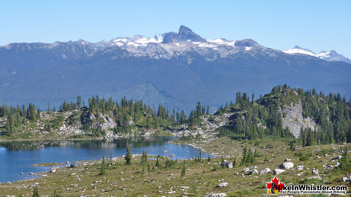
  • Beautiful views of Black Tusk & Daisy Lake
  • Tricky to find trailhead & tough, steep trail
  • Lake is not stunning like Joffre, Wedge, Garibaldi
  • Snow restricts access well into June
  • Trail is only 5k, but feels like 10k!

Hiking into this wasteland of erratics reveals an amazing paradise of small, island forests, cute streams and endless worlds within worlds to explore.  You find yourself wandering along like a kid mesmerized at what you will find next. Brew Lake itself doesn't come close in wow factor to the postcard-perfect alpine lakes such as Wedgemount Lake, Joffre Lakes, Cheakamus Lake or Garibaldi Lake, but I does beat these lakes in other aspects.  Because Brew Lake is outside of Garibaldi Provincial Park few people have heard of it.  More often than not you will have both the lake and entire valley to yourself.  An increasingly rare occurrence elsewhere that gives the place a quiet calm and that strange and satisfying feeling that there are no other humans for quite some distance.  You have that exhilarating wilderness feeling that sometimes gets lost on other Whistler area hikes when you start the trail from a parking lot packed with cars.  The fact that the Brew Lake trail doesn't have a parking lot or proper trailhead actually makes it more mysterious, adventurous and in some ways more fun.  Brew Lake is shallow and absolutely crystal clear. Mesmerizingly clear.  You can look across the lake and see smooth and rounded rocks scattered across the lake bottom.

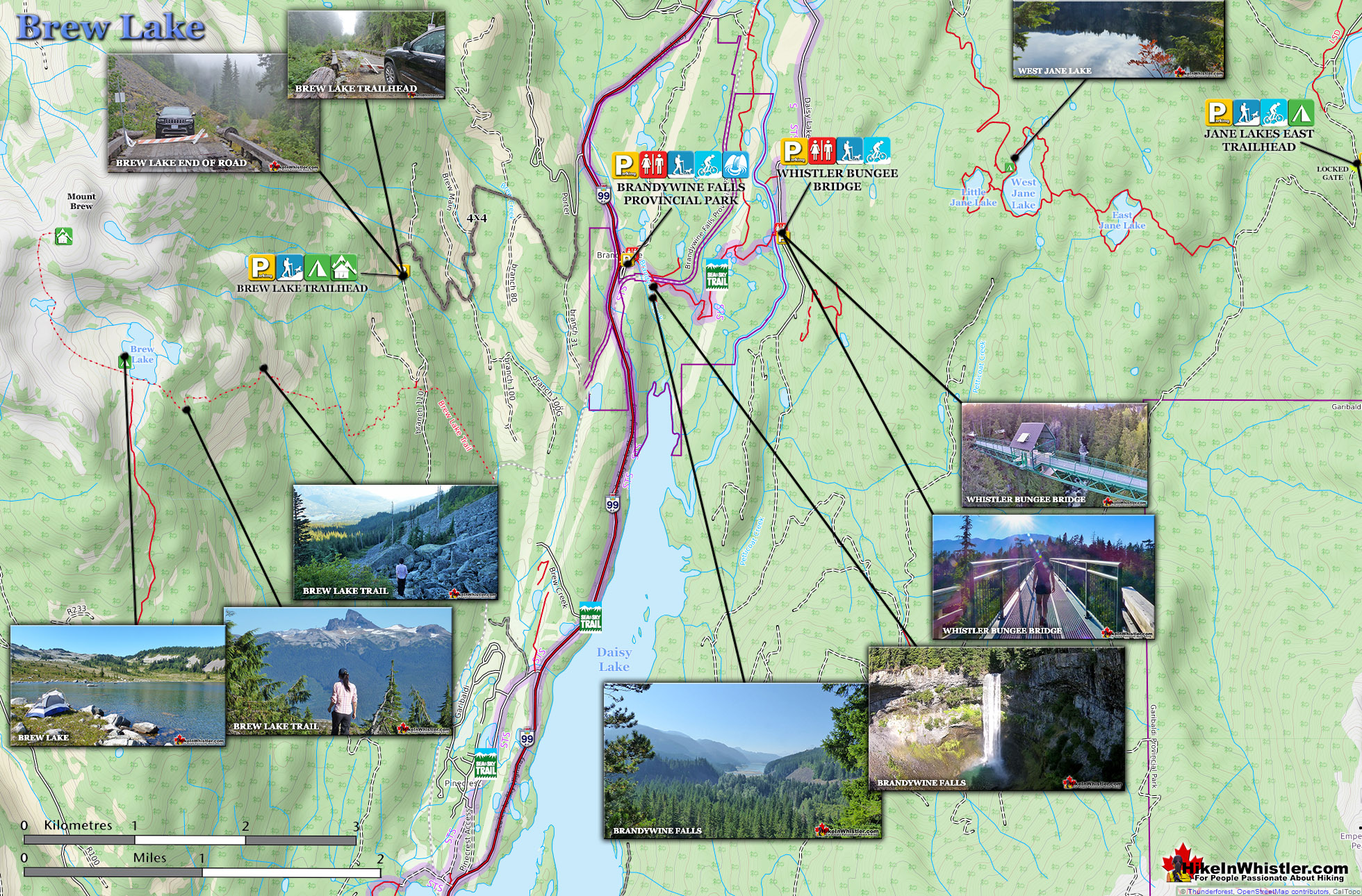
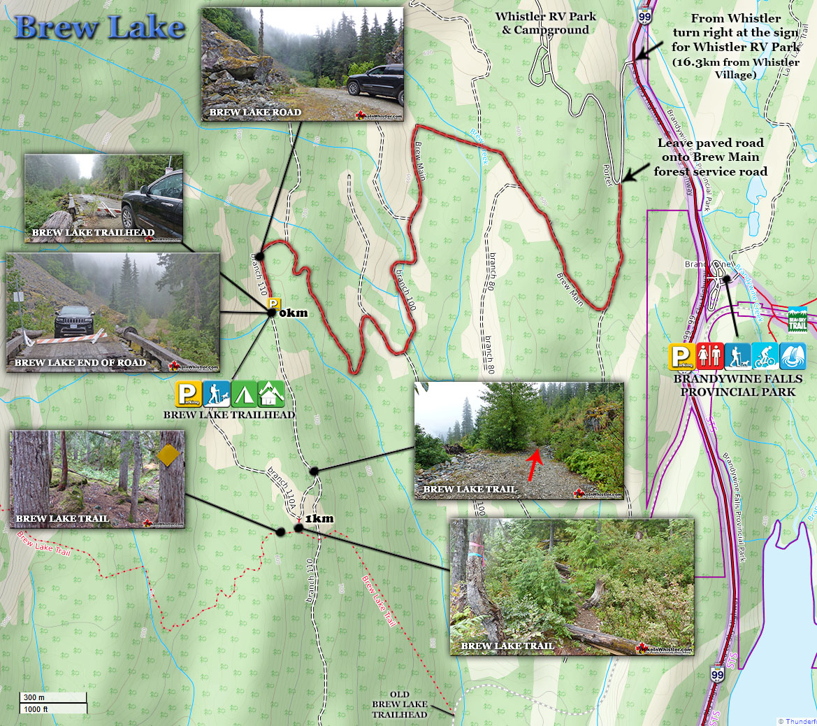
Brew Lake Hiking Trail Map

Brew Lake Map v18

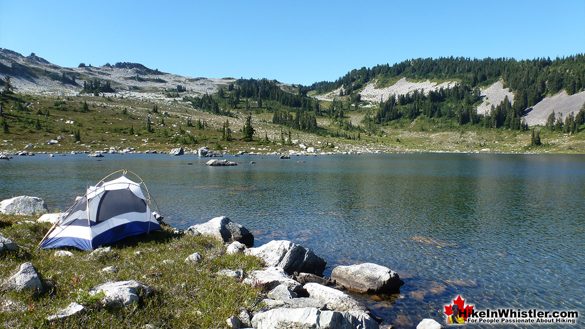
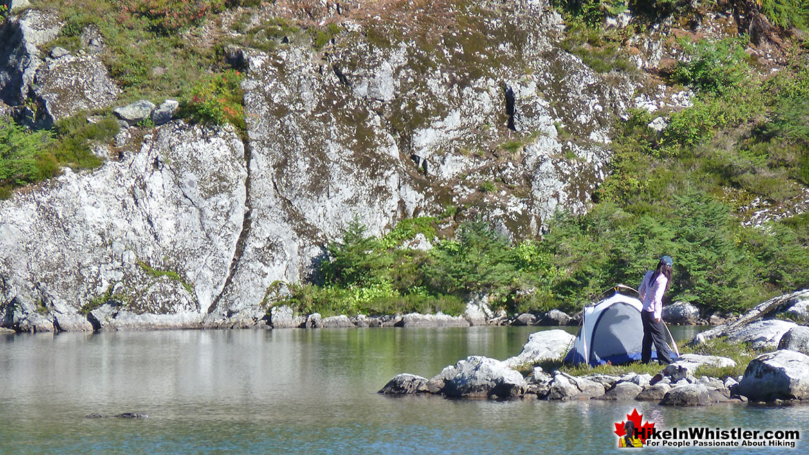
The lake is also relatively small at just a few hundred metres across and unexpectedly warm to swim in. Breathtakingly cold lakes are the norm in the Whistler area, but Brew Lake is an exception.  Try swimming in Wedgemount Lake, Joffre Lakes, Russet Lake, Cirque Lake, Cheakamus Lake or Garibaldi Lake for any length of time and you will be shivering cold. You can manage a minute or two swimming in these lakes, but certainly not 20 or 30 minutes as you can in Brew Lake. There are even some massive, flat topped erratics in the lake to swim to and lounge on. The sun makes them amazingly warm on a sunny day. The edge of the lake surrounded by grass areas littered with erratics making it tricky to find a spot for a tent, but easy to find a place to sit.  Once you do find a place for your tent, further exploration reveals countless other great spots. Grassy clifftops, clearings at the edge of streams.

Brew Lake Tent

A third aspect of Brew Lake that beats the local, alpine lake competition is the hike itself. It is amazing. Comparable in difficulty to the Wedgemount Lake trail, though two kilometres shorter and packed with things to see.  From the dozen or so amazing viewpoints on various plateaus steps from the trail to the endless gnarled, weather-beaten, yet captivating forests of twisted, mangled, huge and bewildering trees. Over and over along the 5 kilometre trail you stop and stare in wonder at how a huge tree, 30 metres tall can have an absurd, sideways L-shape in its trunk big enough to stand in.  You see it over and over until eventually you work out that when these trees are young they spend most of the year under metres of snow.  Over the years they grow at an unusual looking right angle, as if growing sideways. Eventually the tree grows big and thick enough to not have the snow push it over and it grows vertical again.  But of course it keeps this hilarious L-shape as it continues to grow.  You start spotting the smaller ones everywhere you look.  The trunk comes out of the ground one metre, then one metre horizontal, then one metre vertical again.  Hilarious.  Absurd and hilarious.

Camping at Brew Lake is Gorgeous

Brew Lake View of Black Tusk

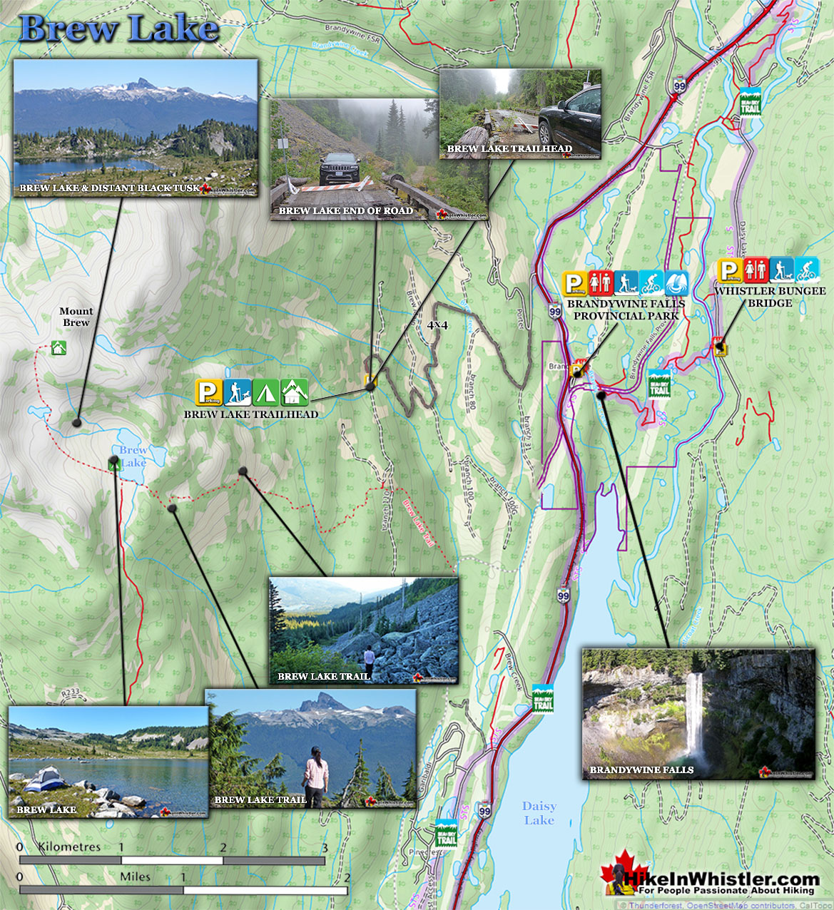
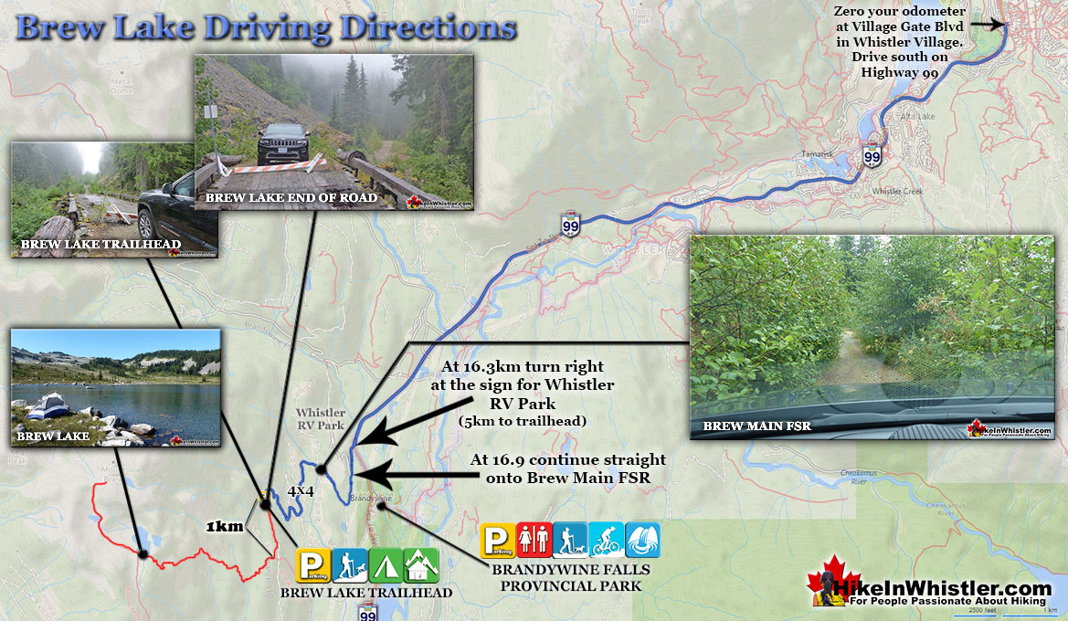
Brew Lake Driving Directions Maps

Finding the Brew Lake trailhead is quite an adventure.  The logging road is long, windy, steep, narrow and unmarked.  The first time you encounter an indication for the Brew Lake trail is when you reach the trail and find the orange or yellow tree markers.  The last road bridge was decommissioned in recent years, so the farthest you can drive with a 4x4 is to this closed bridge one kilometre from the actual trail start.

Brew Lake Driving Directions Map v3

Brew Lake Directions Map v5

More Brew Lake Hiking Info...

More Whistler & Garibaldi Park Hiking Maps!
Brandywine Falls Maps

Brandywine Falls is one of the must see sights on the way to or from Whistler. The falls drop from a 70 metre(230 feet), unnaturally abrupt looking cliff to the valley below. ...
Read more

Cheakamus Lake Maps

Cheakamus Lake is a wonderfully relaxing way to get in the wilderness easily and quickly from Whistler Village.  The trail begins on the far side of Whistler Mountain, 8 ...
Read more

Blackcomb Mountain Maps

Blackcomb Mountain holds an impressive and ever growing array of hiking trails. From the moment you arrive at the Rendezvous Lodge, you see hiking trails ascend into the ...
Read more

Callaghan Lake Maps

Callaghan Lake Park is a relatively untouched wilderness of rugged mountainous terrain. The valley walls were formed by relatively recent glaciation. Evidence of this can be ...
Read more
More Whistler Hiking Trail Maps

Incredible West Coast Trail Guide

Whistler & Garibaldi Park Glossary A to Z
Wedge Creek cuts through the valley that separates Wedge Mountain and Blackcomb Mountain and empties into Green River near the north end of Green Lake.  ...
Read more
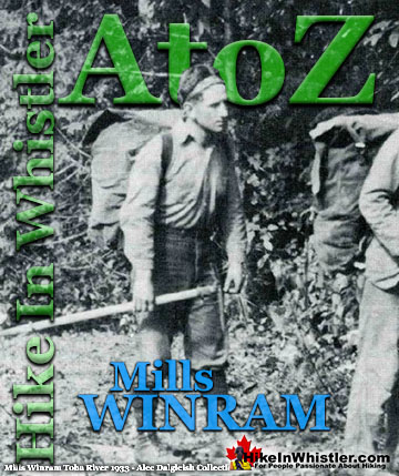
Alec Dalgleish (1 August 1907 - 26 June 1934) was a highly respected mountaineer and climber out of Vancouver in the 1920's and 1930's.  His enthusiasm and ...
Read more
The Pacific yew or western yew is a coniferous tree that grows in Whistler and along the coast from Alaska to California. The Pacific yew’s unique ...
Read more
Fitzsimmons Creek is the beautiful and huge creek that crashes through Whistler Village.  When walking from Whistler Village to the Upper Village, you will cross ...
Read more
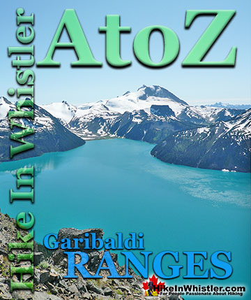
The Spearhead Range is a subsection of the Garibaldi Ranges that runs in an arc that connects Whistler Mountain and Blackcomb Mountain.  The Spearhead ...
Read more
Neal Carter (14 Dec 1902 – 15 Mar 1978) was a mountaineer and early explorer of the Coast Mountains primarily in the 1920’s and 1930’s. Astoundingly skilled as a ...
Read more
Parkhurst Ridge is an incredible place for a lot of reasons.  Of course, the view is spectacular with Green Lake's absurdly vivid green coloured water.  ...
Read more
The Cloudraker Skybridge and the Raven’s Eye Cliff Walk are new additions to the summit of Whistler Mountain.  The Cloudraker Skybridge stretches 130 ...
Read more
More Hike in Whistler Glossary

Free Camping Gear Delivery to Garibaldi Park

The Best Whistler & Garibaldi Park Hiking Trails!
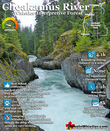
Garibaldi Lake is the centre and base for much of the hiking in Garibaldi Provincial Park. The Garibaldi Lake campsite is located on the amazing, turquoise shores of this massive and mostly still wild ...
Read more
Mount Sproatt, or as it is known locally as just Sproatt, is one of the many towering mountains visible from Whistler Village. Above and beyond Alta Lake, directly across from Whistler Mountain and ...
Read more
Black Tusk is the extraordinarily iconic and appropriately named mountain that can be seen from almost everywhere in Whistler. The massive black spire of crumbling rock juts out of the earth in an incredibly ...
Read more
Skookumchuck Hot Springs(aka T'sek Hot Springs and St. Agnes Well), located two hours north of Whistler along the edge of the huge Lillooet River. The name Skookumchuck means "strong water" in the language ...
Read more
More Whistler Hiking Trails & Maps

HikeInWhistler.com HikeInWhistler.com © 2025
  • Contact Us: [email protected]