![]() December hiking in Whistler is mainly done on snowshoes, though not always. If it hasn't snowed much recently then trails such as Whistler Train Wreck and Rainbow Falls can be done fairly easily without snowshoes. The wonderful, multi-use trail network in Whistler, the Valley Trail is amazing on foot all winter with some sections plowed, some left snow covered and even a few sections groomed for free cross country skiing.
December hiking in Whistler is mainly done on snowshoes, though not always. If it hasn't snowed much recently then trails such as Whistler Train Wreck and Rainbow Falls can be done fairly easily without snowshoes. The wonderful, multi-use trail network in Whistler, the Valley Trail is amazing on foot all winter with some sections plowed, some left snow covered and even a few sections groomed for free cross country skiing.
Whistler & Garibaldi Hiking
![]() Alexander Falls
Alexander Falls ![]() Ancient Cedars
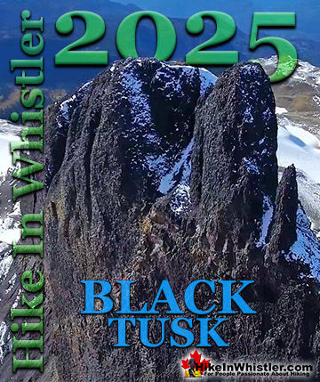
Ancient Cedars ![]() Black Tusk
Black Tusk ![]() Blackcomb Mountain
Blackcomb Mountain ![]() Brandywine Falls
Brandywine Falls ![]() Brandywine Meadows
Brandywine Meadows ![]() Brew Lake
Brew Lake ![]() Callaghan Lake
Callaghan Lake ![]() Cheakamus Lake
Cheakamus Lake ![]() Cheakamus River
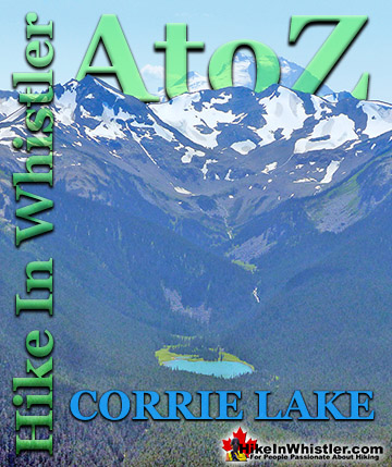
Cheakamus River ![]() Cirque Lake
Cirque Lake ![]() Flank Trail
Flank Trail ![]() Garibaldi Lake
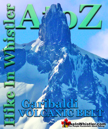
Garibaldi Lake ![]() Garibaldi Park
Garibaldi Park ![]() Helm Creek
Helm Creek ![]() Jane Lakes
Jane Lakes ![]() Joffre Lakes
Joffre Lakes ![]() Keyhole Hot Springs
Keyhole Hot Springs ![]() Logger’s Lake
Logger’s Lake ![]() Madeley Lake
Madeley Lake ![]() Meager Hot Springs
Meager Hot Springs ![]() Nairn Falls
Nairn Falls ![]() Newt Lake
Newt Lake ![]() Panorama Ridge
Panorama Ridge ![]() Parkhurst Ghost Town
Parkhurst Ghost Town ![]() Rainbow Falls
Rainbow Falls ![]() Rainbow Lake
Rainbow Lake ![]() Ring Lake
Ring Lake ![]() Russet Lake
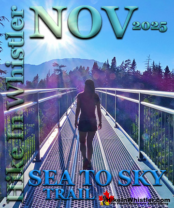
Russet Lake ![]() Sea to Sky Trail
Sea to Sky Trail ![]() Skookumchuck Hot Springs
Skookumchuck Hot Springs ![]() Sloquet Hot Springs
Sloquet Hot Springs ![]() Sproatt East
Sproatt East ![]() Sproatt West
Sproatt West ![]() Taylor Meadows
Taylor Meadows ![]() Train Wreck
Train Wreck ![]() Wedgemount Lake
Wedgemount Lake ![]() Whistler Mountain
Whistler Mountain
![]() January
January ![]() February
February ![]() March
March ![]() April
April ![]() May
May ![]() June
June ![]() July
July ![]() August
August ![]() September
September ![]() October
October ![]() November
November ![]() December
December
Two of these nice groomed sections of the Valley Trail is found at end of Lorimer Road in Whistler Cay. Here you will find the groomed Valley Trail head off in one direction for 1.3km to Rainbow Park and in the other direction 2.6km to Meadow Park. Another nice Whistler park to visit in December is Blueberry Park. Just 1.8km from Whistler Village, this quiet, wilderness park on the shore of Alta Lake has a shoreline trail which loops up and around through the forest to a nice viewpoint then back down to the trailhead. There are four nice piers along the shore and backed by the deep forest, Blueberry Park is a serene paradise within walking distance from the Village! There are lots of amazing trails in December to explore. Whistler Train Wreck is a fantastic trek through the forest to brightly painted, wrecked boxcars abandoned in the 1950's. Parkhurst Ghost Town is another surreal place to see in December with trails extending to remains of the old logging town, to gorgeous viewpoints over Green Lake from Parkhurst. Rainbow Falls is another nice hike into a winter wonderland that continues along Whistler's wonderful Flank Trail. For an easy, drive to sight to see in December, Whistler Bungee Bridge is hard to beat. Accessible year-round, you can park right underneath it! If you are motivated for a wander through the forest, you can cross the Bungee Bridge and follow the Sea to Sky Trail to Brandywine Falls, an amazing sight to see in the winter. For something more challenging, Joffre Lakes is a spectacular mountain lake located just north of Pemberton and in December it is a winter paradise! For something a bit closer and easier try Nairn Falls, an easy trail to the viewpoint surrounded by crashing water through carved canyons. Check out our guides to Whistler's Best Snowshoe Trails or Whistler's Best Dog Friendly Snowshoe Trails. Need to rent snowshoes in Whistler and have them delivered to your door? WeRentGear makes renting hiking and camping gear in Whistler easy.
Beautiful Blueberry Park in December

December Snowshoeing at Rainbow Park

Snowy and Surreal Whistler Train Wreck

Blue Face House at Parkhurst Ghost Town

Parkhurst Ridge View of Green Lake

Rainbow Falls Buried in Snow

Amazing Winter Views from the Flank Trail

Winter Sunrise at Joffre Lakes

Whistler Bungee Bridge in December

Brandywine Falls on a Sunny December Day

Whistler Sights and History
 Whistler Train Wreck Murals
The colourful graffiti and murals that make Whistler Train Wreck the magical place it is today began appearing in 2011, when this hidden place was known by just a few Whistler locals. In the summer of 2011 several Whistler artists came here for "The Train Wreck Paint Jam" and transformed the mangled wreckage into a surreal art exhibit. The artists ranged from aspiring graffiti artists to professional artists like Kups. Remnants of one of his murals from 2011 is found inside the first boxcar you come to after crossing the bridge into Whistler Train Wreck. Several of the original murals were gorgeous. Brilliantly coloured and surreal in such an unusual, tranquil and hidden forest with seven mangled train boxcars scattered. Like some sort of haunting art gallery... Continued here.
 Northair Mine Murals
Way up in the Callaghan Valley on the back side of Mount Sproatt is an abandoned gold mine. Old cement foundations and two unexpectedly beautiful lakes mark the location of Northair Mine, abandoned in 1982. It was a fairly productive gold mine that extracted five tons of gold. Largely forgotten for years, in the last decade it has come to life in stunning colour by graffiti artists and professional muralists. In the summer of 2013, the first mural appeared on the blank foundation walls of Northair Mine. A creation of a professional Whistler artist PETKO. Painted on one of the inside, pillar walls, the mural is about 8 feet tall and five feet wide of what looks like a robot snake in front of a cube background. It stood out in striking contrast to the grey walls in the background... Continued here.
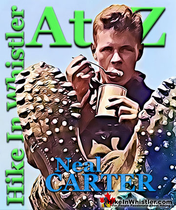
 Neal Carter Mountaineer
Neal Carter (14 Dec 1902 – 15 Mar 1978) was a mountaineer and early explorer of the Coast Mountains primarily in the 1920’s and 1930’s. Highly skilled as a mountaineer and climber, Carter also excelled at cartography and surveying which he used to map the vast unnamed and unexplored mountains of BC. He named a staggering number of mountains and alpine features, as well as making at least 25 first ascents, many around what we now call the Whistler Valley. Carter began climbing the mountains around Vancouver as a teenager and at the age of seventeen he met someone who would change his life forever. In 1920, while hiking with high school friends Carter had a chance encounter with Tom Fyles, arguably the greatest mountaineer of the era. Continued here.
 Tom Fyles Mountaineer
Tom Fyles (27 June 1887 - 27 March 1979) was an astoundingly skilled climber that figured prominently in the mountaineering community in Vancouver for more than two decades. From his introduction to mountaineering in 1912, to his prolific array of elite level climbing ascents that began in earnest just four years later. In 1916 he solo climbed The Table in Garibaldi Park, a mountain widely considered to be too difficult and dangerous to even attempt. Those that knew him well admired his friendliness, enthusiasm, boundless endurance and incredible ability to read a mountain and navigate the best route to the summit. He made many first ascents and inspired countless new climbers, some becoming giants of the era. Continued here.
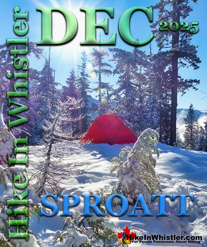
The Sproatt East Trail in December
![]() The Sproatt East trail is one of the nicest snowshoe trails in Whistler. With the trailhead high up in Stonebridge, partway up the flank of Mount Sproatt, you start snowshoeing already high up in the wonderfully secluded wilderness overlooking Whistler valley. Just a few metres along the trail you catch glimpses of Black Tusk far across the valley before entering the forest along the Sirloin trail. The Sproatt East trail branches off from Flank, which is reached by two short, connecting trails, Sirloin and Darwin's. A short, but steep 160 metre access road leads from the end of Stonebridge Place to the marked trailhead for Sirloin. Sirloin takes you steeply up through the forest for just 566 metres before crossing Flank and connecting to the start of Darwin's. Darwin's is when the trail starts getting fun and interesting as there are a few elaborate bridges and boardwalks along the way.
The Sproatt East trail is one of the nicest snowshoe trails in Whistler. With the trailhead high up in Stonebridge, partway up the flank of Mount Sproatt, you start snowshoeing already high up in the wonderfully secluded wilderness overlooking Whistler valley. Just a few metres along the trail you catch glimpses of Black Tusk far across the valley before entering the forest along the Sirloin trail. The Sproatt East trail branches off from Flank, which is reached by two short, connecting trails, Sirloin and Darwin's. A short, but steep 160 metre access road leads from the end of Stonebridge Place to the marked trailhead for Sirloin. Sirloin takes you steeply up through the forest for just 566 metres before crossing Flank and connecting to the start of Darwin's. Darwin's is when the trail starts getting fun and interesting as there are a few elaborate bridges and boardwalks along the way.
Sproatt East Snowshoe Trail Map

Darwin's continues gradually upward for a few minutes before opening up to this beautiful view of Whistler Valley.
Darwin's Trail View of Whistler Valley

Sproatt East View of Whistler Mountain

The trail sinks back into the forest and soon connects to Flank. Along the Flank Trail, just before you cross Nita Creek you see a faint trail lead up to this beautiful spot overlooking the valley. A series of big, snowy and fairly flat clearings perfect for a camp with wonderful views across Whistler Valley.
Amazing Winter Camping on Sproatt

Getting to the Sproatt East Trailhead
![]() Finding your way to the Sproatt East trail is a bit tricky as there are no signs for the trail and the trailhead where you park your car is unmarked as well. Despite the lack of signs, the route is fairly straight forward. From Whistler Village you drive south on the Sea to Sky Highway for 5.3 kilometres, turn right onto Alta Lake Road. 2.3 kilometres along Alta Lake Road turn left onto Stonebridge Drive. Drive another 1.5 kilometres and turn left onto Stonebridge Place and drive another 800 metres until it ends at a roundabout. You will see no parking signs along the roundabout, but parking is allowed along the side of the road just a few metres away.
Finding your way to the Sproatt East trail is a bit tricky as there are no signs for the trail and the trailhead where you park your car is unmarked as well. Despite the lack of signs, the route is fairly straight forward. From Whistler Village you drive south on the Sea to Sky Highway for 5.3 kilometres, turn right onto Alta Lake Road. 2.3 kilometres along Alta Lake Road turn left onto Stonebridge Drive. Drive another 1.5 kilometres and turn left onto Stonebridge Place and drive another 800 metres until it ends at a roundabout. You will see no parking signs along the roundabout, but parking is allowed along the side of the road just a few metres away.
Sproatt East Trailhead Directions Map

Snowshoeing Joffre Lakes in December
![]() Joffre Lakes is an absolutely stunning place to snowshoe in December. You can drive to the partially snowplowed trailhead parking all year-round and Joffre Lakes is so popular with skiers that you can almost always rely on ski tracks in the snow to follow. The trail is fairly well marked with tree markings but having a track in the snow to follow makes the journey much easier. Joffre Lakes is a long, though beautiful 1.2 hour drive north of Whistler. From the trailhead to the first of the three Joffre Lakes is just a few dozen metres so you almost immediately get some stunning views across the lake to distant mountains. The trail then ascends a couple kilometres to the second of the Joffre Lakes which reveals even more amazing views. The third of the Joffre Lakes is at the 5 kilometre mark and you will have gained 400 metres of elevation to get there. The views at the third lake are, of course, more amazing still. Though the snowshoeing trail to Joffre Lakes is only moderately difficult a considerable amount of caution should be taken. For example, in snowy weather the trail may become obscured and wandering off the trail is a dangerous possibility. Also, the days are short and lingering at the lake too long could leave you out in the dark. Another risk is the cold temperatures. Minus 12c is not unusual and being unaccustomed or unprepared for the cold could kill you.
Joffre Lakes is an absolutely stunning place to snowshoe in December. You can drive to the partially snowplowed trailhead parking all year-round and Joffre Lakes is so popular with skiers that you can almost always rely on ski tracks in the snow to follow. The trail is fairly well marked with tree markings but having a track in the snow to follow makes the journey much easier. Joffre Lakes is a long, though beautiful 1.2 hour drive north of Whistler. From the trailhead to the first of the three Joffre Lakes is just a few dozen metres so you almost immediately get some stunning views across the lake to distant mountains. The trail then ascends a couple kilometres to the second of the Joffre Lakes which reveals even more amazing views. The third of the Joffre Lakes is at the 5 kilometre mark and you will have gained 400 metres of elevation to get there. The views at the third lake are, of course, more amazing still. Though the snowshoeing trail to Joffre Lakes is only moderately difficult a considerable amount of caution should be taken. For example, in snowy weather the trail may become obscured and wandering off the trail is a dangerous possibility. Also, the days are short and lingering at the lake too long could leave you out in the dark. Another risk is the cold temperatures. Minus 12c is not unusual and being unaccustomed or unprepared for the cold could kill you.
Snowshoeing the Joffre Lakes Trail

Joffre Lakes Winter Conditions
Make sure you know what you are doing before snowshoeing the Joffre Lakes trail and if you are unsure of the weather or anything be prepared to turn around part way through the journey. The trail is fairly well marked with tree markings but having a track in the snow to follow makes the journey much easier. In the winter, with the lakes frozen and the trees weighed down with snow, Joffre Lakes takes on a serene beauty, with the low sun cutting through the trees and the forest brightly reflecting. The third of the Joffre Lakes ends in a U-shaped valley where you will find the far side of the lake towering with glaciers relentlessly crushing down on the lake. The sun fills the valley and the silence is wonderful. The trailhead and parking lot will be buried in metres of snow in the winter months, however a small parking area is plowed throughout the winter. There are plenty of signs, so even in snowy weather, you should easily spot them. From the winter parking area you will likely have to climb over a plowed, wall of snow and then continue through the snow buried parking lot. At the far end, the parking lot bends right and you will spot the trailhead sign.
Deep Snow on the Joffre Lakes Trail

The Three Joffre Lakes
The first of the Joffre Lakes is just an easy and short 2 minute walk. Here you can see directly across the lake and beyond to your destination. The third of the Joffre Lakes will be at the foot of the distant mountain you see in the V of the closer mountains. If you trust the thickness of the ice on the lake you can take a short-cut by walking across the lake and picking up the trail as it skirts the right side of the lake. This doesn't cut off much distance, however, and finding the marked trail may be tricky. Continuing along the trail you slowly ascend through deep forest and across some small creeks. Past the far side of the first of the Joffre Lakes you then cross a huge boulder field which can be tricky to cross when wet, snowy or icy. On a sunny day, this is a great place to stop and take in the view. All around you are massive pillows of snow resting on massive boulders buried far beneath. The mountains across the valley seem to glow impossibly white. It's here that you will notice that much of the hike will be in the shade. Partly because of the deep forest, but also because the trail is mostly on the hillside facing away from the sun. Because of this you will want to have lots of warm gear and some hot drinks or you won't enjoy the sights on the trail nearly as much. The trail is fairly steep as you gain 400 metres of altitude in just 5 kilometres from the trailhead to the third of the Joffre Lakes. On snowshoes expect to reach the third lake in about 2-3 hours. On a sunny day the frozen lake surrounded by mountains and glaciers is spectacular!
Joffre Lakes Winter Paradise!

Joffre Lakes Snowshoeing Map

Getting to the Joffre Lakes Trailhead
![]() From Whistler, zero your odometer in Whistler at Village Gate Boulevard and follow highway 99 north toward Pemberton. At 32km you will arrive at Pemberton, an intersection, with a Petro Can gas station on your left and McDonalds to your right. Continue straight, through Pemberton. At 39km turn right at the sign to Lillooet. Follow this winding road, and soon you will pass Lillooet Lake on your right as the highway ascends steeply. You are only 20 minutes from the parking lot now. At 65km, you will see the large Joffre Lakes parking lot on your right. There are several worthwhile stops on the drive to Joffre Lakes. Just five minutes from Whistler Village and you will drive along the edge of Green Lake. There is an excellent pullout on the right side of the highway at a great viewpoint over the lake. Wedge Mountain, Blackcomb Mountain, and Whistler Mountain lay beyond Green Lake. Another 15 minutes driving and you will see the sign for Nairn Falls Provincial Park. A short and easy 1.2 kilometre trail runs along the wild and crashing Green River to a viewing area on cliffs across from the falls. In the winter the park gates are closed, so you will have to just park at the edge of the Sea to Sky Highway, next to the gates and walk in. Continuing north on the Sea to Sky Highway, Pemberton is just another 5 minutes away. This cute town is your last chance for a coffee shop, grocery store, liquor store or gas station before Joffre Lakes. You will see two gas stations at the set of traffic lights, but if you want coffee, restaurants, etc, then turn left at these lights and you will find plenty of choices.
From Whistler, zero your odometer in Whistler at Village Gate Boulevard and follow highway 99 north toward Pemberton. At 32km you will arrive at Pemberton, an intersection, with a Petro Can gas station on your left and McDonalds to your right. Continue straight, through Pemberton. At 39km turn right at the sign to Lillooet. Follow this winding road, and soon you will pass Lillooet Lake on your right as the highway ascends steeply. You are only 20 minutes from the parking lot now. At 65km, you will see the large Joffre Lakes parking lot on your right. There are several worthwhile stops on the drive to Joffre Lakes. Just five minutes from Whistler Village and you will drive along the edge of Green Lake. There is an excellent pullout on the right side of the highway at a great viewpoint over the lake. Wedge Mountain, Blackcomb Mountain, and Whistler Mountain lay beyond Green Lake. Another 15 minutes driving and you will see the sign for Nairn Falls Provincial Park. A short and easy 1.2 kilometre trail runs along the wild and crashing Green River to a viewing area on cliffs across from the falls. In the winter the park gates are closed, so you will have to just park at the edge of the Sea to Sky Highway, next to the gates and walk in. Continuing north on the Sea to Sky Highway, Pemberton is just another 5 minutes away. This cute town is your last chance for a coffee shop, grocery store, liquor store or gas station before Joffre Lakes. You will see two gas stations at the set of traffic lights, but if you want coffee, restaurants, etc, then turn left at these lights and you will find plenty of choices.
Joffre Lakes Winter Directions Map

Snowshoeing Whistler Train Wreck in December
![]() Whistler Train Wreck is a surreal array of colourfully painted train cars that derailed along Cheakamus River several decades ago. The cars lay in a marvelously serene forest at a particularly gorgeous part of Cheakamus River. Located in Cheakamus Crossing, just 8 kilometres south of Whistler Village, the Whistler Train Wreck trail is pretty easily accessible year-round. Even during a snowy December you may get away with not having snowshoes to get to the wrecks. There are several wonderful highlights of Whistler Train Wreck. First, the seven colourful and mangled train cars are spread out over an area several hundred metres long. This makes each car somewhat of a destination of its own. One car is perched on the edge of a cliff over Cheakamus River. Another lays in the middle of a clearing in the forest with elaborate bike ramps on, and extending from it. Yet another lays on its side with the remnants of a small fire pit at its centre and the remnants of what must have been quite a memorable party.
Whistler Train Wreck is a surreal array of colourfully painted train cars that derailed along Cheakamus River several decades ago. The cars lay in a marvelously serene forest at a particularly gorgeous part of Cheakamus River. Located in Cheakamus Crossing, just 8 kilometres south of Whistler Village, the Whistler Train Wreck trail is pretty easily accessible year-round. Even during a snowy December you may get away with not having snowshoes to get to the wrecks. There are several wonderful highlights of Whistler Train Wreck. First, the seven colourful and mangled train cars are spread out over an area several hundred metres long. This makes each car somewhat of a destination of its own. One car is perched on the edge of a cliff over Cheakamus River. Another lays in the middle of a clearing in the forest with elaborate bike ramps on, and extending from it. Yet another lays on its side with the remnants of a small fire pit at its centre and the remnants of what must have been quite a memorable party.
Whistler Train Wreck in Winter

Whistler Train Wreck in December

Whistler Train Wreck Snowshoeing Map

History of Whistler Train Wreck
![]() The Whistler Train Wreck happened in 1956 and some of the details have emerged in recent years. The train, coming from Lillooet, was overloaded with lumber and was unable to get up the ascent to Parkhurst, behind Green Lake. To make it through, the train was split into two separate trains, two engines each. This caused the train to fall way behind schedule and the train conductor to ignore a section of construction on the train tracks. He sped through the 24 kilometre per hour section at a dangerously high speed of 56 kilometres per hour. The overloaded train sped through the construction area and the fourth engine turned a rail, jamming three heavily loaded boxcars loaded with lumber. They jammed in a rock cut, an area where rock is blasted out to allow tracks to pass through on the flattest possible route. Pacific Great Eastern Railway attempted to move the trapped boxcars with no success. They turned to a local logging company for help. The Valleau family brought in a couple tractors and equipment and managed to free the cars. They dragged them out of the rock cut and pushed them into the forest where they still sit. This explains why so many trees older than the train wreck surround the wrecks to this day. It also explains why they are so mangled and spread out over quite a large area. One of the boxcars is precariously on the edge of a cliff overlooking Cheakamus River, quite a distance from the train tracks.
The Whistler Train Wreck happened in 1956 and some of the details have emerged in recent years. The train, coming from Lillooet, was overloaded with lumber and was unable to get up the ascent to Parkhurst, behind Green Lake. To make it through, the train was split into two separate trains, two engines each. This caused the train to fall way behind schedule and the train conductor to ignore a section of construction on the train tracks. He sped through the 24 kilometre per hour section at a dangerously high speed of 56 kilometres per hour. The overloaded train sped through the construction area and the fourth engine turned a rail, jamming three heavily loaded boxcars loaded with lumber. They jammed in a rock cut, an area where rock is blasted out to allow tracks to pass through on the flattest possible route. Pacific Great Eastern Railway attempted to move the trapped boxcars with no success. They turned to a local logging company for help. The Valleau family brought in a couple tractors and equipment and managed to free the cars. They dragged them out of the rock cut and pushed them into the forest where they still sit. This explains why so many trees older than the train wreck surround the wrecks to this day. It also explains why they are so mangled and spread out over quite a large area. One of the boxcars is precariously on the edge of a cliff overlooking Cheakamus River, quite a distance from the train tracks.
Directions to Whistler Train Wreck
The Whistler Train Wreck is one of the easiest hiking trails in Whistler to get to by car, bike or public transit. Public transit runs continuously between Whistler Village and Cheakamus Crossing for just $3 one-way. The bus will drop you off at the HI Hostel and a short section of the Sea to Sky Trail connects you to the Trash Trail and Whistler Train Wreck. To get to the trailhead for Whistler Train Wreck by car, drive 7.9 kilometres south of Whistler Village. At the traffic lights at Function Junction turn left onto Cheakamus Lake Road. Drive 700 metres and just after crossing the bridge turn right onto Jane Lakes Road. Drive for 600 metres and look for the small parking area on your left (shown below on the map).
Whistler Train Wreck Directions Map

Snowshoeing Cheakamus River in December
![]() Cheakamus River is a beautiful, crashing, turquoise coloured river that flows from Cheakamus Lake, through Whistler Interpretive Forest at Cheakamus Crossing, then down past Brandywine Falls to Daisy Lake. Also a popular kayaking route, the main attraction to Cheakamus River is the wonderful and quite extensive network of hiking and biking trails that run along either side of it. The Riverside trail and the Farside trail run on either side of Cheakamus River and connect at both ends by bridges.
Cheakamus River is a beautiful, crashing, turquoise coloured river that flows from Cheakamus Lake, through Whistler Interpretive Forest at Cheakamus Crossing, then down past Brandywine Falls to Daisy Lake. Also a popular kayaking route, the main attraction to Cheakamus River is the wonderful and quite extensive network of hiking and biking trails that run along either side of it. The Riverside trail and the Farside trail run on either side of Cheakamus River and connect at both ends by bridges.
Cheakamus River in December

The Cheakamus River hiking and snowshoeing trails are located just 8 kilometres south of Whistler Village just off of the Sea to Sky Highway. This well marked, though beautifully remote feeling snowshoeing trail takes you along both sides of the wildly crashing Cheakamus River. Snow begins to fall heavy in the Whistler area in December, so the best months for snowshoeing Cheakamus River are from December to early April. These trails are frequently used year-round so the snow on the trail is often packed down. You may find that you don't need snowshoes for much or all of the trail. One of the best routes is to walk/snowshoe from your car for about 100 metres following the road to Cheakamus Lake. At about 100 metres you will see a branching road go to the right and a large, vehicle bridge cross the Cheakamus River. Cross the bridge and you will immediately see a trail on your left running along the river. This trail, with Cheakamus River on your left will descend and ascend through a beautiful forest. Sometimes close to the river, sometimes 100 metres away.
MacLaurin's Crossing Over Cheakamus River

Another very nice snowshoeing trail, the Ridge Trail, extends from the Cheakamus River trail. You can find it easily by several excellent trail signs at various junctures. The Ridge trail takes you up a and away from Cheakamus River to Logger’s Lake where you can go around Logger’s Lake, or just along one side before re-connecting to the Cheakamus River trail not far from the suspension bridge. As these trails are popular in the summer for hiking and biking they are well marked with signs. The Cheakamus River suspension bridge, which is 2k from where you parked and should take about an hour to reach. There are wide and straight logging roads on either side of the Cheakamus River which ensure that you can't get lost if you stray from the marked trails.
Cheakamus River Snowshoeing Map

Winter Directions to Cheakamus River
![]() Parking for the Cheakamus River trails and Whistler's Interpretive Forest are numerous. The main Whistler Interpretive Forest parking lot is located just off the Sea to Sky Highway. Easy to spot and just metres from the highway. There is a bus stop very close to the parking lot, so it is convenient by bus as well. In the winter months snow blocks the gravel road to Cheakamus River and Cheakamus Lake, however the two trails along either side of the river both start just a few metres along the snow covered access road. If you park at the Interpretive Forest parking lot, you start by heading down Cheakamus Lake Road for about 400 metres and you will see signs for Cheakamus Lake on your left. Cheakamus Lake forest service road will likely be deep with snow and you start snowshoeing from there. A few metres along this road and the road splits with one road continuing up to Cheakamus Lake and the other crossing a nice bridge over the river and heads up along the other side of Cheakamus River. One side is called the Riverside Trail and the other is called the Farside Trail. Both trails are similar and meet 2 kilometres up the river at MacLaurin's Crossing bridge.
Parking for the Cheakamus River trails and Whistler's Interpretive Forest are numerous. The main Whistler Interpretive Forest parking lot is located just off the Sea to Sky Highway. Easy to spot and just metres from the highway. There is a bus stop very close to the parking lot, so it is convenient by bus as well. In the winter months snow blocks the gravel road to Cheakamus River and Cheakamus Lake, however the two trails along either side of the river both start just a few metres along the snow covered access road. If you park at the Interpretive Forest parking lot, you start by heading down Cheakamus Lake Road for about 400 metres and you will see signs for Cheakamus Lake on your left. Cheakamus Lake forest service road will likely be deep with snow and you start snowshoeing from there. A few metres along this road and the road splits with one road continuing up to Cheakamus Lake and the other crossing a nice bridge over the river and heads up along the other side of Cheakamus River. One side is called the Riverside Trail and the other is called the Farside Trail. Both trails are similar and meet 2 kilometres up the river at MacLaurin's Crossing bridge.
Cheakamus River Winter Directions Map

Snowshoeing Brandywine Falls in December
![]() Just south of the Cheakamus River and Train Wreck trails is a wonderful place to snowshoe in December, Brandywine Falls. Brandywine Falls Provincial Park is located along the Sea to Sky Highway, 15 minutes south of Whistler and BC Parks has locked the parking lot during winter for years. In 2021, despite the ever-increasing popularity of the park, has now put up tow away zone signs along the large turnaround area outside the gate. With no decent parking alternatives nearby this has prevented thousands of people from enjoying this beautiful park and one of the best, and free attractions along the Sea to Sky Highway. Some wintertime visitors to Brandywine Falls know to park at the Bungee Bridge down the very potholed Cal-Cheak forest service road. As inconvenient as this sounds, it is actually a pretty nice alternative as the Bungee Bridge is a worthwhile sight on its own and the 3 kilometre trail to Brandywine Falls is nice and easy. There are quite a few highlights along the Bungee Bridge to Brandywine Falls trail. The Bungee Bridge is quite an impressive sight to see spanning Cheakamus River high above the tree tops. Whistler Bungee is open year-round which is why the road is plowed in the winter and drivable. When they have bookings you will see people bungee jumping off the bridge and there is a great viewing area across from the bridge at the edge of the cliffs. Cheakamus River is a beautiful, crashing river cutting through a deep canyon far below and seeing it from such a height is fantastic. The Sea to Sky Trail is another highlight of this hike as it is easy to follow, wide and well defined with signs at every junction.
Just south of the Cheakamus River and Train Wreck trails is a wonderful place to snowshoe in December, Brandywine Falls. Brandywine Falls Provincial Park is located along the Sea to Sky Highway, 15 minutes south of Whistler and BC Parks has locked the parking lot during winter for years. In 2021, despite the ever-increasing popularity of the park, has now put up tow away zone signs along the large turnaround area outside the gate. With no decent parking alternatives nearby this has prevented thousands of people from enjoying this beautiful park and one of the best, and free attractions along the Sea to Sky Highway. Some wintertime visitors to Brandywine Falls know to park at the Bungee Bridge down the very potholed Cal-Cheak forest service road. As inconvenient as this sounds, it is actually a pretty nice alternative as the Bungee Bridge is a worthwhile sight on its own and the 3 kilometre trail to Brandywine Falls is nice and easy. There are quite a few highlights along the Bungee Bridge to Brandywine Falls trail. The Bungee Bridge is quite an impressive sight to see spanning Cheakamus River high above the tree tops. Whistler Bungee is open year-round which is why the road is plowed in the winter and drivable. When they have bookings you will see people bungee jumping off the bridge and there is a great viewing area across from the bridge at the edge of the cliffs. Cheakamus River is a beautiful, crashing river cutting through a deep canyon far below and seeing it from such a height is fantastic. The Sea to Sky Trail is another highlight of this hike as it is easy to follow, wide and well defined with signs at every junction.
Brandywine Falls Snowshoeing Map

Whistler Bungee Bridge to Brandywine Falls
![]() The three kilometre Cal-Cheak forest service road takes you through the Cal-Cheak Campground. The name Cal-Cheak is derived from Callaghan Creek and Cheakamus River which flow on either side of the campground and merge at its southern end. The bridge you drive across on the Cal-Cheak FSR is over Cheakamus River just before it merges with Callaghan Creek. The Sea to Sky Trail which runs through the campground merges, onto and overlaps the Cal-Cheak FSR all the way to the Bungee Bridge. The parking area for the Bungee Bridge is located directly under the bridge. The 2 metre wide, 100 metre long, $300,000 bridge was built in 2002 by Whistler Bungee. Spanning the large canyon its highest point is 50 metres above Cheakamus River. Back in 1994 when there were competing bids for commercial tenures for bungee jumping in Whistler, Whistler Bungee Inc won, in large part by building the bridge for public use as well as for their commercial use.
The three kilometre Cal-Cheak forest service road takes you through the Cal-Cheak Campground. The name Cal-Cheak is derived from Callaghan Creek and Cheakamus River which flow on either side of the campground and merge at its southern end. The bridge you drive across on the Cal-Cheak FSR is over Cheakamus River just before it merges with Callaghan Creek. The Sea to Sky Trail which runs through the campground merges, onto and overlaps the Cal-Cheak FSR all the way to the Bungee Bridge. The parking area for the Bungee Bridge is located directly under the bridge. The 2 metre wide, 100 metre long, $300,000 bridge was built in 2002 by Whistler Bungee. Spanning the large canyon its highest point is 50 metres above Cheakamus River. Back in 1994 when there were competing bids for commercial tenures for bungee jumping in Whistler, Whistler Bungee Inc won, in large part by building the bridge for public use as well as for their commercial use.
Whistler Bungee Bridge Parking

A decade later when plans for the enormous Sea to Sky Trail were in the works, the Bungee Bridge was incorporated into the route. It is also why the Sea to Sky Trail overlaps the Cal-Cheak forest service road here, despite there being a beautiful forest trail running through the campground, across Cal-Cheak Suspension Bridge and onto Brandywine Falls. That route is arguably nicer to hike and bike, but of coarse misses the Bungee Bridge, which is too nice of an attraction to not include along the Sea to Sky Trail.


Whistler Bungee Bridge Directions Map

Nairn Falls Snowshoeing in December
![]() Brandywine Falls Provincial Park is about 15 minutes south of Whistler Village and another beautiful waterfall park is located about the same distance north. Nairn Falls Provincial Park has a relaxing 1.2 kilometre hiking/snowshoeing trail that runs along Green River to a gorgeous viewing area in the midst of Nairn Falls. The popular trail is actually hike-able year-round, so you most likely will not need your snowshoes unless there has been lots of new snow in the last couple days. The trail is well marked and doesn't gain any significant elevation, making it a very easy, kid friendly trail. The viewing area is located within a bend in the falls/river and the churning waters rushes around where you stand, far below. The water crashes through deep cuts in the rock and rushes into deep, green pools. There is a wonderful sign depicting how the area was formed over thousands of years. A short side trail from the main viewing area takes you over to an abrupt edge, where you can look down on the Green River below. Railings have been constructed as a precaution to prevent people falling off the cliff
Brandywine Falls Provincial Park is about 15 minutes south of Whistler Village and another beautiful waterfall park is located about the same distance north. Nairn Falls Provincial Park has a relaxing 1.2 kilometre hiking/snowshoeing trail that runs along Green River to a gorgeous viewing area in the midst of Nairn Falls. The popular trail is actually hike-able year-round, so you most likely will not need your snowshoes unless there has been lots of new snow in the last couple days. The trail is well marked and doesn't gain any significant elevation, making it a very easy, kid friendly trail. The viewing area is located within a bend in the falls/river and the churning waters rushes around where you stand, far below. The water crashes through deep cuts in the rock and rushes into deep, green pools. There is a wonderful sign depicting how the area was formed over thousands of years. A short side trail from the main viewing area takes you over to an abrupt edge, where you can look down on the Green River below. Railings have been constructed as a precaution to prevent people falling off the cliff


Hiking in Whistler and Garibaldi Park by Month!


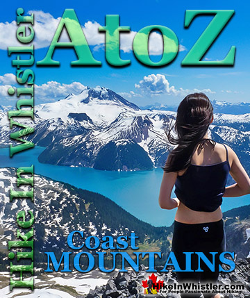
Whistler Hiking Glossary A to Z

Explore BC Hiking Destinations!
Whistler Hiking Trails
Squamish Hiking Trails
Vancouver Hiking Trails
Clayoquot Hiking Trails
Victoria Hiking Trails