HikeInWhistler.com

HikeInWhistler.com

Menu
  • Hike
      • Alexander Falls Provincial Park
      • Ancient Cedars & Showh Lakes
      • Black Tusk in Garibaldi Park
      • Blackcomb Mountain Hiking Trails
      • Brandywine Falls Provincial Park
      • Brandywine Meadows
      • Brew Lake & Mount Brew
      • Callaghan Lake Park
      • Cheakamus Lake in Garibaldi Park
      • Cheakamus River & Interpretive Forest
      • Cirque Lake in Callaghan Valley
      • Flank Trail (Rainbow-Sproatt)
      • Garibaldi Lake in Garibaldi Park
      • Helm Creek in Garibaldi Park
      • Jane Lakes West
      • Joffre Lakes Provincial Park
      • Keyhole Hot Springs
      • Logger's Lake
      • Madeley Lake & Hanging Lake
      • Meager Hot Springs
      • Nairn Falls Provincial Park
      • Newt Lake & Ancient Cedars
      • Panorama Ridge in Garibaldi Park
      • Parkhurst Ghost Town
      • Rainbow Falls
      • Rainbow Lake
      • Ring Lake & Conflict Lake
      • Russet Lake in Garibaldi Park
      • Sea to Sky Trail
      • Skookumchuck Hot Springs
      • Sloquet Hot Springs
      • Sproatt West(Northair) Trail
      • Sproatt East(Stonebridge) Trail
      • Train Wreck & Trash Trail
      • Taylor Meadows in Garibaldi Park
      • Wedgemount Lake in Garibaldi Park
      • Whistler Mountain Hiking Trails
  • Snow
      • Blueberry Trail Snowshoeing
      • Brandywine Falls Snowshoeing
      • Cheakamus River Snowshoeing
      • Elfin Lakes Snowshoeing
      • Flank Trail Snowshoeing
      • Joffre Lakes Snowshoeing
      • Nairn Falls Snowshoeing
      • Parkhurst Ghost Town Snowshoeing
      • Rainbow Falls Snowshoeing
      • Rainbow Lake Snowshoeing
      • Rainbow Park Snowshoeing
      • Sproatt East Snowshoeing
      • Taylor Meadows Snowshoeing
      • Train Wreck Snowshoeing
      • Wedgemount Lake Snowshoeing
  • Run
      • Whistler Golf Course 5k(3.1 Mile)
      • Blueberry Hill 6k(3.7 Mile)
      • Lost Lake 6k(3.7 Mile)
      • Alta Lake 8k(5 Mile)
      • Fitzsimmons Creek 9k(5.6 Mile)
      • Alta Green Lost 15k(9.3 Mile)
  • Best
      • Best Whistler Hiking by Month
          • Best by Month
      • Best Walk, Bike or Bus To Trails
      • Best Whistler Kid Friendly Trails
      • Best Whistler Dog Friendly Trails
      • Best Free Camping in Whistler
      • Best Sights Sea to Sky
      • Best Whistler Waterfalls
      • Best Whistler Aerial Views
      • Best Squamish Hiking Trails
      • Best Whistler Hiking Trails
      • Best Vancouver Hiking Trails
      • Best Whistler Snowshoeing
          • Best Whistler Snowshoe Trails
      • Best Whistler Running Trails
      • Best Whistler Hiking Gear Rentals
      • Best Whistler Parks & Beaches
  • AtoZ
      • Ablation Zone
      • Accumulation Zone
      • Adit Lakes
      • Aiguille
      • Alpine Zone
      • Arborlith or Lithophyte
      • Arête
      • A River Runs Through It
      • Armchair Glacier
      • The Barrier
      • Battleship Islands
      • Bears
      • Bench
      • Bergschrund or Schrund
      • Bivouac or Bivy
      • Blue Face House in Parkhurst
      • Bungee Bridge
      • Cairns & Inukshuks
      • Carter, Neal
      • Caterpillar D8
      • Caterpillar RD8
      • Chimney
      • Cirque or Cirque Lake
      • Cloudraker Skybridge
      • Coast Mountains
      • Col
      • Crevasse
      • Deadfall
      • Emerald Forest
      • Erratic or Glacier Erratic
      • The Fissile
      • Fitzsimmons Creek
      • Fitzsimmons Range
      • Fyles, Tom
      • Garibaldi Ranges
      • Garibaldi Volcanic Belt
      • Gemel or Inosculation
      • Glacier Window
      • Green Lake
      • Hoary Marmot
      • Krummholz
      • Moraine
      • Mount Garibaldi
      • Mount James Turner
      • Northair Mine
      • Nunatuk
      • Overlord Mountain & Glacier
      • Peak2Peak Gondola
      • Roundhouse Lodge
      • Rubble Creek
      • Spearhead Range
      • Tarn
      • The Table
      • Usnea or Old Man's Beard
      • Western Redcedar
  • Maps
      • Alexander Falls Maps
      • Ancient Cedars Maps
      • Black Tusk Maps
      • Blackcomb Mountain Maps
      • Brandywine Falls Maps
      • Brandywine Meadows Maps
      • Brew Lake Maps
      • Callaghan Lake Maps
      • Cheakamus Lake Maps
      • Cheakamus River Maps
      • Cirque Lake Maps
      • Garibaldi Lake Maps
      • Helm Creek Maps
      • Joffre Lakes Maps
      • Keyhole Hot Springs Maps
      • Logger's Lake Maps
      • Madeley Lake Maps
      • Meager Hot Springs Maps
      • Nairn Falls Maps
      • Panorama Ridge Maps
      • Parkhurst Ghost Town Maps
      • Rainbow Falls Maps
      • Rainbow Lake Maps
      • Ring Lake Maps
      • Russet Lake Maps
      • Skookumchuck Maps
      • Sloquet Hot Springs Maps
      • Sproatt Maps
      • Taylor Meadows Maps
      • Train Wreck Maps
      • Wedgemount Lake Maps
      • Whistler Mountain Maps
  • More
      • Whistler Hiking News & Blog
      • Live Whistler Webcams
      • Live Tofino Webcams
      • Live Vancouver Webcams
      • Garibaldi Provincial Park
      • Hike in Whistler Glossary

Newt Lake

Joffre Lakes

Black Tusk

Wedgemount Lake

Callaghan Lake

Whistler Train Wreck

Wedgemount Lake

Cirque Lake

Adit Lakes

Black Tusk

Northair Mine

Brandywine Meadows

Logger's Lake

Spectacular Whistler!

Whistler hiking is wonderful! Check out our Best Whistler Hiking by Month guides! WeRentGear.com rents tents, sleeping bags, sleeping pads, camp stoves, packs, complete kits and more!

Best Trails This Week!

Best This Week: Whistler Train Wreck and Parkhurst Ghost Town are easy, fun and dog friendly. Check out our July and August Whistler and Garibaldi Park guides here!

Russet Lake is a surreal little paradise that lays at the base of The Fissile. The Fissile is the strikingly bronze mountain visible from Whistler Village.  From the Village look into the distance at the Peak2Peak hanging between Whistler Mountain and Blackcomb Mountain and you will see The Fissile. Its pyramid shape in the distance perfectly separates the two mountains.

  • At least 5 amazing routes to this hidden paradise
  • The Fissile looms ominously over the lake
  • Overlord Glacier fills the valley below and across
  • Part of the Spearhead Traverse
  • Every direction you look is shockingly beautiful
  • Adit Lakes is a hidden world nearby
  • Scrambling routes up & beyond The Fissile!
  • Musical Bumps Trail to Russet is very beautiful
  • Russet Lake is not as beautiful as other lakes
  • The old 5k access road is inaccessible due to slide

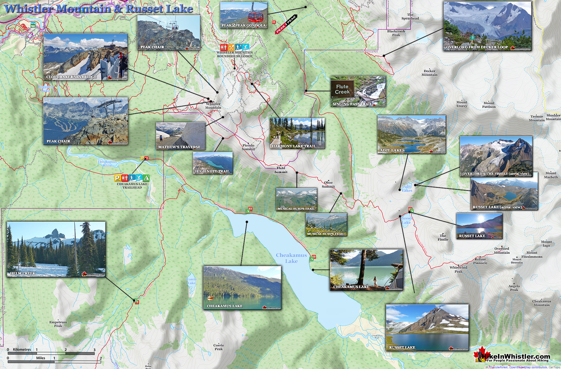
Though Russet Lake is not terribly impressive in terms of size or colour, the valley around it is remarkably beautiful. The colours change from moment to moment in and extraordinary way. The distinctive colour of The Fissile and the stark grey of the mountains around contrast amazingly with the blue of the lake and green grass in the valley. So many different factors fill the place with colour.  There are several ways to get to hike Russet Lake.  The Singing Pass trail from the base of Whistler Mountain near the Whistler Gondola. The Musical Bumps trail that begins near the top of the Whistler Gondola.  The High Note trail that begins at the top of the Peak Chair on Whistler Mountain. There is an increasingly popular route that begins from Blackcomb Mountain.  And finally, a very infrequently hiked route from Cheakamus Lake that runs along Singing Creek. In short, the three ways to get to Russet Lake are 1. Musical Bumps (direct route and beautiful), 2. High Note trail (a bit longer but even more beautiful), and the Singing Pass trail (not as nice as the previous two and constantly uphill, but no expensive gondola charge).  All three routes are have signs and well established trails. None are very difficult with the exception of being long trails. Though each can be done in a day, 28 kilometres of hiking in one day is quite a long way.

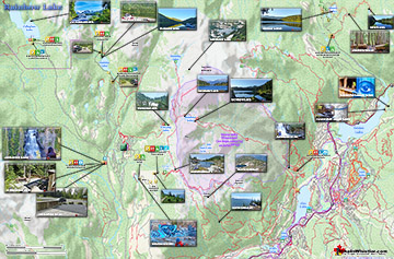
Russet Lake Hiking Trail Map

Russet Lake is a great place to camp at the end of the lake with a beautiful stream that runs along the camping area. There are no tent platforms but over a dozen tent clearings.  There is a considerable amount of exploring available in the valley around Russet Lake. The Fissile is a difficult but very feasible hike from Russet Lake.  Below Russet Lake is a very accessible glacier as well as a bonanza of glacier formed landscape features, inviting hours of interesting exploration.  Above Russet Lake there is a beautiful snow covered ridge that commands incredible views all around and if you have the energy makes for a spectacular tent site.

Russet Lake Map v20

Russet Lake Sunset, BC Parks Garibaldi Provincial Park

Aerial View of The Fissile and Russet Lake

Musical Bumps Trail to Russet Lake

Moderately Challenging with Steep HillsTaking the Musical Bumps trail that begins at the Roundhouse Lodge on Whistler Mountain is arguably the best route to Russet Lake.  It is fairly direct(12.5 kilometres) to Russet Lake) and full of incredible views. Alpine forests, massive valleys, small alpine lakes, dramatic mountain views all around.  The trail has considerable elevation gain and loss though.  The trail is well marked with signs directing you along the Musical Bumps trail.  You won't see Russet Lake signs until you reach the trail junction at the Singing Pass trail.  This route is a very popular trail running route in Whistler.  From the Roundhouse Lodge to the Village is 24 kilometres, and much of it downhill.  To find the Russet Lake trailhead, take the Whistler Gondola up to the Roundhouse Lodge.  Walk out of the Gondola and past the Peak2Peak Gondola building, up a gravel slope about 50 metres.  On your left you will see a trailhead.

Russet Lake Musical Bumps Trail - Hike in Whistler

Whistler Mountain Russet Lake Map v20

More Russet Lake Hiking Info...

More Whistler & Garibaldi Park Hiking Maps!

Panorama Ridge Maps

Panorama Ridge is easily one of the most amazing hikes in Garibaldi Provincial Park.  The 15 kilometre hike from the trailhead at Rubble Creek to Panorama Ridge takes you ...
Read more

Ring Lake Maps

Ring Lake is a fantastically serene and wonderfully remote lake similar to Cirque Lake, but considerably farther to hike to reach it. The 10 kilometre(6.2 mile) hike takes you ...
Read more

Callaghan Lake Maps

Callaghan Lake Park is a relatively untouched wilderness of rugged mountainous terrain. The valley walls were formed by relatively recent glaciation. Evidence of this can be ...
Read more

Black Tusk Maps

Black Tusk is the extraordinarily iconic and appropriately named mountain that can be seen from almost everywhere in Whistler.  The massive black spire of crumbling rock juts out ...
Read more
More Whistler Hiking Trail Maps

Amazing West Coast Trail Guide

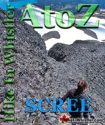
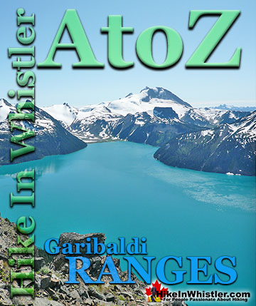
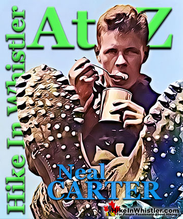
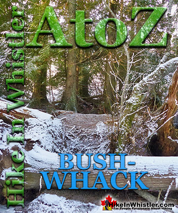
Whistler & Garibaldi Park Glossary A to Z

Scree: from the Norse “skridha”, landslide.  The small, loose stones covering a slope. Also called talus, the French word for slope. Scree is mainly formed ...
Read more
Deadfall means a tangled mass of fallen trees and branches.  There are several name variations for fallen trees that are commonly used in Whistler.  ...
Read more
Along Whistler’s Valley Trail near Rainbow Park you come across some impressively unusual trees. Unlike most other Whistler trees with straight trunks and ...
Read more
The Pacific yew or western yew is a coniferous tree that grows in Whistler and along the coast from Alaska to California. The Pacific yew’s unique ...
Read more
The Spearhead Range is a subsection of the Garibaldi Ranges that runs in an arc that connects Whistler Mountain and Blackcomb Mountain.  The Spearhead ...
Read more
Surprisingly often in Whistler's forests you will find a tree growing on an old fallen tree or out of a decaying tree stump. Decaying logs and stumps in ...
Read more
The sawmill at Parkhurst operated on the triangle of land that juts out into Green Lake and also extended north between the train tracks and the lake.  The ...
Read more
Western redcedar is a very large tree commonly found in the Pacific Northwest. Frequently growing up to 70 metres and with a trunk diameter of 7 metres, ...
Read more
More Hike in Whistler Glossary

Free Camping Gear Delivery to Garibaldi Park

The Best Whistler & Garibaldi Park Hiking Trails!

Joffre Lakes Provincial Park is a gorgeous park with extraordinarily coloured lakes, waterfalls, stunning mountain peaks and ominous glaciers pouring into the valley.  Joffre Lakes is one of those incredible ...
Read more
Panorama Ridge is easily one of the most amazing hikes in Garibaldi Provincial Park.  The 15 kilometre(9.3 mile) hike from the trailhead at Rubble Creek to Panorama Ridge takes you through beautiful and deep ...
Read more
Brew Lake is beautiful mountain lake just a short drive south of Whistler and is relatively unknown and seldom hiked. Laying at the base of Mount Brew, Brew Lake lays in a massive alpine valley of enormous ...
Read more
Callaghan Lake Park is a relatively untouched wilderness of rugged mountainous terrain. The valley walls were formed by relatively recent glaciation. Evidence of this can be seen in the considerable glacial ...
Read more
More Whistler Hiking Trails & Maps

HikeInWhistler.com HikeInWhistler.com © 2025
  • Contact Us: [email protected]