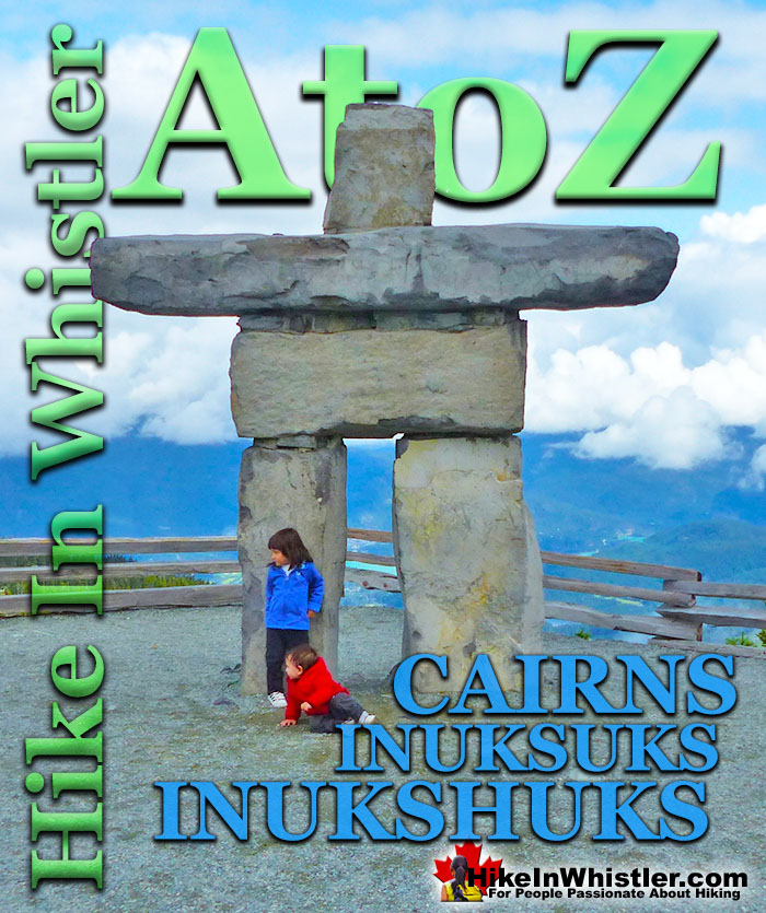
Cairns, inukshuks or inuksuks are a pile or arrangement of rocks used to indicate a route, landmark or a summit. The word cairn originates from the Scottish Gaelic word carn. A cairn or inukshuk can be either large and elaborate or as simple as a small pile of rocks. To be effective a cairn marking a trail has to just be noticeable and obviously man-made. In the alpine areas around Whistler, above the treeline, cairns are the main method of marking a route.
In the spring and fall when snow covers alpine trails, cairns mark many routes. An inukshuk(also spelled inuksuk) is the name for a cairn used by peoples of the Arctic region of North America. Both spelling versions are pronounced nearly as they are spelled. So inukshuk is pronounced inook-shuk, and inuksuk with inook-suk. Though an inukshuk can take many forms similar to a cairn, it is usually represented by large rocks formed into a human shape. The word inukshuk literally translates from two separate Inuit words, inuk "person" and suk "substitute". The 2010 Winter Olympics in Vancouver and Whistler used the inukshuk for the logo of the games. Today you will find several giant rock inukshuks in Vancouver and Whistler at various places. In Whistler there is an impressive inukshuk, several metres high a the peak of Whistler Mountain. Another huge inukshuk sits overlooking Whistler Valley at the Roundhouse next to the Umbrella Bar. The first inukshuk that most visitors to Whistler see is the huge one on Village Gate Boulevard.
Inukshuk Near the Roundhouse
Whistler Peak Inukshuk
Inukshuk and Distant Black Tusk
Battleship Islands Cairns, Garibaldi Lake
More Whistler & Garibaldi Park Hiking A to Z!
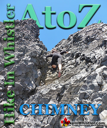
Chimney: a gap between two vertical faces of rock or ice. Often a chimney offers the only viable route to the summit of a mountain. An example of this is Black ...
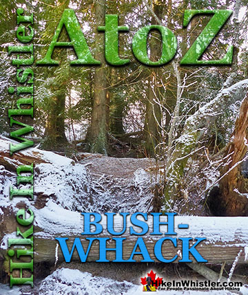
Bushwhack is a term often used in Canada and the United States to refer to hiking off-trail where no trail exists. Literally means 'bush' and 'whack'. To ...
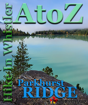
Parkhurst Ridge is an incredible place for a lot of reasons. Of course, the view is spectacular with Green Lake's absurdly vivid green coloured water. ...
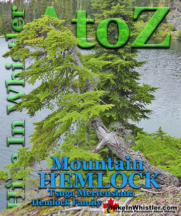
Mountain hemlock is a species of hemlock that thrives along the west coast of North America from Alaska to California. In Whistler and Garibaldi Park you ...
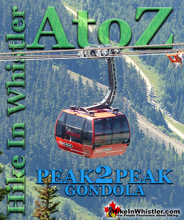
The Peak 2 Peak Gondola connects Whistler Mountain and Blackcomb Mountain at a dizzying height of 436 metres(1427 feet). It runs all winter and in the ...
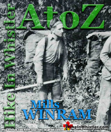
Mills Winram was a very active mountaineer from Vancouver with some very notable ascents in the 1920's and 1930's. He, along with Fred Parkes and Stan ...
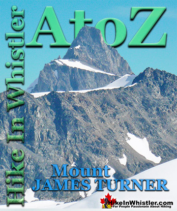
If you make it to the summit of Wedge Mountain you will notice off in the distance a beautifully symmetrical mountain that stands out among the rest. ...
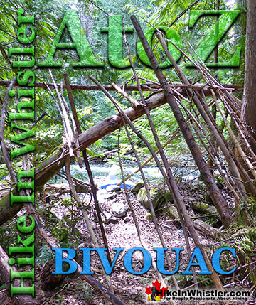
Bivouac or Bivy: a primitive campsite or simple, flat area where camping is possible. Traditionally used to refer to a very primitive campsite comprised of ...
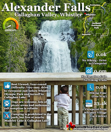
Alexander Falls is a very impressive 43 metre/141 foot waterfall just 30 to 40 minutes south of Whistler in the Callaghan Valley. Open year-round and located just before Whistler Olympic Park where several ...
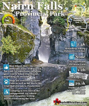
Nairn Falls is a wonderful, crashing and chaotic waterfall that surrounds you from the deluxe viewing platform that allows you to safely watch it from above. The beautiful, green water rushes through the ...
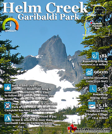
Helm Creek is a cute, meandering creek that winds its way from beyond Black Tusk, down the valley to the wonderful campground that takes its name. From the Helm Creek campground, Helm Creek descends further ...
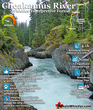
Cheakamus River is a beautiful, crashing, turquoise coloured river that flows from Cheakamus Lake, through Whistler Interpretive Forest, then down past Brandywine Falls to Daisy Lake, then all the way to ...
Hiking in Whistler in October is often unexpectedly stunning. The days are much shorter and colder but the mountains are alive with colour from the fall ...
November in Whistler is when the temperatures plummet and the first heavy snow falls in the alpine and often in Whistler Village. The hiking opportunities become ...
December hiking in Whistler is mainly done on snowshoes, though not always. If it hasn't snowed much recently then trails such as Whistler Train Wreck and ...
Hiking in Whistler is spectacular and wonderfully varied. Looking at a map of Whistler you see an extraordinary spider web of hiking trails that are unbelievably numerous. Easy trails, moderate trails and challenging hiking trails are all available. Another marvellous ...
Squamish is located in the midst of a staggering array of amazing hiking trails. Garibaldi Provincial Park sprawls alongside Squamish and up and beyond Whistler. Tantalus Provincial Park lays across the valley to the west and the wonderfully remote Callaghan Valley ...
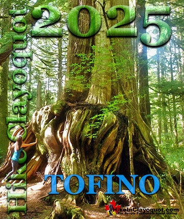
Clayoquot Sound has a staggering array of hiking trails within it. Between Tofino and Ucluelet, Pacific Rim Park has several wilderness and beach trails, each one radically different from the last. The islands in the area are often Provincial parks on their own with ...
Victoria has a seemingly endless number of amazing hiking trails. Most take you to wild and beautiful Pacific Ocean views and others take you to tranquil lakes in beautiful BC Coastal Rainforest wilderness. Regional Parks and Provincial Parks are everywhere you turn in ...
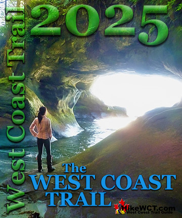
The West Coast Trail was created after decades of brutal and costly shipwrecks occurred along the West Coast of Vancouver Island. One shipwreck in particular was so horrific, tragic and unbelievable that it forced the creation of a trail along the coast, which ...