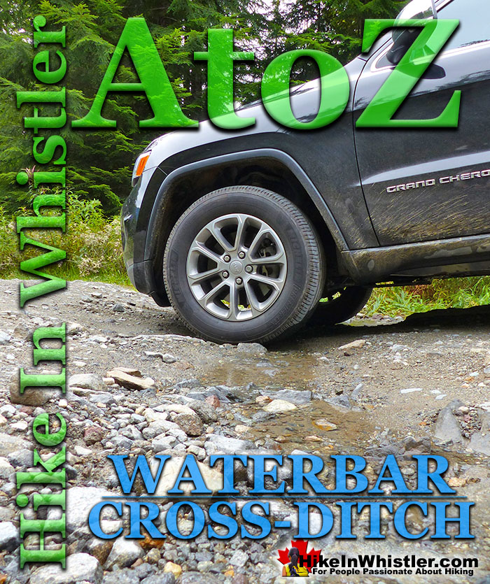
![]() Waterbar and Cross-Ditch: the purpose of a waterbar or cross-ditch is to capture and redirect surface water from the road and channel it across the road surface beyond the shoulder of the road. A waterbar differs from a cross-ditch as it collects only road surface water and not water flowing down a ditch line or creek. Waterbars often form naturally across forest service roads over time by seasonal flooding. Man-made waterbars are visibly different than natural ones in that they are deeper, straighter and have a berm on the downhill side.
Waterbar and Cross-Ditch: the purpose of a waterbar or cross-ditch is to capture and redirect surface water from the road and channel it across the road surface beyond the shoulder of the road. A waterbar differs from a cross-ditch as it collects only road surface water and not water flowing down a ditch line or creek. Waterbars often form naturally across forest service roads over time by seasonal flooding. Man-made waterbars are visibly different than natural ones in that they are deeper, straighter and have a berm on the downhill side.
Whistler & Garibaldi Hiking
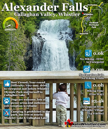
![]() Alexander Falls
Alexander Falls ![]() Ancient Cedars
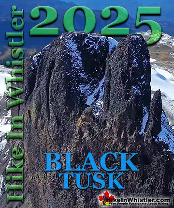
Ancient Cedars ![]() Black Tusk
Black Tusk ![]() Blackcomb Mountain
Blackcomb Mountain ![]() Brandywine Falls
Brandywine Falls ![]() Brandywine Meadows
Brandywine Meadows ![]() Brew Lake
Brew Lake ![]() Callaghan Lake
Callaghan Lake ![]() Cheakamus Lake
Cheakamus Lake ![]() Cheakamus River
Cheakamus River ![]() Cirque Lake
Cirque Lake ![]() Flank Trail
Flank Trail ![]() Garibaldi Lake
Garibaldi Lake ![]() Garibaldi Park
Garibaldi Park ![]() Helm Creek
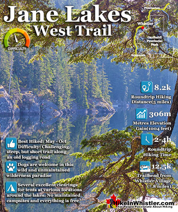
Helm Creek ![]() Jane Lakes
Jane Lakes ![]() Joffre Lakes
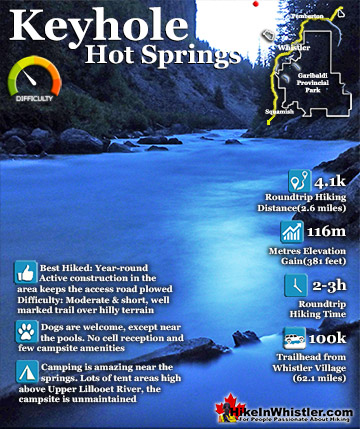
Joffre Lakes ![]() Keyhole Hot Springs
Keyhole Hot Springs ![]() Logger’s Lake
Logger’s Lake ![]() Madeley Lake
Madeley Lake ![]() Meager Hot Springs
Meager Hot Springs ![]() Nairn Falls
Nairn Falls ![]() Newt Lake
Newt Lake ![]() Panorama Ridge
Panorama Ridge ![]() Parkhurst Ghost Town
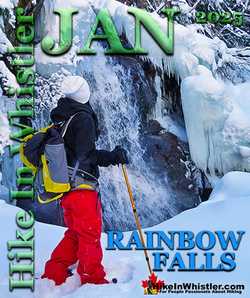
Parkhurst Ghost Town ![]() Rainbow Falls
Rainbow Falls ![]() Rainbow Lake
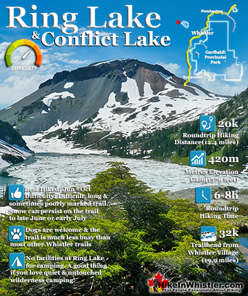
Rainbow Lake ![]() Ring Lake
Ring Lake ![]() Russet Lake
Russet Lake ![]() Sea to Sky Trail
Sea to Sky Trail ![]() Skookumchuck Hot Springs
Skookumchuck Hot Springs ![]() Sloquet Hot Springs
Sloquet Hot Springs ![]() Sproatt East
Sproatt East ![]() Sproatt West
Sproatt West ![]() Taylor Meadows
Taylor Meadows ![]() Train Wreck
Train Wreck ![]() Wedgemount Lake
Wedgemount Lake ![]() Whistler Mountain
Whistler Mountain
![]() January
January ![]() February
February ![]() March
March ![]() April
April ![]() May
May ![]() June
June ![]() July
July ![]() August
August ![]() September
September ![]() October
October ![]() November
November ![]() December
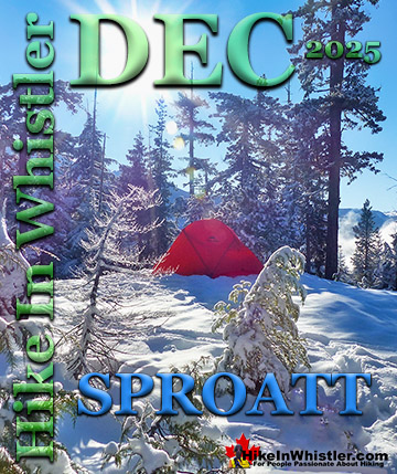
December
A berm is an artificial ridge or raised bank running along the downhill side of the waterbar. A berm uses the excavated material dug out of the ditch to allow the waterbar to channel a higher volume of water, yet be shallow enough to be crossed by vehicles. Waterbars and cross-ditches are similar, however cross-ditches are generally larger, more visibly man-made, and designed to channel a permanent flow of water. On active forest service roads waterbars and cross-ditches are designed to allow vehicles to cross them. On deactivated forest service roads, cross-ditches can be constructed large enough to prevent vehicle access and to allow a more natural looking stream to permanently form. Access roads in Whistler have many examples of waterbars and cross-ditches. The old 8 kilometre access road to Callaghan Lake has almost continuous waterbars that range from not too bad to very bad. An SUV will have no worries crossing even the deepest of these waterbars, though many require slowing to a crawl. Cars will have some difficulty getting past the waterbars, though with careful and slow driving, getting to Callaghan Lake should be possible for most. The road to Madeley Lake that branches off from the Callaghan Lake FSR is similarly crossed by waterbars. Far less numerous, the waterbars along the 6.2 kilometre road to Madeley Lake don't start until about 4 kilometres up the road. After the trailhead to Hanging Lake at 4.2 km the Madeley Lake Road has a few very deep waterbars that appear to get deeper every year.
Typical Waterbar Along the Callaghan Lake FSR

Waterbars Modified to Cross-Ditches
The old logging road that extends from Cheakamus Crossing to Jane Lakes was blocked off in 2019 and there you can see good examples of how waterbars have been modified into cross-ditches. The future of this comparatively unknown old logging road looks very promising. Particularly owing to the enticing network of biking trails around Jane Lakes and the seemingly endless energy of bike trail builders in Whistler this trail seems poised to be something special. The trail itself is quite steep and the newly dug cross-ditches are quite wide and deep. Even in the dry months of fall several are tricky to jump across without splashing through. Added to that the fact that this trail will be frequently used as an exit route for bikes coming down the steep old road at high speed would hint at the need for bridges over the dozens of cross-ditches. Hiking up the trail to Jane Lakes, you can't help but visualize the trail in a couple years with bridges over creeks every few hundred metres. Though the excavator used to dig the cross-ditches gouged out the road considerably in 2019, the next couple years will see the forest push back in. The dense forest and steep terrain open up fantastic views all along the trail and the hiking and biking possibilities seem endless. Jane Lakes have trails around them as well as extending through to the Microwave Road which brings you back along Cheakamus River to Cheakamus Crossing. Another trail connects partway up the Jane Lakes West trail to the Daisy Lake FSR between the Bungee Bridge and the Cal-Cheak Campground.
Cross-Ditch on the Jane Lakes West Trail


More Whistler & Garibaldi Park Hiking A to Z!

The Best Whistler & Garibaldi Park Hiking Trails!
Whistler & Garibaldi Park Best Hiking by Month!

Explore BC Hiking Destinations!
Whistler Hiking Trails
Squamish Hiking Trails
Vancouver Hiking Trails
Clayoquot Hiking Trails
Victoria Hiking Trails