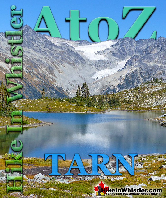
Tarn: a small alpine lake. The word tarn originates from the Norse word tjorn which translates to English as pond. In the United Kingdom, tarn is widely used to refer to any small lake or pond. In British Columbia tarn is used specifically for small mountain lakes. Around Whistler tarns number in the hundreds and many are so small and/or hidden as to remain unnamed. Russet Lake in Garibaldi Provincial Park could be called a tarn, however its relatively large size dominates the area and the term lake seems more appropriate.
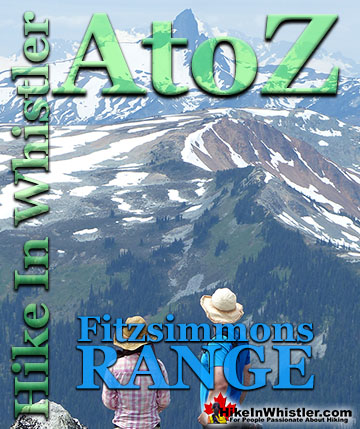
Near Russet Lake there are two beautifully characteristic tarns named Adit Lakes. Both lakes are small, shallow and have irregular shapes. The two lakes lay in quite a remarkable setting overlooking the valley separating the Fitzsimmons Range and the Spearhead Range. The image below shows the view across to the Spearhead Range. Tremor Mountain and Mount Macbeth are the two prominent peaks. The upper glacier flows from Tremor Mountain from the left and Quiver Peak and The Ripsaw from the right. The lower glacier is Curtain Glacier which disappears behind Mount Macbeth. Hundreds of tarns can be found in the mountains around Whistler and most are unnamed. Mount Sproatt, across the valley from Whistler Mountain is home to several stunning tarns. Owing to the broad and seemingly endless alpine terrain on Mount Sproatt, there are dozens of tarns. Tarns are by definition quite small and comparatively warm to swim in, unlike the brutally cold Garibaldi Lake, Wedgemount Lake, Cheakamus Lake and Green Lake. Though many hiking trails in Whistler and Garibaldi Park have become crowded in recent years, finding a beautiful tarn in the wilderness around Whistler is actually pretty easy. Having a serene and secluded tarn on top of a mountain all to yourself is pretty amazing.
Finding a perfect paradise in the mountains around Whistler is not too difficult. This serene little tarn is on Mount Sproatt and just one of many found in the vast wilderness up there. The water temperature is far from cold due to the shallowness, only about 3 metres deep in the middle. Mount Sproatt is criss-crossed with several hiking and biking trails, which makes it reasonably accessible. It's vast area, however, makes it easy to find solitude and a perfect waterfront view for your tent.
More Whistler & Garibaldi Park Hiking A to Z!
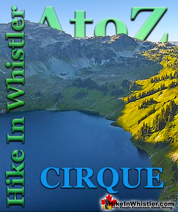
Cirque: a glacier-carved bowl or amphitheater in the mountains. To form, the glacier must be a combination of size, a certain slope and more unexpectedly, a ...
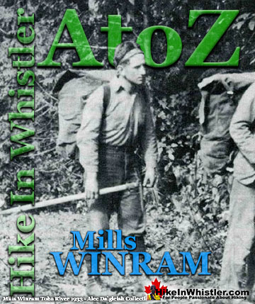
Mills Winram was a very active mountaineer from Vancouver with some very notable ascents in the 1920's and 1930's. He, along with Fred Parkes and Stan ...
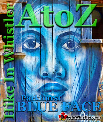
Back in 2011 Kups, a Whistler local and now professional muralist painted a hauntingly surreal, blue face on the side of this house. This beautiful ...
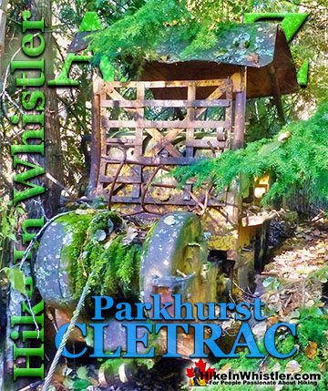
Adjacent to the huge Caterpillar tractor in Parkhurst is a large disintegrating wooden dock that is a great place to take in the wonderful view of Green ...
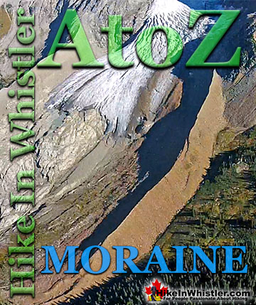
Moraines are glacially deposited ridges of debris that accumulate at the sides or terminus of a glacier. Lateral moraines form at the sides of glaciers ...
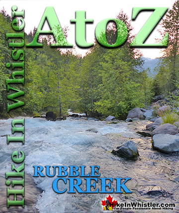
The Rubble Creek trailhead is the main access point for many of the best hikes and sights in Garibaldi Provincial Park. Rubble Creek is located midway ...
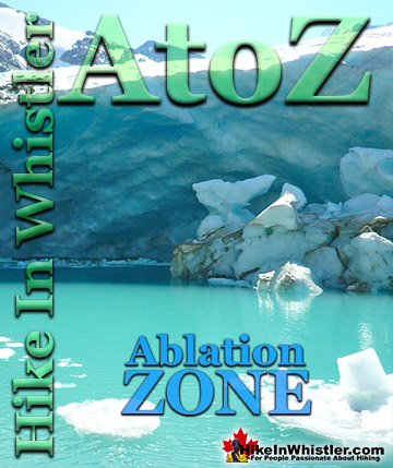
Ablation Zone: the lower altitude region of a glacier where there is a net loss of ice mass due to melting, sublimation, evaporation, ice calving or ...
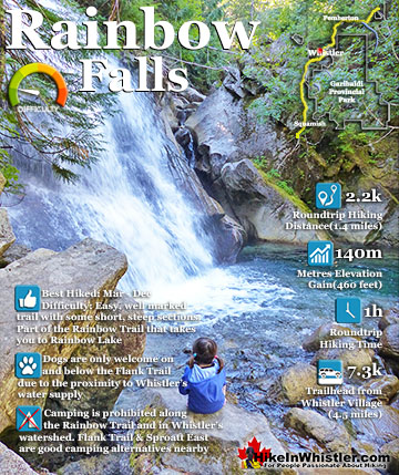
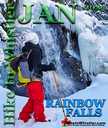
The short, winding, and ever-changing hiking trail to Rainbow Falls is the same as the much more popular trailhead for Rainbow Lake. The trailhead is marked as the Rainbow Trail, and the trail quickly ...
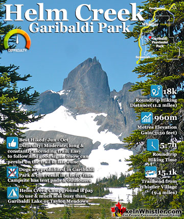
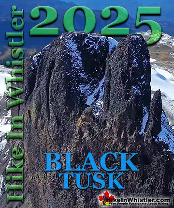
Helm Creek is a cute, meandering creek that winds its way from beyond Black Tusk, down the valley to the wonderful campground that takes its name. From the Helm Creek campground, Helm Creek descends further ...
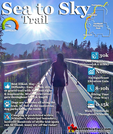
The Sea to Sky Trail is a 180 kilometre multi-use trail that runs from Squamish to D'Arcy. The trail is still under construction in many parts, however, the amazing route through Whistler is finally in ...
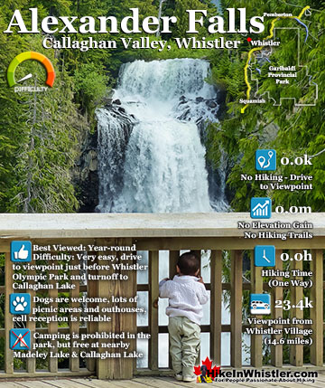
Alexander Falls is a very impressive 43 metre/141 foot waterfall just 30 to 40 minutes south of Whistler in the Callaghan Valley. Open year-round and located just before Whistler Olympic Park where several ...
Hiking in Whistler in October is often unexpectedly stunning. The days are much shorter and colder but the mountains are alive with colour from the fall ...
November in Whistler is when the temperatures plummet and the first heavy snow falls in the alpine and often in Whistler Village. The hiking opportunities become ...
December hiking in Whistler is mainly done on snowshoes, though not always. If it hasn't snowed much recently then trails such as Whistler Train Wreck and ...
Hiking in Whistler is spectacular and wonderfully varied. Looking at a map of Whistler you see an extraordinary spider web of hiking trails that are unbelievably numerous. Easy trails, moderate trails and challenging hiking trails are all available. Another marvellous ...
Squamish is located in the midst of a staggering array of amazing hiking trails. Garibaldi Provincial Park sprawls alongside Squamish and up and beyond Whistler. Tantalus Provincial Park lays across the valley to the west and the wonderfully remote Callaghan Valley ...
Clayoquot Sound has a staggering array of hiking trails within it. Between Tofino and Ucluelet, Pacific Rim Park has several wilderness and beach trails, each one radically different from the last. The islands in the area are often Provincial parks on their own with ...
Victoria has a seemingly endless number of amazing hiking trails. Most take you to wild and beautiful Pacific Ocean views and others take you to tranquil lakes in beautiful BC Coastal Rainforest wilderness. Regional Parks and Provincial Parks are everywhere you turn in ...
The West Coast Trail was created after decades of brutal and costly shipwrecks occurred along the West Coast of Vancouver Island. One shipwreck in particular was so horrific, tragic and unbelievable that it forced the creation of a trail along the coast, which ...