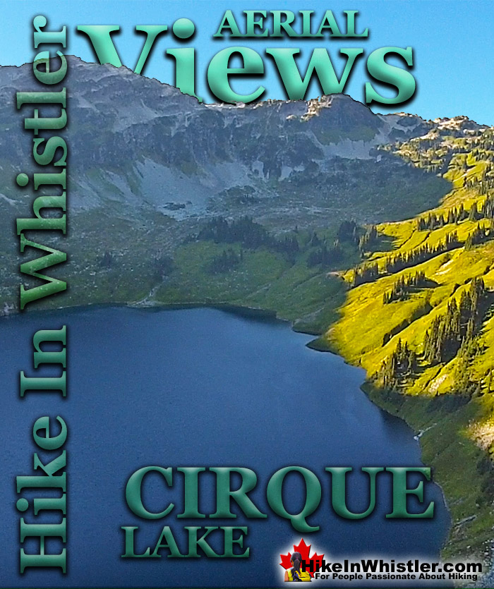
![]() Cirque Lake is a beautiful mountain lake hidden up alongside Mount Callaghan in Callaghan Lake Provincial Park. The trailhead is tricky to find and located at the far end of Callaghan Lake. You can only reach the trailhead by boat and the trail is quite steep but very short. Less than two kilometres long the steep trail hugs Cirque Creek and Cirque Falls up to Cirque Lake.
Cirque Lake is a beautiful mountain lake hidden up alongside Mount Callaghan in Callaghan Lake Provincial Park. The trailhead is tricky to find and located at the far end of Callaghan Lake. You can only reach the trailhead by boat and the trail is quite steep but very short. Less than two kilometres long the steep trail hugs Cirque Creek and Cirque Falls up to Cirque Lake.
Whistler & Garibaldi Hiking
![]() Alexander Falls
Alexander Falls ![]() Ancient Cedars
Ancient Cedars ![]() Black Tusk
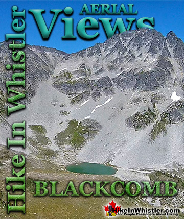
Black Tusk ![]() Blackcomb Mountain
Blackcomb Mountain ![]() Brandywine Falls
Brandywine Falls ![]() Brandywine Meadows
Brandywine Meadows ![]() Brew Lake
Brew Lake ![]() Callaghan Lake
Callaghan Lake ![]() Cheakamus Lake
Cheakamus Lake ![]() Cheakamus River
Cheakamus River ![]() Cirque Lake
Cirque Lake ![]() Flank Trail
Flank Trail ![]() Garibaldi Lake
Garibaldi Lake ![]() Garibaldi Park
Garibaldi Park ![]() Helm Creek
Helm Creek ![]() Jane Lakes
Jane Lakes ![]() Joffre Lakes
Joffre Lakes ![]() Keyhole Hot Springs
Keyhole Hot Springs ![]() Logger’s Lake
Logger’s Lake ![]() Madeley Lake
Madeley Lake ![]() Meager Hot Springs
Meager Hot Springs ![]() Nairn Falls
Nairn Falls ![]() Newt Lake
Newt Lake ![]() Panorama Ridge
Panorama Ridge ![]() Parkhurst Ghost Town
Parkhurst Ghost Town ![]() Rainbow Falls
Rainbow Falls ![]() Rainbow Lake
Rainbow Lake ![]() Ring Lake
Ring Lake ![]() Russet Lake
Russet Lake ![]() Sea to Sky Trail
Sea to Sky Trail ![]() Skookumchuck Hot Springs
Skookumchuck Hot Springs ![]() Sloquet Hot Springs
Sloquet Hot Springs ![]() Sproatt East
Sproatt East ![]() Sproatt West
Sproatt West ![]() Taylor Meadows
Taylor Meadows ![]() Train Wreck
Train Wreck ![]() Wedgemount Lake
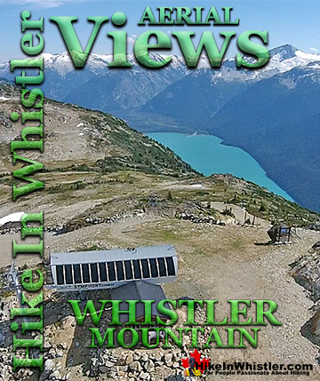
Wedgemount Lake ![]() Whistler Mountain
Whistler Mountain
Whistler Aerial Views
![]() Alexander
Alexander ![]() Brandywine
Brandywine ![]() Blackcomb
Blackcomb ![]() Callaghan
Callaghan ![]() Cirque
Cirque ![]() Joffre
Joffre ![]() Keyhole
Keyhole ![]() Logger's
Logger's ![]() Madeley
Madeley ![]() Panorama
Panorama ![]() Sproatt
Sproatt ![]() Parkhurst
Parkhurst ![]() Rainbow
Rainbow ![]() Russet
Russet ![]() Train Wreck
Train Wreck ![]() Wedge Glacier
Wedge Glacier ![]() Wedgemount
Wedgemount ![]() Whistler
Whistler
The lake itself sits in a huge cirque along the north side of Mount Callaghan and is untouched by humanity. Cirque Lake is well into the alpine so you won't need to find hiking trails as the alpine is wide open for hiking. A fairly easy route along the right side of the lake takes you further into the alpine along the right edge of the cirque. This alpine leads to more alpine lakes that descend like steps down into the valley below. At Cirque Lake you will find few areas of ground suitable for a tent. The rugged terrain is rocky and buried in snow most of the year. The snow retreats from along the shore of Cirque Lake in mid to late July, but the trail is mostly free of snow by early July. At less than two kilometres, the Cirque Lake trail is steep, however not too steep to require technical skill. Callaghan Lake Provincial Park doesn't prohibit dogs, making the Cirque Lake trail one of the few hiking trails in Whistler that is dog friendly. The steep trail and necessity of canoeing to the trailhead make Cirque Lake far less hiked than other Whistler area hiking trails. The alpine beyond Cirque Lake is even less popular with hikers and you rarely see anyone up there on even the sunniest summer days. More details, directions and maps for Cirque Lake.

Cirque Lake Aerial Views


Parking & Trailhead Directions to Cirque Lake
![]()
![]()
![]() The trailhead to Cirque Lake is found at the far end of Callaghan Lake. Callaghan Lake Provincial Park is less than an hours drive from Whistler Village and most of the drive is quite beautiful. From Whistler drive 13.8 kilometres towards Vancouver on the Sea to Sky Highway. Turn right onto Callaghan Valley Road at the sign for Whistler Olympic Park. Drive up the beautiful, winding road for 9.6 kilometres. The sign for Callaghan Lake Provincial Park will be just after Alexander Falls Provincial Park and just before Whistler Olympic Park. You will turn left, cross a bridge and drive up the horrendously potholed Callaghan Lake FSR for 8.5 kilometres. Most vehicles can make it to the lake but with extreme caution and care at several waterbars and the frequent and very deep potholes. You often see full size motorhomes at the campsite so as long as you drive slow, most vehicles should make it slowly but surely. This logging road is usually deep with snow until June(June 4th in 2019). If you attempt to drive this road in early summer, be sure to bring a shovel and rope in case you find yourself stuck in the snow. You will have spotty cell reception all the way to the Callaghan campsite, however you may have to walk along the road until you catch a usable signal. Access to Callaghan Lake FSR is blocked by a chain at the bridge until May 15th every year. A huge pile of snow is plowed to block Callaghan Lake FSR just past the bridge. It keeps people from driving up and getting stuck in the snow on the higher elevations. When this snow pile melts, it is a good indication that the road to Callaghan Lake may be clear as well.
The trailhead to Cirque Lake is found at the far end of Callaghan Lake. Callaghan Lake Provincial Park is less than an hours drive from Whistler Village and most of the drive is quite beautiful. From Whistler drive 13.8 kilometres towards Vancouver on the Sea to Sky Highway. Turn right onto Callaghan Valley Road at the sign for Whistler Olympic Park. Drive up the beautiful, winding road for 9.6 kilometres. The sign for Callaghan Lake Provincial Park will be just after Alexander Falls Provincial Park and just before Whistler Olympic Park. You will turn left, cross a bridge and drive up the horrendously potholed Callaghan Lake FSR for 8.5 kilometres. Most vehicles can make it to the lake but with extreme caution and care at several waterbars and the frequent and very deep potholes. You often see full size motorhomes at the campsite so as long as you drive slow, most vehicles should make it slowly but surely. This logging road is usually deep with snow until June(June 4th in 2019). If you attempt to drive this road in early summer, be sure to bring a shovel and rope in case you find yourself stuck in the snow. You will have spotty cell reception all the way to the Callaghan campsite, however you may have to walk along the road until you catch a usable signal. Access to Callaghan Lake FSR is blocked by a chain at the bridge until May 15th every year. A huge pile of snow is plowed to block Callaghan Lake FSR just past the bridge. It keeps people from driving up and getting stuck in the snow on the higher elevations. When this snow pile melts, it is a good indication that the road to Callaghan Lake may be clear as well.


Finding the Hidden Cirque Lake Trailhead
![]() To reach the very hidden trailhead to Cirque Lake, paddle your canoe towards the waterfall far off in the distance. Not until you are only 50 metres from the shore, nearest the sound of the now hidden waterfall, you will see a small clearing jutting out from the shore, this is the trailhead, despite it not looking like one. Pull your canoe up here and drag into the bushes. Only a few metres into shore you will notice an obvious trail. There are even plenty of tree markers on the way. From here it is only an hour hike to the lake, though even steeper than the Wedgemount Lake trail. About two thirds of the way up the trail you will come to a massive boulder field. The trail emerges from the forest into this field and cuts across it. You then hike the precarious boulder field along the right side. The route zig-zags all the while following several not so obviously placed cairns and orange trail marker ribbons. At the top of the boulder field you will have to climb up a narrow cliff gap with an impressive array of brutalized krummholz trees. These boulder mangled trees, bent and twisted by the crushing weight of snow and rockfalls. From this gap to Cirque Lake is only another 15 minutes of ever more beautiful views.
To reach the very hidden trailhead to Cirque Lake, paddle your canoe towards the waterfall far off in the distance. Not until you are only 50 metres from the shore, nearest the sound of the now hidden waterfall, you will see a small clearing jutting out from the shore, this is the trailhead, despite it not looking like one. Pull your canoe up here and drag into the bushes. Only a few metres into shore you will notice an obvious trail. There are even plenty of tree markers on the way. From here it is only an hour hike to the lake, though even steeper than the Wedgemount Lake trail. About two thirds of the way up the trail you will come to a massive boulder field. The trail emerges from the forest into this field and cuts across it. You then hike the precarious boulder field along the right side. The route zig-zags all the while following several not so obviously placed cairns and orange trail marker ribbons. At the top of the boulder field you will have to climb up a narrow cliff gap with an impressive array of brutalized krummholz trees. These boulder mangled trees, bent and twisted by the crushing weight of snow and rockfalls. From this gap to Cirque Lake is only another 15 minutes of ever more beautiful views.

More Great Hiking in the Callaghan Valley
![]() The Callaghan Valley lays quietly across from Whistler despite being home to some incredible hikes. Ring & Conflict Lake and Cirque Lake are two phenomenal hiking destinations in the valley that few people have even heard of. Cirque Lake resides high above Callaghan Lake at the end of a very steep, though very short hike that runs startlingly close to the almost vertical falls that empty Cirque Lake. Ring & Conflict Lake sit high up in the mountains 10 kilometres west of Callaghan Lake. You will never, or at least comparatively rarely see anyone on the trails to Cirque Lake, Ring & Conflict Lake for several reasons. First is location. Despite the Callaghan Valley being tremendously beautiful geographically. The distant mountains are snow covered, even in September. The lakes are emerald coloured and crystal clear. The forests are an untouched blanket of beautiful green. The creeks, rivers and waterfalls are everywhere in your view or if not in view, heard as distant sounds of running water. Despite this beauty, it seems that the biggest reason for the Callaghan Valley's lack of use as a hiking destination is its location next to Garibaldi Park. The beautiful and well known park focuses all the throngs of hikers in the justifiably popular areas of Garibaldi Lake, Black Tusk, Taylor Meadows, Wedgemount Lake and Elfin Lakes. Laying outside this monstrously famous Provincial Park exists the relatively untouched and unknown Callaghan Valley. The second big reason of course is that the hikes in the Callaghan Valley are unmaintained or at least rarely maintained. The campsite at Callaghan Lake is maintained to a very high standard, however the trail to Cirque Lake evidently doesn't fall into any park jurisdiction and finding the unmarked trailhead is a challenge. There are flagging tapes along the trail after the trailhead. The third reason, at least for Cirque Lake, for being hardly hiked is the fact that the unmarked trailhead starts at the far end of Callaghan Lake. So you need to canoe or otherwise, boat there. This added impediment surely contributes to this wonderful trail, continuing to be infrequently hiked. The fourth, more practical, yet inexplicable reason is that the road to Callaghan Lake Provincial Park is horribly unmaintained. Obviously grading this poor logging road is expensive, however it is beyond neglected. Boulders, waterbars and potholes exist on this road to such a high degree that the neglect seems malicious. In fact, the moment you leave the deluxe road to the Olympic Nordic Centre the monstrous potholes begin, presumably scaring away any 4x4 lacking tourists Callaghan Lake Provincial Park bound. The Callaghan Valley gets a lot of drive in traffic since the recent paving of the road and installation of Whistler Olympic Park for the 2010 Olympics. This road is open year-round and in the summer is frequented by bear watchers. The grass along the road is a favourite for bears and in the summer months consistently ensures at least a couple bears along the route to the Callaghan Valley. Whistler has quite a few beautiful waterfalls to see. From Squamish there is Shannon Falls, then Brandywine Falls closer to Whistler. Rainbow Falls in Whistler and Nairn Falls twenty minutes north. Out of these, Alexander Falls in the Callaghan Valley is both impressively huge and convenient to see. It is located just before the turnoff to Callaghan Lake. You can drive to the viewing platform and actually see the falls without leaving your car.
The Callaghan Valley lays quietly across from Whistler despite being home to some incredible hikes. Ring & Conflict Lake and Cirque Lake are two phenomenal hiking destinations in the valley that few people have even heard of. Cirque Lake resides high above Callaghan Lake at the end of a very steep, though very short hike that runs startlingly close to the almost vertical falls that empty Cirque Lake. Ring & Conflict Lake sit high up in the mountains 10 kilometres west of Callaghan Lake. You will never, or at least comparatively rarely see anyone on the trails to Cirque Lake, Ring & Conflict Lake for several reasons. First is location. Despite the Callaghan Valley being tremendously beautiful geographically. The distant mountains are snow covered, even in September. The lakes are emerald coloured and crystal clear. The forests are an untouched blanket of beautiful green. The creeks, rivers and waterfalls are everywhere in your view or if not in view, heard as distant sounds of running water. Despite this beauty, it seems that the biggest reason for the Callaghan Valley's lack of use as a hiking destination is its location next to Garibaldi Park. The beautiful and well known park focuses all the throngs of hikers in the justifiably popular areas of Garibaldi Lake, Black Tusk, Taylor Meadows, Wedgemount Lake and Elfin Lakes. Laying outside this monstrously famous Provincial Park exists the relatively untouched and unknown Callaghan Valley. The second big reason of course is that the hikes in the Callaghan Valley are unmaintained or at least rarely maintained. The campsite at Callaghan Lake is maintained to a very high standard, however the trail to Cirque Lake evidently doesn't fall into any park jurisdiction and finding the unmarked trailhead is a challenge. There are flagging tapes along the trail after the trailhead. The third reason, at least for Cirque Lake, for being hardly hiked is the fact that the unmarked trailhead starts at the far end of Callaghan Lake. So you need to canoe or otherwise, boat there. This added impediment surely contributes to this wonderful trail, continuing to be infrequently hiked. The fourth, more practical, yet inexplicable reason is that the road to Callaghan Lake Provincial Park is horribly unmaintained. Obviously grading this poor logging road is expensive, however it is beyond neglected. Boulders, waterbars and potholes exist on this road to such a high degree that the neglect seems malicious. In fact, the moment you leave the deluxe road to the Olympic Nordic Centre the monstrous potholes begin, presumably scaring away any 4x4 lacking tourists Callaghan Lake Provincial Park bound. The Callaghan Valley gets a lot of drive in traffic since the recent paving of the road and installation of Whistler Olympic Park for the 2010 Olympics. This road is open year-round and in the summer is frequented by bear watchers. The grass along the road is a favourite for bears and in the summer months consistently ensures at least a couple bears along the route to the Callaghan Valley. Whistler has quite a few beautiful waterfalls to see. From Squamish there is Shannon Falls, then Brandywine Falls closer to Whistler. Rainbow Falls in Whistler and Nairn Falls twenty minutes north. Out of these, Alexander Falls in the Callaghan Valley is both impressively huge and convenient to see. It is located just before the turnoff to Callaghan Lake. You can drive to the viewing platform and actually see the falls without leaving your car.

More details, directions and maps for Cirque Lake.
More Whistler Aerial Views!

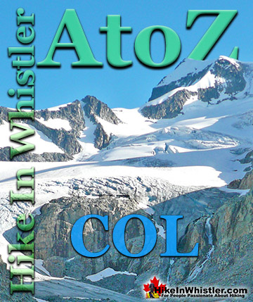
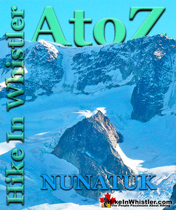
Whistler & Garibaldi Park Hiking Glossary A to Z
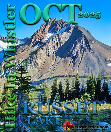
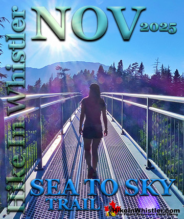
Whistler & Garibaldi Park Best Hiking by Month!

Explore BC Hiking Destinations!
Whistler Hiking Trails
Squamish Hiking Trails
Vancouver Hiking Trails
Clayoquot Hiking Trails
Victoria Hiking Trails