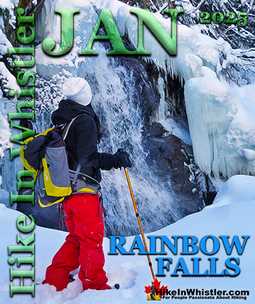
![]() The Rainbow Trail is a convenient and popular trail near Whistler Village that takes you to Rainbow Lake as well as the Rainbow-Sproatt Flank Trail, Rainbow Falls, Hanging Lake, Madeley Lake, Beverley Lake, Rainbow Mountain... and even Whistler Olympic Park if you are determined. It is a consistently uphill and very beautiful trail with several water (bridge) crossings and waterfalls on the way to the picture-perfect lake.
The Rainbow Trail is a convenient and popular trail near Whistler Village that takes you to Rainbow Lake as well as the Rainbow-Sproatt Flank Trail, Rainbow Falls, Hanging Lake, Madeley Lake, Beverley Lake, Rainbow Mountain... and even Whistler Olympic Park if you are determined. It is a consistently uphill and very beautiful trail with several water (bridge) crossings and waterfalls on the way to the picture-perfect lake.
Whistler & Garibaldi Hiking
![]() Alexander Falls
Alexander Falls ![]() Ancient Cedars
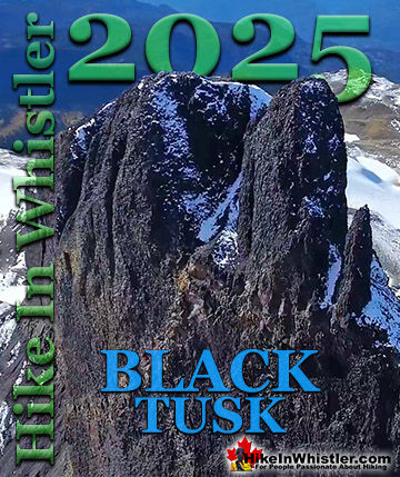
Ancient Cedars ![]() Black Tusk
Black Tusk ![]() Blackcomb Mountain
Blackcomb Mountain ![]() Brandywine Falls
Brandywine Falls ![]() Brandywine Meadows
Brandywine Meadows ![]() Brew Lake
Brew Lake ![]() Callaghan Lake
Callaghan Lake ![]() Cheakamus Lake
Cheakamus Lake ![]() Cheakamus River
Cheakamus River ![]() Cirque Lake
Cirque Lake ![]() Flank Trail
Flank Trail ![]() Garibaldi Lake
Garibaldi Lake ![]() Garibaldi Park
Garibaldi Park ![]() Helm Creek
Helm Creek ![]() Jane Lakes
Jane Lakes ![]() Joffre Lakes
Joffre Lakes ![]() Keyhole Hot Springs
Keyhole Hot Springs ![]() Logger’s Lake
Logger’s Lake ![]() Madeley Lake
Madeley Lake ![]() Meager Hot Springs
Meager Hot Springs ![]() Nairn Falls
Nairn Falls ![]() Newt Lake
Newt Lake ![]() Panorama Ridge
Panorama Ridge ![]() Parkhurst Ghost Town
Parkhurst Ghost Town ![]() Rainbow Falls
Rainbow Falls ![]() Rainbow Lake
Rainbow Lake ![]() Ring Lake
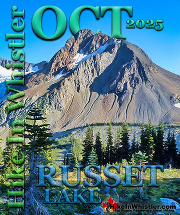
Ring Lake ![]() Russet Lake
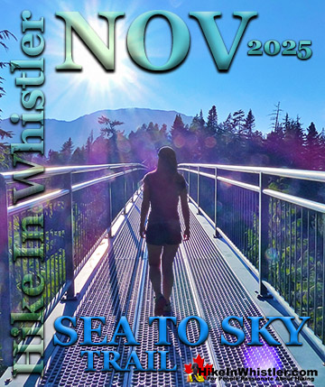
Russet Lake ![]() Sea to Sky Trail
Sea to Sky Trail ![]() Skookumchuck Hot Springs
Skookumchuck Hot Springs ![]() Sloquet Hot Springs
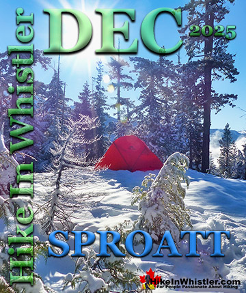
Sloquet Hot Springs ![]() Sproatt East
Sproatt East ![]() Sproatt West
Sproatt West ![]() Taylor Meadows
Taylor Meadows ![]() Train Wreck
Train Wreck ![]() Wedgemount Lake
Wedgemount Lake ![]() Whistler Mountain
Whistler Mountain
Whistler Aerial Views
![]() Alexander
Alexander ![]() Brandywine
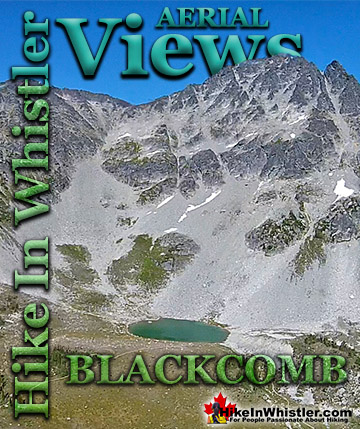
Brandywine ![]() Blackcomb
Blackcomb ![]() Callaghan
Callaghan ![]() Cirque
Cirque ![]() Joffre
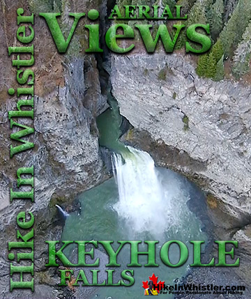
Joffre ![]() Keyhole
Keyhole ![]() Logger's
Logger's ![]() Madeley
Madeley ![]() Panorama
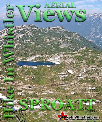
Panorama ![]() Sproatt
Sproatt ![]() Parkhurst
Parkhurst ![]() Rainbow
Rainbow ![]() Russet
Russet ![]() Train Wreck
Train Wreck ![]() Wedge Glacier
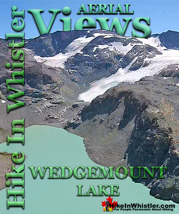
Wedge Glacier ![]() Wedgemount
Wedgemount ![]() Whistler
Whistler
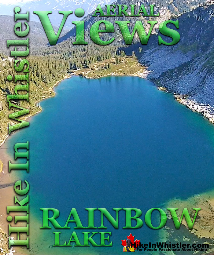
There are a few views of the valley across to Whistler Mountain, Blackcomb Mountain, and Wedge Mountain. Rainbow Lake itself is in a gorgeous alpine valley with branching trails that extend further beyond the lake in at least three directions. Along with the waterfalls, bridge crossings and valley views, the Rainbow Trail passes through deep forest with some impressively huge trees. Plenty of birds can be heard and seen along the trail and though black bears frequent the area, they are infrequently spotted due to their migration down into the valley. Cougars are also known to roam around this area, though also rarely spotted. As recently as 2014 signs of cougar activity were identified on the Flank Trail near where it branches off from the Rainbow Trail. In September 2018 an extremely rare sighting of a grizzly bear near Rainbow Mountain caused some concern for hiker safety in the following weeks. An very rare occurrence attributed to increased trail use in the area. The Rainbow Trail has a small side trail that takes you to Rainbow Falls. Not far from the trailhead, the small Rainbow Falls sign is easily missed. It is located about five minutes into the Rainbow Trail and your best bet to find it is to keep bearing right along the first couple trail branches. Don't worry about getting lost here though as all the trails reconnect further along the trail when you briefly exit the forest at the water treatment building. Unfortunately, Rainbow Lake is the water supply for Whistler, so you cannot swim, fish or camp near the lake. There is decent camping available nearby at Hanging Lake as well as Beverley Lake in the direction of Rainbow Mountain.

Rainbow Lake Aerial Views


Getting to the Rainbow Trailhead
![]()
![]()
![]()
![]() Rainbow Lake is well within walking and biking distance from Whistler Village. It takes about an hour to walk from Whistler Village to the trailhead or about 20 minutes by bike. To walk or bike to the trailhead you take the Valley Trail from Whistler Village down to the end of Lorimer Road then continue of the Valley Trail to Rainbow Park. From there it is just a 10 minute walk away along Alta Lake Road. Taking a bus to the trailhead is not a great option as no buses go very close. You can take a bus from the Village down to Whistler Cay, near the end of Lorimer Road, then start walking along the Valley Trail, but it only saves you about 30 minutes walking. Driving directions to trailhead: Zero your odometer at Village Gate Boulevard(in Whistler Village), drive north on Highway 99. At 3.9km turn left onto Alpine Way, then at the next stop sign turn left onto Rainbow Drive. Continue straight until at 7.3km you will see the trailhead sign, "Rainbow Trail" on your right, half buried in snow most of the winter. There is room for several cars to park, but be careful if the parking area is packed with snow, you may be able to get in, but not be able to get out easily. Keep that in mind and park in a way that allows you to get out easily. Hike up the Rainbow Trail and to reach Rainbow Falls, bear right at the two obvious forks in the trail. Signs do not indicate where the falls are, but there are several orange trail markers on the trees on the way. Rainbow Falls are found before the water treatment building and the beautiful bridge over the river is just after the treatment building.
Rainbow Lake is well within walking and biking distance from Whistler Village. It takes about an hour to walk from Whistler Village to the trailhead or about 20 minutes by bike. To walk or bike to the trailhead you take the Valley Trail from Whistler Village down to the end of Lorimer Road then continue of the Valley Trail to Rainbow Park. From there it is just a 10 minute walk away along Alta Lake Road. Taking a bus to the trailhead is not a great option as no buses go very close. You can take a bus from the Village down to Whistler Cay, near the end of Lorimer Road, then start walking along the Valley Trail, but it only saves you about 30 minutes walking. Driving directions to trailhead: Zero your odometer at Village Gate Boulevard(in Whistler Village), drive north on Highway 99. At 3.9km turn left onto Alpine Way, then at the next stop sign turn left onto Rainbow Drive. Continue straight until at 7.3km you will see the trailhead sign, "Rainbow Trail" on your right, half buried in snow most of the winter. There is room for several cars to park, but be careful if the parking area is packed with snow, you may be able to get in, but not be able to get out easily. Keep that in mind and park in a way that allows you to get out easily. Hike up the Rainbow Trail and to reach Rainbow Falls, bear right at the two obvious forks in the trail. Signs do not indicate where the falls are, but there are several orange trail markers on the trees on the way. Rainbow Falls are found before the water treatment building and the beautiful bridge over the river is just after the treatment building.

More info, details, maps and directions to Rainbow Lake
More Whistler Aerial Views!

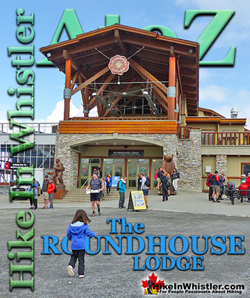
Whistler & Garibaldi Park Hiking Glossary A to Z

Whistler & Garibaldi Park Best Hiking by Month!

Explore BC Hiking Destinations!
Whistler Hiking Trails
Squamish Hiking Trails
Vancouver Hiking Trails
Clayoquot Hiking Trails
Victoria Hiking Trails