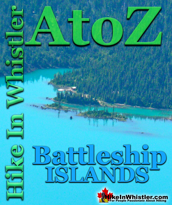
The rocky and narrow row of islands in Garibaldi Lake just offshore from the Garibaldi Lake campsite are known as Battleship Islands. Named by the prolific mountaineer Neal Carter in 1927 "..because they are a group of tiny islands with often a single tree as a mast, presenting the appearance of boats, as viewed from Panorama Point(a lookout on Panorama Ridge)." The name "The Battleship Islands" originally appeared on AJ Campbell's 1928 map of Garibaldi Provincial Park.
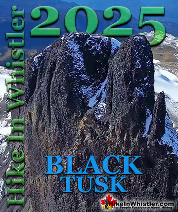
Garibaldi Park maps since 1957 have officially shortened the name to "Battleship Islands. The Battleship Islands are located roughly parallel to the shoreline in front of the Garibaldi Lake campground. Garibaldi Lake is the centre and base for much of the hiking in Garibaldi Provincial Park. The Garibaldi Lake campsite is located on the amazing, turquoise shores of this massive and mostly still wild mountain lake. There are no trails around the edge of the lake except the small section leading to the campsites, so your view is an impossibly coloured lake edged by swaths of forest and a magnificent glacier towering in the distance. Compared to other lakes in the Whistler area and in Garibaldi Provincial Park, Garibaldi Lake is enormous with a surface area of almost 10 square kilometres or 2460 acres. It is also a very deep lake with its average depth of 119 metres or 390 feet and at its deepest, 258 metres or 849 feet! What really makes Garibaldi Lake extraordinary is its geography. It is flanked by volcanoes on three sides and lava flows from Mount Price during the last ice age formed The Barrier which blocked the valley which filled with water, creating Garibaldi Lake. Vantage points around the lake such as Panorama Ridge and Black Tusk allow relatively easy views of this magnificent lake with Mount Garibaldi and other impressive peaks surrounding it. At the Garibaldi Lake campsite the water is painfully cold, though plenty of brave hikers swim here as well as camp. Garibaldi Lake, though beautiful enough as a primary destination, is often a base camp for further hiking. The summit of Black Tusk is just a 2 hour hike from the lake. Panorama Ridge is a bit further at about 3 hours from the lake. Taylor Meadows is a beautiful, often flower filled valley, and home to the other Garibaldi Provincial Park campsites in the area. Helm Creek campsites are located past Black Tusk and Panorama Ridge, on the way to Cheakamus Lake. If you can manage transport, you can start at Rubble Creek trailhead and finish at Cheakamus Lake trailhead. This allows for a linear route instead of a there and back route. Garibaldi Lake, Taylor Meadows, Black Tusk, Panorama Ridge, Helm Creek and Cheakamus Lake are all beautiful destinations on their own, but combined in a 2 or 3 day hiking expedition are extraordinary.
More Whistler & Garibaldi Park Hiking A to Z!
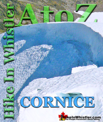
Cornice: a wind deposited wave of snow on a ridge, often overhanging a steep slope or cliff. They are the result of snow building up on the crest of a ...
Along Whistler’s Valley Trail near Rainbow Park you come across some impressively unusual trees. Unlike most other Whistler trees with straight trunks and ...
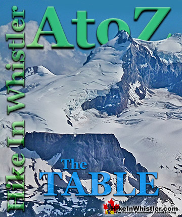
The Table is an extraordinary flat-topped mountain located in Garibaldi Park just one kilometre south of Garibaldi Lake. Sometimes reflexively referred to as ...
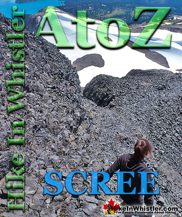
Scree: from the Norse “skridha”, landslide. The small, loose stones covering a slope. Also called talus, the French word for slope. Scree is mainly formed ...
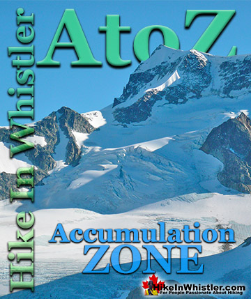
Accumulation Zone: the area where snow accumulations exceeds melt, located above the firn line. Snowfall accumulates faster than melting, evaporation and ...
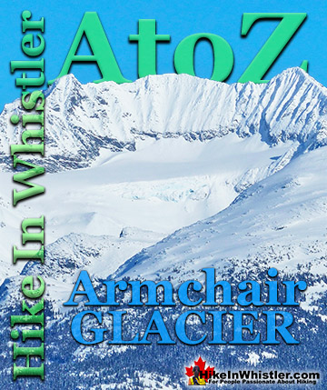
Armchair Glacier is one of the many easily identifiable mountain features around Whistler. Along with Wedge Mountain and Black Tusk, Armchair Glacier has a ...
Tom Fyles (27 June 1887 - 27 March 1979) was an astoundingly skilled climber and mountaineer based out of Vancouver where he was an early explorer of the ...
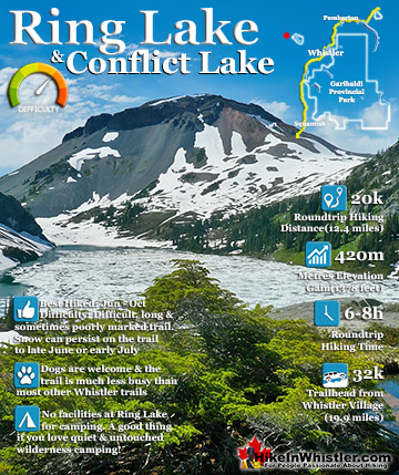
Ring Lake is a fantastically serene and wonderfully remote lake similar to Cirque Lake, but considerably farther to hike to reach it. The 10 kilometre(6.2 mile) hike takes you through a rarely hiked forest, ...
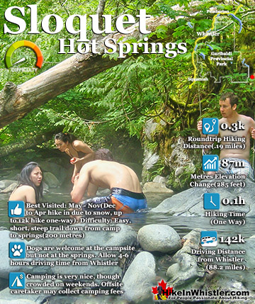
Sloquet Hot Springs is a wonderfully wild set of shallow, man-made pools fed by a small, all natural, and very hot, waterfall. The pools stretch from the waterfall to the large and crashing Sloquet River. The ...
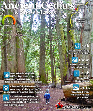
Ancient Cedars is a nice, easy/moderate 2.5 kilometre (1.6 mile) hiking trail on the far side of Cougar Mountain, just 13.1 kilometres north of Whistler Village. A small, untouched grove of huge western ...
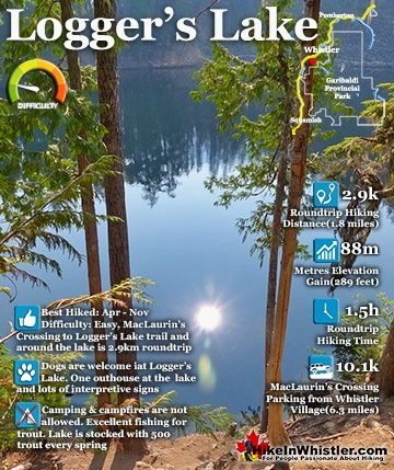
Logger's Lake is an amazing little lake hidden up in the deep forest above the more well known Cheakamus River. The lake, almost unbelievably exists in a long extinct volcano. However, as soon as you see ...
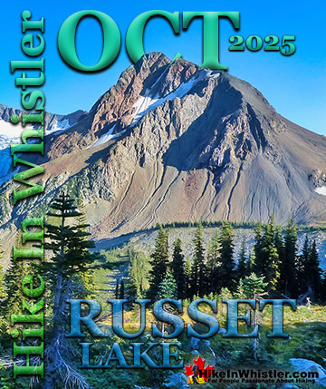
Hiking in Whistler in October is often unexpectedly stunning. The days are much shorter and colder but the mountains are alive with colour from the fall ...
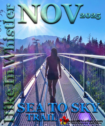
November in Whistler is when the temperatures plummet and the first heavy snow falls in the alpine and often in Whistler Village. The hiking opportunities become ...
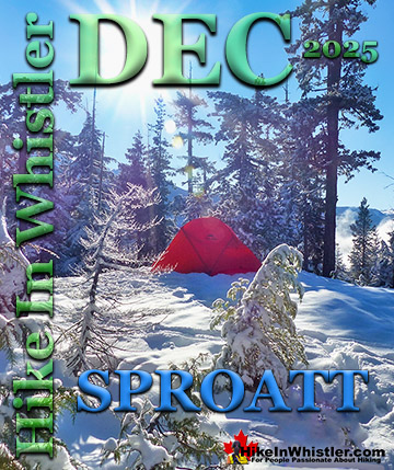
December hiking in Whistler is mainly done on snowshoes, though not always. If it hasn't snowed much recently then trails such as Whistler Train Wreck and ...
Hiking in Whistler is spectacular and wonderfully varied. Looking at a map of Whistler you see an extraordinary spider web of hiking trails that are unbelievably numerous. Easy trails, moderate trails and challenging hiking trails are all available. Another marvellous ...
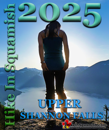
Squamish is located in the midst of a staggering array of amazing hiking trails. Garibaldi Provincial Park sprawls alongside Squamish and up and beyond Whistler. Tantalus Provincial Park lays across the valley to the west and the wonderfully remote Callaghan Valley ...
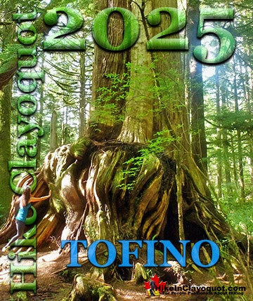
Clayoquot Sound has a staggering array of hiking trails within it. Between Tofino and Ucluelet, Pacific Rim Park has several wilderness and beach trails, each one radically different from the last. The islands in the area are often Provincial parks on their own with ...
Victoria has a seemingly endless number of amazing hiking trails. Most take you to wild and beautiful Pacific Ocean views and others take you to tranquil lakes in beautiful BC Coastal Rainforest wilderness. Regional Parks and Provincial Parks are everywhere you turn in ...
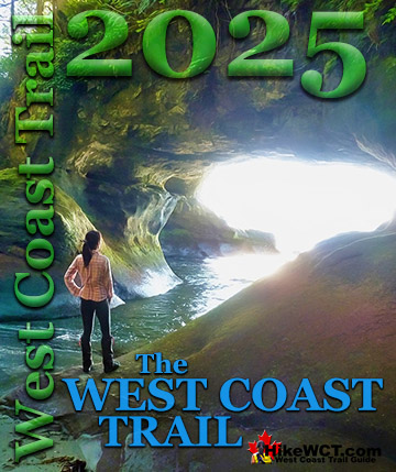
The West Coast Trail was created after decades of brutal and costly shipwrecks occurred along the West Coast of Vancouver Island. One shipwreck in particular was so horrific, tragic and unbelievable that it forced the creation of a trail along the coast, which ...